Glenview, Kentucky

Last updated

Glenview, Kentucky
Jefferson County Kentucky Incorporated and Unincorporated areas Glenview Highlighted 2131348.svg
Location of Glenview in Jefferson County, Kentucky
USA Kentucky location map.svg
Red pog.svg
Glenview
Location within the state of Kentucky
Usa edcp location map.svg
Red pog.svg
Glenview
Glenview (the United States)
Coordinates: 38°18′07″N85°39′06″W / 38.30194°N 85.65167°W / 38.30194; -85.65167
Country United States
State Kentucky
County Jefferson
Named for Glen View, a former horse farm
Area
[1]
  Total1.43 sq mi (3.71 km2)
  Land1.43 sq mi (3.69 km2)
  Water0.01 sq mi (0.02 km2)
Elevation
[2]
545 ft (166 m)
Population
 (2020)
  Total596
  Density418.25/sq mi (161.50/km2)
Time zone UTC-5 (Eastern (EST))
  Summer (DST) UTC-4 (EDT)
ZIP code
40025
Area code 502
FIPS code 21-31348
GNIS feature ID2403704 [2]
Website www.glenviewky.gov
Glenview Historic District
USA Kentucky location map.svg
Red pog.svg
Usa edcp location map.svg
Red pog.svg
LocationGlenview Ave., Louisville, Kentucky
Area80 acres (32 ha)
ArchitectMultiple
Architectural styleLate 19th And 20th Century Revivals
MPS Jefferson County MRA
NRHP reference No. 83002673 [3]
Added to NRHPAugust 16, 1983

Glenview is a 6th-class city along the southern bank of the Ohio River in northeastern Jefferson County, Kentucky, United States The population was 531 at the 2010 census. [4]

Contents

Glenview has the 2nd-highest per capita income within Kentucky and the 74th-highest in the United States. The city is known for its old estate homes on high bluffs overlooking the Ohio River.

History

5,000 acres (20 km2) of the surrounding land were originally owned by James Smalley Bate and named "Berry Hill" for his former Virginia home. The estate was purchased in 1868 by meat packer James C. McFerran. McFerran's horse farm was named "Glen View". After his death in 1885, John E. Green acquired the farm and renamed it "Glenview Stock Farm". The community received its post office on May 11, 1893. [5]

In the late 19th century, wealthy families from Louisville began moving east to build summer homes in communities such as Anchorage. Some of these eventually became full-time residences. Early residents of Glenview cooperated with other communities to open the Louisville, Harrods Creek and Westport Railroad in 1877, a commuter rail line in use until its abandonment in the 1950s. Some of Louisville's most influential families, including the Binghams, the Ballards, and the Belknaps, moved into the area after the opening of the railroad. [6]

Many houses are part of the Glenview Historic District. Several buildings are individually listed on the National Register of Historic Places including the Ballard School, Boxhill and Lincliff.

Some developers have played off Glenview's reputation, establishing similarly named communities at Glenview Manor and Glenview Hills in the 1960s and 70s. Louisville attempted to annex Glenview in 1983, which prompted its residents to seek a separate incorporation from the state legislature. This was granted in 1985. [7] Many of the houses are part of the Glenview Historic District, which is on the National Register of Historic Places.

Geography

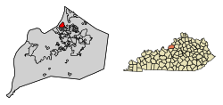
Glenview is located in northern Jefferson County. It is bordered to the northwest by the Ohio River, to the southwest by Indian Hills, and on all other sides by consolidated Louisville/Jefferson County. Interstate 71 runs along the southern edge of the community, but with no direct access. Downtown Louisville is 7 miles (11 km) to the southwest via River Road.

According to the United States Census Bureau, Glenview has a total area of 1.4 square miles (3.7 km2), of which 0.01 square miles (0.02 km2), or 0.43%, are water. [4]

Demographics

Historical population
CensusPop.Note
1990 653
2000 558−14.5%
2010 531−4.8%
2020 59612.2%
U.S. Decennial Census [8]

As of the census [9] of 2000, there were 558 people, 214 households, and 181 families residing in the city. The population density was 386.3 inhabitants per square mile (149.2/km2). There were 232 housing units at an average density of 160.6 per square mile (62.0/km2). The racial makeup of the city was 96.24% White, 0.18% Native American, 2.69% Asian, 0.18% Pacific Islander, 0.72% from other races. Hispanic or Latino of any race were 1.08% of the population.

There were 214 households, out of which 34.1% had children under the age of 18 living with them, 81.8% were married couples living together, 2.3% had a female householder with no husband present, and 15.0% were non-families. 13.1% of all households were made up of individuals, and 6.5% had someone living alone who was 65 years of age or older. The average household size was 2.61 and the average family size was 2.84.

In the city, the population was spread out, with 22.4% under the age of 18, 5.2% from 18 to 24, 13.3% from 25 to 44, 42.5% from 45 to 64, and 16.7% who were 65 years of age or older. The median age was 48 years. For every 100 females, there were 97.2 males. For every 100 females age 18 and over, there were 94.2 males.

The median income for a household in the city was $161,571, and the median income for a family was $183,800. Males had a median income of $100,000 versus $46,250 for females. The per capita income for the city was $85,094. About 3.3% of families and 4.2% of the population were below the poverty line, including 6.5% of those under age 18 and none of those age 65 or over.

See also

Related Research Articles

<span class="mw-page-title-main">Jefferson County, Kentucky</span> County in Kentucky, United States

Jefferson County is located in the north central portion of the U.S. state of Kentucky. As of the 2020 census, the population was 782,969. It is the most populous county in the commonwealth.

<span class="mw-page-title-main">Anchorage, Kentucky</span> City in Kentucky, United States

Anchorage is a home rule-class city in eastern Jefferson County, Kentucky, United States. The population was 2,348 at the 2010 census and an estimated 2,432 in 2018. It is a suburb of Louisville.

<span class="mw-page-title-main">Cambridge, Kentucky</span> City in Kentucky, United States

Cambridge is a home rule-class city in Jefferson County, Kentucky, United States. The population was 175 at the 2010 census.

<span class="mw-page-title-main">Glenview Hills, Kentucky</span> City in Kentucky, United States

Glenview Hills is a home rule-class city in Jefferson County, Kentucky, United States. The population was 319 at the 2010 census.

<span class="mw-page-title-main">Glenview Manor, Kentucky</span> City in Kentucky, United States

Glenview Manor is a home rule-class city in Jefferson County, Kentucky, United States. The population was 191 at the 2010 census.

<span class="mw-page-title-main">Goose Creek, Kentucky</span> City in Kentucky, United States

Goose Creek is a home rule-class city in Jefferson County, Kentucky, United States. The population was 294 at the 2010 census.

<span class="mw-page-title-main">Indian Hills, Kentucky</span> City in Kentucky, United States

Indian Hills is a home rule-class city along the Ohio River in Jefferson County, Kentucky, United States. The population was 2,860 as of the 2020 census. Indian Hills and the nearby cities of Mockingbird Valley, Glenview, and Anchorage have been cited as Louisville's most prosperous suburbs since the mid-20th century. Indian Hills was among the nation's highest-income places as of the 2000 U.S. census.

<span class="mw-page-title-main">Maryhill Estates, Kentucky</span> City in Kentucky, United States

Maryhill Estates is a home rule-class city in Jefferson County, Kentucky, United States. The population was 179 as of the 2010 census.

<span class="mw-page-title-main">Meadow Vale, Kentucky</span> City in Kentucky, United States

Meadow Vale is a home rule-class city in Jefferson County, Kentucky, United States. As of the 2010 census the population was 736.

<span class="mw-page-title-main">Mockingbird Valley, Kentucky</span> City in Kentucky, United States

Mockingbird Valley is a home rule-class city in Jefferson County, Kentucky, United States. Since incorporation, there has been some interest in making it a historic preservation district, largely to prevent unwanted development. The population was 167 at the 2010 census. It has the highest per capita income of any location in Kentucky and the tenth-highest of any location in the United States.

<span class="mw-page-title-main">Murray Hill, Kentucky</span> City in Kentucky, United States

Murray Hill is a home rule-class city in Jefferson County, Kentucky, United States, and a part of the Louisville Metro government. The population was 582 during the 2010 census.

<span class="mw-page-title-main">Northfield, Kentucky</span> City in Kentucky, United States

Northfield is a home rule-class city in Jefferson County, Kentucky, United States. The population was 1,020 at the 2010 census.

Okolona is a former census-designated place (CDP) in southern Louisville/Jefferson County, Kentucky, United States. It is centered on the intersection of Preston Highway and the Outer Loop. The population was 17,807 at the 2000 census. When the government of Jefferson County merged with the city of Louisville, Kentucky in 2003, residents of Okolona also became citizens of Louisville Metro. As a result, Okolona is said to be a neighborhood within the city limits of Louisville.

<span class="mw-page-title-main">Old Brownsboro Place, Kentucky</span> City in Jefferson County, Kentucky, United States

Old Brownsboro Place is a home rule-class city in Jefferson County, Kentucky, United States, and a part of the united Metro government. The population was 353 at the 2010 census.

<span class="mw-page-title-main">Riverwood, Kentucky</span> City in Kentucky, United States

Riverwood is a home rule-class city in northeastern Jefferson County, Kentucky, United States. The population was 446 at the 2010 census.

<span class="mw-page-title-main">Rolling Fields, Kentucky</span> City in Kentucky, United States

Rolling Fields is a home rule-class city in Jefferson County, Kentucky, United States. The population was 646 at the 2010 census. It incorporated as a city in 1958.

<span class="mw-page-title-main">South Park View, Kentucky</span> City in Kentucky, United States

South Park View is a home rule-class city in Jefferson County, Kentucky, United States. The population was 0 at the 2020 census. The community was named for its location near South Park Hill, elevation 902 feet (275 m), the highest point in Jefferson County. It is the smallest incorporated city in the commonwealth of Kentucky and one of nine incorporated places in the U.S. that have no recorded population.

<span class="mw-page-title-main">Windy Hills, Kentucky</span> City in Jefferson County, Kentucky, United States

Windy Hills is a home rule-class city, incorporated in 1952, in eastern Jefferson County, Kentucky, United States. The population was 2,385 at the 2010 census.

<span class="mw-page-title-main">Brandenburg, Kentucky</span> City in Kentucky, United States

Brandenburg is a home rule-class city on the Ohio River in Meade County, Kentucky, in the United States. The city is 40 miles (64 km) southwest of Louisville. It is the seat of its county. The population was 2,894 at the 2020 census.

<span class="mw-page-title-main">Prospect, Kentucky</span> City in Kentucky, United States

Prospect is a home rule-class city in Jefferson and Oldham counties in the U.S. state of Kentucky. The Jefferson County portion is a part of the Louisville Metro government. The population was 4,698 at the time 2010 census. It is one of the wealthiest communities in Kentucky.

References

  1. "2020 U.S. Gazetteer Files". United States Census Bureau. Retrieved March 18, 2022.
  2. 1 2 U.S. Geological Survey Geographic Names Information System: Glenview, Kentucky
  3. "National Register Information System". National Register of Historic Places . National Park Service. July 9, 2010.
  4. 1 2 "Geographic Identifiers: 2010 Census Summary File 1 (G001): Glenview city, Kentucky". American Factfinder. U.S. Census Bureau. Archived from the original on February 13, 2020. Retrieved May 30, 2018.
  5. Rennick, Robert. Kentucky Place Names, pp. 117–118. "Glenview". University Press of Kentucky (Lexington), 1987. Accessed 28 July 2013.
  6. Hurd, Phyllis. "Courier-Journal.com: Places in Time". orig.courier-journal.com. Retrieved December 29, 2017.
  7. Commonwealth of Kentucky. Office of the Secretary of State. Land Office. "Glenview, Kentucky". Accessed 28 July 2013.
  8. "Census of Population and Housing". Census.gov. Retrieved June 4, 2015.
  9. "U.S. Census website". United States Census Bureau . Retrieved January 31, 2008.

Further reading