Related Research Articles
Wilder Park is a neighborhood four miles south of downtown Louisville, Kentucky USA. The area was originally the site of Greenland race course, built in 1866, a sister track of Churchill Downs. Greenland track closed in 1888 and was subsequently used as a park.

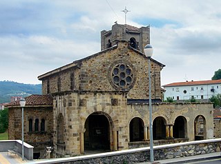
Zaratamo is a town and municipality located in the province of Biscay, in the autonomous community of Basque Country, northern Spain. Zaratamo has an area 10.2 km² and an elevation of 173m. As of 2019 its population is 1,614 with a density of 158.8 people per km². 50.1% of the population is female while 49.9% is male.

Shelby Park is a neighborhood two miles southeast of downtown Louisville, Kentucky USA named after Kentucky's first governor, Isaac Shelby. Shelby Park has always been considered a working-class neighborhood. It was first populated by German immigrants in the early 1900s. By the 1950s, the neighborhood was majority African American. Today, Shelby Park is a blend of ethnic and economic diversity. People from all walks of life co-exist in a vibrant, art-filled community.
Clifton Heights is a neighborhood two miles east of downtown Louisville, Kentucky USA. It was named because of its hilly location atop a ridge about 100 feet above the Ohio River floodplain, overlooking the adjacent community of Clifton. Though first planned in the 1890s as Summit Park, actual growth didn't begin until after World War I when automobiles made the hilly area accessible. Clifton Heights has had an African American presence since its founding, in 2000 they accounted for 21% of the population. Housing stock includes a variety of styles and time frames, from older shotgun houses and bungalows to suburban ranch homes built in the 1970s.
Audubon is a neighborhood in Louisville, Kentucky, United States. Its boundaries are Clarks Lane to the north, Poplar Level Road to the east, Preston Highway to the west, and the city of Audubon Park to the south. The smaller city of Parkway Village is surrounded by Audubon. George Rogers Clark Park, the site of a cabin owned by the parents of George Rogers Clark, is a prominent feature of the neighborhood.

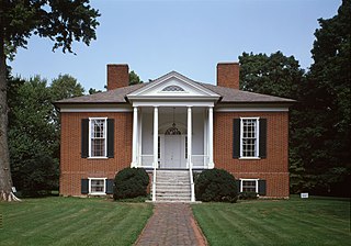
Hawthorne is a neighborhood in eastern Louisville, Kentucky, United States. Its boundaries are Taylorsville Road, Hawthorne Avenue, Bardstown Road and I-264. The land was once part of John Speed's Farmington estate, known for its plantation house built around 1815–16. The neighborhood is primarily residential and was first subdivided in 1909, but saw its fastest grown in the 1920s. It takes its name from Hawthorne Avenue, and most of the other streets are named after writers or poets. Sullivan University is located in the neighborhood.
Bellhouse Provincial Park is a provincial park in the southern Gulf Islands of British Columbia, Canada. It is located in the Sturdies Bay area of southeastern Galiano Island.
Greenwood is a neighborhood of Louisville, Kentucky located along Cane Run Road and Greenwood Road. It is sometimes referred to by its large industrial park and shipping facility, Riverport.
Kosmosdale is a neighborhood in southwestern Louisville, Kentucky located along Dixie Highway near Depot Lane and is named after the Kosmos Cement Company. The Kosmos Cement Company was purchased by the Flintkote Corporation in 1957 and operated as a Division of Flintkote for many years. It is now operated by Cemex, Inc. as a joint venture.

Riverside Gardens is a neighborhood of Louisville, Kentucky centered along Campground Road and Lees Lane. In 2007, the first stretch of the proposed 110-mile Louisville Loop bike and pedestrian trail was completed to Lees Lane in Riverside Gardens from Riverview Park. The project included a $2 million bridge over Mill Creek. The concrete trail is expected to be connected to Shawnee Park by spring of 2008. In the future, a wharf and riverfront park is planned for Riverside Gardens.
Long Run is a neighborhood of Louisville, Kentucky located near Shelbyville Road (US 60) and Clark Station Road.
Medora is a neighborhood of Louisville, Kentucky, centered along Pendleton Road and Medora Road.
Valley Village is a neighborhood of Louisville, Kentucky west of Dixie Highway and north of Bowen Avenue.
Valley Gardens is a neighborhood of Louisville, Kentucky, in the United States. It is centered along Johnsontown Road and Terry Road.
Sylvania is a neighborhood of Louisville, Kentucky located near Terry Road along Sylvania Road.
Valley Downs is a neighborhood of Louisville, Kentucky, USA located along Omar Khayyam Boulevard south of Johnsontown Road.
Louisville Motor Speedway was a 3/8-mile race track located in Louisville, Kentucky. It was opened in 1988.
Punkin Center is an unincorporated community in Gila County, Arizona, United States. The community is located within the Tonto Basin at the confluence of Reno and Tonto creeks. Payson is 29 miles to the north along Arizona Route 188 and Arizona Route 87. Roosevelt Lake is eight miles to the south on Route 188.

Chwałów is a village in the administrative district of Gmina Żerków, within Jarocin County, Greater Poland Voivodeship, in west-central Poland. It lies approximately 8 kilometres (5 mi) north-east of Żerków, 19 km (12 mi) north-east of Jarocin, and 61 km (38 mi) south-east of the regional capital Poznań.
The Louisville Astronomical Society (LAS) was founded in 1931 in Louisville, Kentucky by amateur astronomers, including James Gilbert Baker. Monthly meetings are held at 8:00 p.m. on the Third Tuesdays of each month. Monthly observing sessions, are held at the society's dark sky location, the James G. Baker Center for Astronomy in Curby, Indiana on the third Saturday of each month. They hold public star parties at their Urban Astronomy Center located in E. P. "Tom" Sawyer State Park on the Fourth Friday of every month. Star parties begin at dusk and are open to the public. The LAS has certified instructors for Boy Scout Astronomy requirements.
References
- ^ "HomeTownLocator" . Retrieved 2006-06-10.
