
Louisville is the most populous city in the Commonwealth of Kentucky, sixth-most populous city in the Southeast, and the 27th-most-populous city in the United States. By land area, it is the country's 24th-largest city, although by population density, it is the 265th most dense city. Louisville is the historical county seat and, since 2003, the nominal seat of Jefferson County, on the Indiana border.

Barbourmeade is a home rule-class city in Jefferson County, Kentucky, United States. It was formally incorporated by the state assembly in 1962. The population was 1,216 as of the 2020 census, stagnant from 1,218 at the 2010 census.

Hurstbourne is a home rule-class city in Jefferson County, Kentucky, United States. The population was 4,216 at the 2010 census, up from 3,884 at the time of the 2000 U.S. census. It is part of the Louisville Metro Government.
Lyndon is a home rule-class city in Jefferson County, Kentucky, United States. The population was 11,002 at the 2010 census, up from 9,369 at the 2000 census.

Middletown is an independent, home rule-class city in Jefferson County, Kentucky, United States, and a suburb of Louisville. The population was 7,218 at the 2010 census. The city is home to the main campus of the largest church in the state, the Southeast Christian Church.

St. Matthews is a city in Jefferson County, Kentucky, United States. It forms part of the Louisville Metro government but is separately incorporated as a home rule-class city. The population was 17,472 at the 2010 census, up from 15,852 at the 2000 census. It is the 23rd-largest city in the state. St. Matthews is one of the state's major shopping areas, home to the fifth-largest mall in Kentucky along with many smaller shopping centers along Shelbyville Road.

Prospect is a home rule-class city in Jefferson and Oldham counties in the U.S. state of Kentucky. The Jefferson County portion is a part of the Louisville Metro government. The population was 4,592 as of the 2020 census, down from 4,698 at the time of the 2010 census. It is one of the wealthiest communities in Kentucky.

The history of Louisville, Kentucky spans nearly two-and-a-half centuries since its founding in the late 18th century. The geology of the Ohio River, with but a single series of rapids midway in its length from the confluence of the Monongahela and Allegheny rivers to its union with the Mississippi, made it inevitable that a town would grow on the site. The town of Louisville, Kentucky was chartered there in 1780. From its early days on the frontier, it quickly grew to be a major trading and distribution center in the mid-19th century and an important industrial city in the early 20th. The city declined in the mid-20th century, but by the late 20th, it was revitalized as a culturally-focused mid-sized American city.

Crescent Hill is a neighborhood four miles (6 km) east of downtown Louisville, Kentucky USA. This area was originally called "Beargrass" because it sits on a ridge between two forks of Beargrass Creek. The boundaries of Crescent Hill are N Ewing Ave to the St. Matthews city limit by Brownsboro Road to Lexington Road. Frankfort Avenue generally bisects the neighborhood.

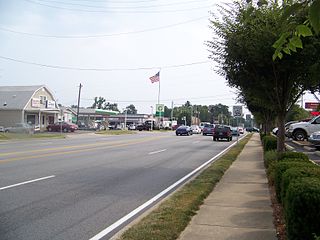
This is a list of official neighborhoods in Louisville, Kentucky. Like many older American cities, Louisville has well-defined neighborhoods, many with well over a century of history as a neighborhood.
Park DuValle is a neighborhood southwest of downtown Louisville, Kentucky. It was developed starting in the late-19th century and historically been a predominantly African-American community. Its boundaries are I-264 to the west, the Norfolk Southern Railway tracks to the north, Cypress Street to the east, and Bells Lane and Algonquin Parkway to the south. The neighborhood reflects the presence of several nearby parks, and DuValle Junior High School; all named after Lucie DuValle, the first female principal of a high school in Louisville.

Kenwood Hill is a hill and neighborhood on the south side of Louisville, Kentucky, United States. Its boundaries are New Cut Road, Kenwood Drive, Southside Drive and Palatka Road. The hill, earlier known as Sunshine Hill and then Cox's Knob, was used by Native Americans to spot buffalo. By 1868 Benoni Figg owned the area as a part of his charcoal business. His family oversaw development on the land until it was sold in 1890 to a development company which named the area Kenwood Hill. Southern Parkway was opened soon after in 1893.
Hayfield-Dundee is a neighborhood in eastern Louisville, Kentucky. Its boundaries are Dundee Road, Emerson Avenue, Newburg Road, I-264, and Tremont Drive to the east. Prior to subdivision, much of the land had been part of the Hayfield Farm, owned by Dr. Charles Wilkens Short, a founding professor of the University of Louisville medical school.
City of Parks is a municipal project to create a continuous paved pedestrian and biking trail around the city of Louisville, Kentucky while also adding a large amount of park land. The project was announced on February 22, 2005. Current plans call for making approximately 4,000 acres (1,600 ha) of the Floyds Fork floodplain in eastern Jefferson County into park space, expanding area in the Jefferson Memorial Forest, and adding riverfront land and wharfs along the Riverwalk Trail and Levee Trail. There are also plans to connect the 100-mile (160 km) Louisville trail to a planned seven mile (11 km) trail connecting the Southern Indiana cities of New Albany, Clarksville and Jeffersonville.
Berrytown is a neighborhood of Louisville, Kentucky, United States, which has historically been a predominantly African-American community. Its location is centered along English Station Road, on the eastern boundary of the city of Anchorage, Kentucky.

Harrods Creek is a neighborhood of Louisville, Kentucky centered near Harrods Creek at the intersection of River Road and Wolf Pen Branch Road. It is roughly bordered by the Ohio River to the west and US 42 to the east. Its ZIP code is 40027. Formerly an unincorporated community, it was designated a neighborhood of Louisville when the city merged with Jefferson County in 2003.
Lake Dreamland is a neighborhood of Louisville, Kentucky located along Campground Road and the Ohio River.
The Jefferson County Fire Service is an organization that coordinates the independent fire protection districts in Jefferson County, Kentucky. The JCFS was formed for the purpose of mutual aid, dispatch, training, and local standardization. The Shively Fire Department is the only suburban department that has not joined the JCFS; it uses the same dispatch and radio channels as the Louisville Division of Fire.

