Related Research Articles

Russell is a neighborhood immediately west of downtown Louisville, Kentucky, U.S.. It is nicknamed "Louisville's Harlem". It was named for renowned African American educator and Bloomfield, Kentucky native, Harvey Clarence Russell Sr. Its boundaries are West Market Street, 9th Street, West Broadway and I-264.
Shawnee is a neighborhood in western Louisville, Kentucky. Its boundaries are the Ohio River on the West, Bank Street and the Portland neighborhood on the North, I-264 on the East, and West Broadway on the South. Maps sometimes identify the area as Shawneeland.
Parkland is a neighborhood in Louisville, Kentucky, USA. Its boundaries are 34th Street on the west, West Broadway on the north, Woodland Avenue on the south, and 26th Street on the east.
Wilder Park is a neighborhood four miles south of downtown Louisville, Kentucky, USA. The area was originally the site of Greenland race course, built in 1866, a sister track of Churchill Downs. Greenland track closed in 1888 and the area became the Wilder Park neighborhood.
Beechmont is a neighborhood in the south end of Louisville, Kentucky. Its modern boundaries are I-264 to the north, Taylor Boulevard to the west, Southern Parkway and Southland Boulevard to the south, and Third Street, Allmond and Louisville Avenues to the east.

Crescent Hill is a neighborhood four miles (6 km) east of downtown Louisville, Kentucky USA. This area was originally called "Beargrass" because it sits on a ridge between two forks of Beargrass Creek. The boundaries of Crescent Hill are N Ewing Ave to the St. Matthews city limit by Brownsboro Road to Lexington Road. Frankfort Avenue generally bisects the neighborhood.

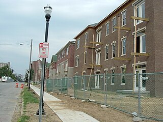
This is a list of official neighborhoods in Louisville, Kentucky. Like many older American cities, Louisville has well-defined neighborhoods, many with well over a century of history as a neighborhood.
Highland Park was a city near and eventually neighborhood in Louisville, Kentucky, United States, that was razed as a part of the expansion of Louisville International Airport. Its boundaries were roughly the CSX railroad tracks to the west, and what would become the Kentucky State Fair & Exposition Center and the airport on all other sides.

Auburndale is a neighborhood in Louisville, Kentucky, United States. Its boundaries are Palatka Road to the north, and New Cut Road and Third Street to the east.
California is a neighborhood in urban Louisville, Kentucky, United States. It is bounded on the north by Broadway, on the east by Ninth Street, on the south by Oak Street, and on the west by Twenty-Sixth Street. There are no written records of the beginning of the neighborhood, but the area was settled by German immigrants around 1849. It is said that the subdivision, initially called Henderson, came to be known as California because it was the "far west" of Louisville.
Edgewood is a neighborhood on the south side of Louisville, Kentucky, United States. Its boundaries are Fern Valley Road to the south, I-65 to the west and Preston Highway to the north. Streets were laid out in the 1920s, but development was halted by the Great Depression. The area was also far from the city and had poor infrastructure. An improved sewage system after World War II and the large expansion of Standiford Field spurred development of Edgewood and its annexation by Louisville in 1957.
Park DuValle is a neighborhood southwest of downtown Louisville, Kentucky. It was developed starting in the late-19th century and historically been a predominantly African-American community. Its boundaries are I-264 to the west, the Norfolk Southern Railway tracks to the north, Cypress Street to the east, and Bells Lane and Algonquin Parkway to the south. The neighborhood reflects the presence of several nearby parks, and DuValle Junior High School; all named after Lucie DuValle, the first female principal of a high school in Louisville.
Phoenix Hill is a neighborhood of Louisville, Kentucky just east of Downtown. Its boundaries are Market Street to the North, Preston Street to the West, Broadway to the South, and Baxter Avenue to the East. The Phoenix Hill neighborhood, settled before 1850 by German immigrants, is now a rich tapestry of people and a diverse mix of business, industry and residences.
Wyandotte, is a neighborhood on the southside of Louisville, Kentucky, United States. Its modern boundaries are Longfield Avenue to the north, Taylor Boulevard to the west, I-264 to the south, and Southern Parkway to the east. The opening of Iroquois Park in the early 1890s created a huge demand for suburban homes south of Louisville. The Coleman-Bush company had begun selling lots in a subdivision called Oakdale in late 1890. Oakdale was one of many middle-class communities created at this time, facilitated by the southward extension of streetcar lines.

Kenwood Hill is a hill and neighborhood on the south side of Louisville, Kentucky, United States. Its boundaries are New Cut Road, Kenwood Drive, Southside Drive and Palatka Road. The hill, earlier known as Sunshine Hill and then Cox's Knob, was used by Native Americans to spot buffalo. By 1868 Benoni Figg owned the area as a part of his charcoal business. His family oversaw development on the land until it was sold in 1890 to a development company which named the area Kenwood Hill. Southern Parkway was opened soon after in 1893.
Jacobs is a neighborhood on the south side of Louisville, Kentucky, in the United States. Its boundaries are Berry Boulevard to the north, Taylor Boulevard to the east, the I-264 to the south, and Seventh Street to the west. It was developed as Jacob's Addition in 1892 after the opening of nearby Jacob's Park and named for four-time Louisville mayor Charles Donald Jacob. The area housed a veteran's hospital, Nichols General Hospital, until 1952. The area includes Manslick Cemetery, a burial ground for indigents started in the 1870s, and Watterson Lake Park.
Hazelwood is a neighborhood on the south side of Louisville, Kentucky, United States. Its boundaries are Manslick Road to the west, I-264 to the north, Taylor Boulevard to the east, and Hazelwood Avenue to the south. Its development, as with other nearby neighborhoods, was spurred by the opening of Iroquois Park in the early 1890s. E.E. Meacham first subdivided the land in 1899. A larger subdivision, called Bergmann's Addition, was financed in 1902. The Hazelwood Center, opened in 1907, is a former tuberculous center and since 1971 a hospital for the mentally handicapped located in the neighborhood.
Bashford Manor is a neighborhood in Louisville, Kentucky, United States. Its boundaries are I-264 to the north, Bardstown Road to the east, Bashford Manor Lane to the south, and Newburg Road to the west. Originally a part of Thomas Byrd's 1,000 acre (4 km2) land grant from Virginia in 1787, James Bennett Wilder bought the land in 1870 and built a home which he named Bashford Manor, after his family's home in England. He sold the property to George James Long in 1888, who turned it into a horse farm which produced three early Kentucky Derby winners: Azra, Manuel and Sir Huon.

Iroquois Park is a 725-acre (3.0 km2) municipal park in Louisville, Kentucky, United States. It was designed by Frederick Law Olmsted, who also designed Louisville's Cherokee Park and Shawnee Park, at what were then the edges of the city. Located south of downtown, Iroquois Park was promoted as "Louisville's Yellowstone". It is built on a large knob covered with old growth forest, and its most prominent feature are the scenic viewpoints atop the hill.
Southside is a neighborhood in Louisville, Kentucky, United States. Its boundaries are Third Street to the west, Woodlawn Avenue, Allmond Avenue and Hiawatha Avenue to the north, the CSX railroad tracks to the east, and the southern boundary of the Greater Louisville Technology Park, Southside Drive and Kenwood Drive to the south.
References
- ↑ Kleber, John (2001). "Iroquois". The Encyclopedia of Louisville (1 ed.). University Press of Kentucky. ISBN 978-0813121000.
- ↑ "Louisville West Kentucky US Topo Map". MyTopo Map Store. Retrieved 2022-12-26.
- ↑ "Louisville Title Co.'s revised map of Louisville, Ky. and environs ; Revised map of Louisville, Ky. and environs". Scanned Maps - CURIOSity Digital Collections. Retrieved 2022-12-26.
- ↑ Buzan, Stefanie Rae; Rosemary Hauck McCandless (2007). A View From the Top: The Neighborhoods of Iroquois Park and Kenwood Hill. Louisville, Kentucky: The Little Loomhouse. ISBN 978-1-4276-1659-3.
- ↑ Johnson, Stephan (2012-01-20). "Iroquois Homes go down, and so does crime". WRDB. Retrieved 2018-12-10.
- ↑ Mayfield, Colin (2016-03-30). "Urban farm taking over former Iroquois housing complex". WLKY. Retrieved 2018-12-10.
- ↑ "Kentucky Public Library Directory". Kentucky Department for Libraries and Archives. Archived from the original on 11 January 2019. Retrieved 5 June 2019.
