Related Research Articles

St. Matthews is a city in Jefferson County, Kentucky, United States. It forms part of the Louisville Metro government but is separately incorporated as a home rule-class city. The population was 17,472 at the 2010 census, up from 15,852 at the 2000 census. It is the 23rd-largest city in the state. St. Matthews is one of the state's major shopping areas, home to the fifth-largest mall in Kentucky along with many smaller shopping centers along Shelbyville Road.

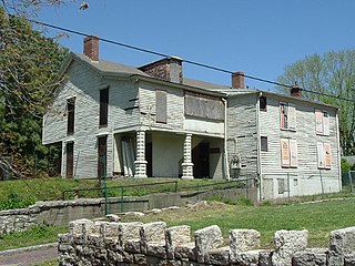
Old Louisville is a historic district and neighborhood in central Louisville, Kentucky, United States. It is the third largest such district in the United States, and the largest preservation district featuring almost entirely Victorian architecture. It is also unique in that a majority of its structures are made of brick, and the neighborhood contains the highest concentration of residential homes with stained glass windows in the U.S. Many of the buildings are in the Victorian era styles of Romanesque Revival, Queen Anne, or Italianate, and many blocks have had few or no buildings razed. There are also several 20th-century buildings from 15 to 20 stories.

Zachary Taylor National Cemetery is a United States National Cemetery located at 4701 Brownsboro Road (US-42), in Louisville, Kentucky. It is named for Zachary Taylor, the 12th president of the United States, who is buried there with his wife, Margaret Mackall Smith Taylor. Zachary Taylor National Cemetery was listed in the National Register of Historic Places on November 3, 1983. As of 2014, the cemetery has over 14,000 interments and is one of seven national cemeteries in the Commonwealth of Kentucky, and one of 112 in the United States. Those buried at the national cemetery served in six wars: Spanish–American War, World War I, World War II, Korean War, Vietnam War, and the Persian Gulf War.

The Original Highlands is a historic neighborhood in the Highlands area of Louisville, Kentucky, United States.
Portland is a historic district, neighborhood and former independent town northwest of downtown Louisville, Kentucky. It is situated along a bend of the Ohio River just below the Falls of the Ohio National Wildlife Conservation Area, where the river curves to the north and then to the south, thus placing Portland at the northern tip of urban Louisville. In its early days it was the largest of the six major settlements at the falls, the others being Shippingport and Louisville in Kentucky and New Albany, Clarksville, and Jeffersonville on the Indiana side. Its modern boundaries are the Ohio River along the northwest, north, and northeast, 10th Street at the far east, Market Street on the south, and the Shawnee Golf Course at the far west.
Phoenix Hill is a neighborhood of Louisville, Kentucky just east of Downtown. Its boundaries are Market Street to the North, Preston Street to the West, Broadway to the South, and Baxter Avenue to the East. The Phoenix Hill neighborhood, settled before 1850 by German immigrants, is now a rich tapestry of people and a diverse mix of business, industry and residences.
Klondike is a neighborhood in eastern Louisville, Kentucky, United States. Due to being on the edge of the old city limits, its boundaries are irregular, it is south of Hikes Lane and west of Breckenridge Lane. Development began after World War II, with developers Edward Butler and Chester Cooper purchasing and subdividing 45 acres (180,000 m2) of the Graff farm and part of the Hikes family's Midlane farm.
Hallmark is a small, primarily residential neighborhood in western Louisville, Kentucky, United States founded in 1965. Its boundaries are Cane Run Road to the west, Algonquin Parkway to the north, and Cypress street to the east. The origins of its name are not known. The area sits along Algonquin Park east to west near the border of Louisville and Shively. There are few distinctions that separate Hallmark from the surrounding areas of Park Duvalle or Shively.
Hayfield-Dundee is a neighborhood in eastern Louisville, Kentucky. Its boundaries are Dundee Road, Emerson Avenue, Newburg Road, I-264, and Tremont Drive to the east. Prior to subdivision, much of the land had been part of the Hayfield Farm, owned by Dr. Charles Wilkens Short, a founding professor of the University of Louisville medical school.
Bashford Manor is a neighborhood in Louisville, Kentucky, United States. Its boundaries are I-264 to the north, Bardstown Road to the east, Bashford Manor Lane to the south, and Newburg Road to the west. Originally a part of Thomas Byrd's 1,000 acre (4 km2) land grant from Virginia in 1787, James Bennett Wilder bought the land in 1870 and built a home which he named Bashford Manor, after his family's home in England. He sold the property to George James Long in 1888, who turned it into a horse farm which produced three early Kentucky Derby winners: Azra, Manuel and Sir Huon.
Waverly Hills is a neighborhood in Southwestern Louisville, Kentucky which is centered at Dixie Highway and Pages Lane. It is located in a hilly section of the city, which is part of the larger Knobs Region which extends into southeastern Kentucky. Its boundaries are roughly Stonestreet Road and 3rd Street Road to the south, Dixie Highway to the west, St Andrews Church Road to the north, and Auburndale to the east.
Worthington is a neighborhood of Louisville, Kentucky located along Brownsboro Road and Ballardsville Road. In the 1870s, a toll gate was built on Brownsboro Road at its intersection with Ballardsville Road. In the early 1900s the area was primarily potato farms, but residential development which began in the 1940s accelerated with the opening of Interstates 71 and 265 in the late 1960s.

Harrods Creek is a neighborhood of Louisville, Kentucky centered near Harrods Creek at the intersection of River Road and Wolf Pen Branch Road. It is roughly bordered by the Ohio River to the west and US 42 to the east. Its ZIP code is 40027. Formerly an unincorporated community, it was designated a neighborhood of Louisville when the city merged with Jefferson County in 2003.
Prairie Village is a neighborhood of Louisville, Kentucky, composed of a series of subdivisions and farms centered on the intersection of Third Street Road, Valley Station Road, and Stonestreet Road.
Springdale is a neighborhood in Louisville, Kentucky located along Brownsboro Road and Barbour Lane. The community is named for the family farm purchased by Laurence Young and his family in 1830, which was intersected by present-day Brownsboro Road, with the estate on the south side of the road. The Young family's Springdale farm today is the site of the Standard Country Club, as well as portions of Barbourmeade, Goose Creek and Brownsboro Farm. Though it is not a formally recognized neighborhood or district within Louisville, nor does it have official boundaries, older businesses and institutions in the community still retain the Springdale name, and the name was used to refer to the area until it was subdivided in the 1950s and '60s.

Walnut Street Baptist Church is a Southern Baptist, Christian former megachurch in Louisville, Kentucky. It is associated with the Southern Baptist Convention, Kentucky Baptist Convention, and the Long Run Baptist Association.

The East Market District, colloquially referred to as NuLu, is an unofficial district of Louisville, Kentucky, situated along Market Street between downtown to the west, Butchertown to the north, Phoenix Hill to the south, and Irish Hill to the east. The area is home to schools, churches, large and small businesses and some of the city's oldest homes and businesses. A destination since Louisville's founding, Market Street has played host to a variety of businesses throughout the city's history that have drawn Louisvillians for generations to its addresses.
Perry Park is an unincorporated community, country club and golf resort in Owen County, Kentucky, between Owenton and Carrollton. It is located one hour southwest of Cincinnati, one hour northwest of Lexington, and one hour northeast of Louisville, and lies on the Kentucky River. The ZIP Code for Perry Park is 40363. Perry Park is located at coordinates 38°32′53″N84°59′59″W.

The Cherokee Triangle is a historic neighborhood in Louisville, Kentucky, USA, known for its large homes displaying an eclectic mix of architectural styles. Its boundaries are Bardstown Road to the southwest, Cherokee Park and Eastern Parkway to the southeast, and Cave Hill Cemetery to the north, and is considered a part of a larger area of Louisville called The Highlands. It is named for nearby Cherokee Park, a 409 acres (1.7 km2) park designed by Frederick Law Olmsted, the designer of New York's Central Park.
Warwick Village is a neighborhood located in Louisville, Kentucky. Warwick Village is just outside the Watterson Expressway and part of the City of St. Matthews, Its boundaries are roughly New La Grange Rd, Washburn Ave, and Columbia Ave. Many of Warwick Village's streets are surrounded by Warwick Park also known as Warwick-Villa Park Playground.
References
- "Hikes Point". The Encyclopedia of Louisville (1 ed.). 2001.
