Related Research Articles

Meriwether is a neighborhood two miles southeast of downtown Louisville, Kentucky, USA, and just east of the University of Louisville. It was laid out by David Meriwether in 1871 and the first houses were built in 1891. Nearly all of the homes are shotgun houses.
Algonquin is a neighborhood in Louisville, Kentucky, United States. Its boundaries are Hill street to the north, Cypress Street to the west, CSX tracks to the east, and Bernheim Lane and Algonquin Parkway to the south. It was established in the 1920s and is primarily a residential neighborhood, named for nearby Algonquin Park. Samuel D. Jones Park is located on Thirteenth and Bashear streets.

Auburndale is a neighborhood in Louisville, Kentucky, United States. Its boundaries are Palatka Road to the north, and New Cut Road and Third Street to the east.
Park Hill is a neighborhood in Louisville, Kentucky, United States, located just west of Old Louisville. Its boundaries are the CSX railroad tracks to the east, Hill Street to the south, Twenty-sixth street to the west, and Virginia Avenue and Oak Street to the north. In the 19th century, the southwestern farmland portion of the neighborhood was known as the Cabbage Patch, the citizens of which inspired Alice Hegan Rice's 1901 children's novel Mrs. Wiggs of the Cabbage Patch.
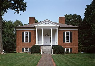
Hawthorne is a neighborhood in eastern Louisville, Kentucky, United States. Its boundaries are Taylorsville Road, Hawthorne Avenue, Bardstown Road and I-264. The land was once part of John Speed's Farmington estate, known for its plantation house built around 1815–16. The neighborhood is primarily residential and was first subdivided in 1909, but saw its fastest grown in the 1920s. It takes its name from Hawthorne Avenue, and most of the other streets are named after writers or poets. Sullivan University is located in the neighborhood.
Gardiner Lane is a neighborhood in eastern Louisville, Kentucky, United States. Its boundaries are Emerson Avenue to the north, Bardstown Road to the east, I-264 to the south, and Tremont Drive to the west. As with surrounding neighborhoods, it was farmland well into the first half of the 1900s. 16 subdivisions were developed from 1913 to 1950.
Hazelwood is a neighborhood on the south side of Louisville, Kentucky, United States. Its boundaries are Manslick Road to the west, I-264 to the north, Taylor Boulevard to the east, and Hazelwood Avenue to the south. Its development, as with other nearby neighborhoods, was spurred by the opening of Iroquois Park in the early 1890s. E.E. Meacham first subdivided the land in 1899. A larger subdivision, called Bergmann's Addition, was financed in 1902. The Hazelwood Center, opened in 1907, is a former tuberculous center and since 1971 a hospital for the mentally handicapped located in the neighborhood.
Brownsboro-Zorn is a neighborhood in northeast Louisville, Kentucky, United States. Its boundaries are Brownsboro Road to the south, Birchwood Avenue to the west, Mellwood Avenue to the north, and Mockingbird Valley to the east. Residential development began in 1911 between Birchwood and Zorn Avenue, a wide street which bisects the neighborhood. The core of the neighborhood is residential, but there is substantial commerce along Brownsboro Road. The Veterans Affairs Medical Center is located along Zorn.
Greenwood is a neighborhood of Louisville, Kentucky located along Cane Run Road and Greenwood Road. It is sometimes referred to by its large industrial park and shipping facility, Riverport.
Bethany is a neighborhood of Louisville, Kentucky located on Dixie Highway by Bethany Cemetery.

Riverside Gardens is a neighborhood of Louisville, Kentucky centered along Campground Road and Lees Lane. In 2007, the first stretch of the proposed 110-mile Louisville Loop bike and pedestrian trail was completed to Lees Lane in Riverside Gardens from Riverview Park. The project included a $2 million bridge over Mill Creek. The concrete trail is expected to be connected to Shawnee Park by spring of 2008. In the future, a wharf and riverfront park is planned for Riverside Gardens.

Clark Station is a neighborhood of Louisville, Kentucky located on Clark Station Road.
Orell is a neighborhood of Louisville, Kentucky centered along Dixie Highway and Orell Road.
Valley Village is a neighborhood in Valley Station, Louisville, Kentucky. It is located at Dixie Highway and Watson Lane.
Valley Gardens is a neighborhood of Louisville, Kentucky, in the United States. It is centered along Johnsontown Road and Terry Road.
Sylvania is a neighborhood of Louisville, Kentucky located near Terry Road along Sylvania Road.
Valley Downs is a neighborhood of Louisville, Kentucky, USA located along Omar Khayyam Boulevard south of Johnsontown Road.
Longview is a neighborhood of Louisville, Kentucky located along Longview and Box Hill Lanes off River Road, and is near Route 60.
Lake Louisvilla is a neighborhood partially located in Louisville, Kentucky. It is located between Westport Road in Louisville and KY 22 in Oldham County. Lake Louisvilla was developed in the 1920s as a summer resort for people living in the city of Louisville. The state of Kentucky drained the lake in the late 1980s due to safety concerns regarding the stability of a dam.
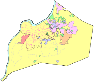
The Louisville/Jefferson County metro government (balance) is a statistical entity in the U.S. state of Kentucky defined by the United States Census Bureau to represent the portion of the consolidated city-county of Louisville-Jefferson County that does not include any of the 83 separate incorporated places (municipalities) located within the city and county. It is made of the portion of Jefferson County that was the city of Louisville prior to the 2003 creation of Louisville Metro, plus a large swath of previously unincorporated territory.
References
- ^ "HomeTownLocator" . Retrieved 2006-06-10.
City of Louisville and metro area | ||
|---|---|---|
| History |
|  |
| Geography | ||
| Government |
| |
| Transportation | ||
| Other subject areas | ||
| Top subjects | ||
| National Historic Landmarks | ||
| Prominent suburbs (over 10K pop.) | ||
| International | |
|---|---|
| National | |
| | This Louisville-related article is a stub. You can help Wikipedia by expanding it. |
| | This Jefferson County, Kentucky state location article is a stub. You can help Wikipedia by expanding it. |