Related Research Articles
Chickasaw is a neighborhood in Louisville, Kentucky, USA. Its boundaries are West Broadway, 34th Street, Hale Avenue and Chickasaw Park.

Meriwether is a neighborhood two miles southeast of downtown Louisville, Kentucky, USA, and just east of the University of Louisville. It was laid out by David Meriwether in 1871 and the first houses were built in 1891. Nearly all of the homes are shotgun houses.
Wilder Park is a neighborhood four miles south of downtown Louisville, Kentucky, USA. The area was originally the site of Greenland race course, built in 1866, a sister track of Churchill Downs. Greenland track closed in 1888 and the area became the Wilder Park neighborhood.
Beechmont is a neighborhood in the south end of Louisville, Kentucky. Its modern boundaries are I-264 to the north, Taylor Boulevard to the west, Southern Parkway and Southland Boulevard to the south, and Third Street, Allmond and Louisville Avenues to the east.

Shelby Park is a neighborhood two miles southeast of downtown Louisville, Kentucky, USA, named after Kentucky's first governor, Isaac Shelby. Shelby Park has always been considered a working-class neighborhood. It was first populated by German immigrants in the early 1900s. By the 1950s, the neighborhood was majority African-American. Today, Shelby Park is a blend of ethnic and economic diversity. People from all walks of life co-exist in a vibrant, art-filled community.
Algonquin is a neighborhood in Louisville, Kentucky, United States. Its boundaries are Hill street to the north, Cypress Street to the west, CSX tracks to the east, and Bernheim Lane and Algonquin Parkway to the south. It was established in the 1920s and is primarily a residential neighborhood, named for nearby Algonquin Park. Samuel D. Jones Park is located on Thirteenth and Bashear streets.

Auburndale is a neighborhood in Louisville, Kentucky, United States. Its boundaries are Palatka Road to the north, and New Cut Road and Third Street to the east.
Audubon is a neighborhood in Louisville, Kentucky, United States. Its boundaries are Clarks Lane to the north, Poplar Level Road to the east, Preston Highway to the west, and the city of Audubon Park to the south. The smaller city of Parkway Village is surrounded by Audubon. George Rogers Clark Park, the site of a cabin owned by the parents of George Rogers Clark, is a prominent feature of the neighborhood.
Park Hill is a neighborhood in Louisville, Kentucky, United States, located just west of Old Louisville. Its boundaries are the CSX railroad tracks to the east, Hill Street to the south, Twenty-sixth street to the west, and Virginia Avenue and Oak Street to the north. In the 19th century, the southwestern farmland portion of the neighborhood was known as the Cabbage Patch, the citizens of which inspired Alice Hegan Rice's 1901 children's novel Mrs. Wiggs of the Cabbage Patch.
Wyandotte, is a neighborhood on the southside of Louisville, Kentucky, United States. Its modern boundaries are Longfield Avenue to the north, Taylor Boulevard to the west, I-264 to the south, and Southern Parkway to the east. The opening of Iroquois Park in the early 1890s created a huge demand for suburban homes south of Louisville. The Coleman-Bush company had begun selling lots in a subdivision called Oakdale in late 1890. Oakdale was one of many middle-class communities created at this time, facilitated by the southward extension of streetcar lines.
Jacobs is a neighborhood on the south side of Louisville, Kentucky, in the United States. Its boundaries are Berry Boulevard to the north, Taylor Boulevard to the east, the I-264 to the south, and Seventh Street to the west. It was developed as Jacob's Addition in 1892 after the opening of nearby Jacob's Park and named for four-time Louisville mayor Charles Donald Jacob. The area housed a veteran's hospital, Nichols General Hospital, until 1952. The area includes Manslick Cemetery, a burial ground for indigents started in the 1870s, and Watterson Lake Park.
Klondike is a neighborhood in eastern Louisville, Kentucky, United States. Due to being on the edge of the old city limits, its boundaries are irregular, it is south of Hikes Lane and west of Breckenridge Lane. Development began after World War II, with developers Edward Butler and Chester Cooper purchasing and subdividing 45 acres (180,000 m2) of the Graff farm and part of the Hikes family's Midlane farm.
Hallmark is a small, primarily residential neighborhood in western Louisville, Kentucky, United States founded in 1965. Its boundaries are Cane Run Road to the west, Algonquin Parkway to the north, and Cypress street to the east. The origins of its name are not known. The area sits along Algonquin Park east to west near the border of Louisville and Shively. There are few distinctions that separate Hallmark from the surrounding areas of Park Duvalle or Shively.
Hazelwood is a neighborhood on the south side of Louisville, Kentucky, United States. Its boundaries are Manslick Road to the west, I-264 to the north, Taylor Boulevard to the east, and Hazelwood Avenue to the south. Its development, as with other nearby neighborhoods, was spurred by the opening of Iroquois Park in the early 1890s. E.E. Meacham first subdivided the land in 1899. A larger subdivision, called Bergmann's Addition, was financed in 1902. The Hazelwood Center, opened in 1907, is a former tuberculous center and since 1971 a hospital for the mentally handicapped located in the neighborhood.
Greenwood is a neighborhood of Louisville, Kentucky located along Cane Run Road and Greenwood Road. It is sometimes referred to by its large industrial park and shipping facility, Riverport.

Riverside Gardens is a neighborhood of Louisville, Kentucky centered along Campground Road and Lees Lane. In 2007, the first stretch of the proposed 110-mile Louisville Loop bike and pedestrian trail was completed to Lees Lane in Riverside Gardens from Riverview Park. The project included a $2 million bridge over Mill Creek. The concrete trail is expected to be connected to Shawnee Park by spring of 2008. In the future, a wharf and riverfront park is planned for Riverside Gardens.
Parkwood is a neighborhood of Louisville, Kentucky near Iroquois Park. It is located along KY-1931 south of Gagel Avenue which forms its border with Cloverleaf.

500 West Jefferson, previously known as PNC Plaza for several decades until renamed in 2020, and now also called 500W or 500 West by its owners, is a skyscraper in Downtown, Louisville, Kentucky and located at 500 West Jefferson Street. Previously owned by Pittsburgh-based PNC Bank and currently owned by SomeraRoad Inc, the 31-story, 420-foot (128 m) high structure was designed by architect Welton Becket and was completed in 1971. A notable feature of the building is the pattern of pre-cast concrete panels on the exterior of its windows. The building, originally named Citizens Fidelity Plaza, was named after Citizens Fidelity Bank and renamed PNC Plaza when Citizens Fidelity was acquired by PNC Bank.
Rockcreek-Lexington Road is an irregular-shaped neighborhood in Louisville, Kentucky, United States. Its boundaries are Seneca Park and Briar Hill Road to the west, Cannons Lane to the east, Interstate 64 to the south, and Lexington Road to the north. Also included are "areas immediately adjoining Shelbyville Rd. from Cannons Ln. to Fairfax Ave. and those along Nanz Ave. from Cannons Ln. to Macon Ave."
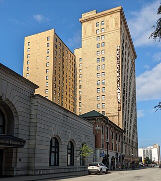
Kentucky Towers is a historic apartment building located in Downtown Louisville, Kentucky, USA, at 430 W Muhammad Ali Blvd.
References
- "Southland Park". The Encyclopedia of Louisville (1 ed.). 2001.
