
Tyler Park is a neighborhood three miles (5 km) southeast of downtown Louisville, Kentucky, USA. It is considered a part of a larger area of Louisville called The Highlands. Near the middle of the neighborhood is a city park of the same name, and many houses in the neighborhood feature park views. The neighborhood boundaries are St Louis Cemetery to the north, Bardstown Road to the east, Eastern Parkway to the south and Beargrass Creek to the west.

The Original Highlands is a historic neighborhood in the Highlands area of Louisville, Kentucky, United States.
Portland is a historic district, neighborhood and former independent town northwest of downtown Louisville, Kentucky. It is situated along a bend of the Ohio River just below the Falls of the Ohio National Wildlife Conservation Area, where the river curves to the north and then to the south, thus placing Portland at the northern tip of urban Louisville. In its early days it was the largest of the six major settlements at the falls, the others being Shippingport and Louisville in Kentucky and New Albany, Clarksville, and Jeffersonville on the Indiana side. Its modern boundaries are the Ohio River along the northwest, north, and northeast, 10th Street at the far east, Market Street on the south, and the Shawnee Golf Course at the far west.

Russell is a neighborhood immediately west of downtown Louisville, Kentucky, U.S.. It is nicknamed "Louisville's Harlem". It was named for renowned African American educator and Bloomfield, Kentucky native, Harvey Clarence Russell Sr. Its boundaries are West Market Street, 9th Street, West Broadway and I-264.
Shawnee is a neighborhood in western Louisville, Kentucky. Its boundaries are the Ohio River on the West, Bank Street and the Portland neighborhood on the North, I-264 on the East, and West Broadway on the South. Maps sometimes identify the area as Shawneeland.
St. Joseph is a neighborhood two miles south of downtown Louisville, Kentucky, United States, and immediately east of the University of Louisville. It borders the Meriwether neighborhood to the north and Schnitzelburg to the east. The area was named after the St. Joseph's Infirmary hospital, which was established by the Sisters of Charity of Nazareth. The building, once located at the corner of Preston Street and Eastern Parkway, was razed in 1980.

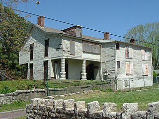
Meriwether is a neighborhood two miles southeast of downtown Louisville, Kentucky, USA, and just east of the University of Louisville. It was laid out by David Meriwether in 1871 and the first houses were built in 1891. Nearly all of the homes are shotgun houses.

South Louisville is a neighborhood two miles south of downtown Louisville, Kentucky, US. The area was incorporated as a city in 1886. The city of Louisville fought to annex the area and did so, after a three-year lawsuit, in 1898. As of 2000, the population of South Louisville was 4,688.
Beechmont is a neighborhood in the south end of Louisville, Kentucky. Its modern boundaries are I-264 to the north, Taylor Boulevard to the west, Southern Parkway and Southland Boulevard to the south, and Third Street, Allmond and Louisville Avenues to the east.

Crescent Hill is a neighborhood four miles (6 km) east of downtown Louisville, Kentucky USA. This area was originally called "Beargrass" because it sits on a ridge between two forks of Beargrass Creek. The boundaries of Crescent Hill are N Ewing Ave to the St. Matthews city limit by Brownsboro Road to Lexington Road. Frankfort Avenue generally bisects the neighborhood.
Cherokee Gardens is a residential area six miles east of downtown Louisville, Kentucky, US. The area is a collection of small, unconnected subdivisions along Lexington Road and large estates built just outside Cherokee Park.

Central Park is a 17-acre (69,000 m2) municipal park maintained by the city of Louisville, Kentucky. Located in the Old Louisville neighborhood, it was originally the country estate of the DuPont family. Early in its existence, the park was the site of the Southern Exposition, but later became mostly known for hosting the Kentucky Shakespeare Festival and northern portions of the annual St. James Court Art Show.
California is a neighborhood in urban Louisville, Kentucky, United States. It is bounded on the north by Broadway, on the east by Ninth Street, on the south by Oak Street, and on the west by Twenty-Sixth Street. There are no written records of the beginning of the neighborhood, but the area was settled by German immigrants around 1849. It is said that the subdivision, initially called Henderson, came to be known as California because it was the "far west" of Louisville.
Cherokee-Seneca is a neighborhood in Louisville, Kentucky, United States. It is bounded by I-64 and other neighborhoods, and includes the two large parks Cherokee Park and Seneca Park, as well as the homes built around those parks. The area is hilly, consisting of ridges around the middle fork of Beargrass Creek. It is home to the former Gardencourt Mansion, now part of the Louisville Presbyterian Theological Seminary.
Phoenix Hill is a neighborhood of Louisville, Kentucky just east of Downtown. Its boundaries are Market Street to the North, Preston Street to the West, Broadway to the South, and Baxter Avenue to the East. The Phoenix Hill neighborhood, settled before 1850 by German immigrants, is now a rich tapestry of people and a diverse mix of business, industry and residences.
Iroquois is a neighborhood on the south side of Louisville, Kentucky, United States. It is split into two parts by Beechmont. From a historical perspective, the northwestern section would be the Bryn Mawr neighborhood and the southeastern section would be the Kenwood neighborhood. The Iroquois neighborhood is roughly bounded by Hazelwood Avenue, Beechmont, Third Street, Kenwood Drive, and Iroquois Park. Located near the Louisville International Airport, residents have frequently complained of noise and challenged airport expansion. The largely residential neighborhood was developed as a suburb after World War II and into the 1950s.
Poplar Level is a neighborhood five miles (8 km) southeast of downtown Louisville, Kentucky, United States. It is part of the larger Camp Zachary Taylor area.

The East Market District, colloquially referred to as NuLu, is an unofficial district of Louisville, Kentucky, situated along Market Street between downtown to the west, Butchertown to the north, Phoenix Hill to the south, and Irish Hill to the east. The area is home to schools, churches, large and small businesses and some of the city's oldest homes and businesses. A destination since Louisville's founding, Market Street has played host to a variety of businesses throughout the city's history that have drawn Louisvillians for generations to its addresses.
Southside is a neighborhood in Louisville, Kentucky, United States. Its boundaries are Third Street to the west, Woodlawn Avenue, Allmond Avenue and Hiawatha Avenue to the north, the CSX railroad tracks to the east, and the southern boundary of the Greater Louisville Technology Park, Southside Drive and Kenwood Drive to the south.

The Cherokee Triangle is a historic neighborhood in Louisville, Kentucky, USA, known for its large homes displaying an eclectic mix of architectural styles. Its boundaries are Bardstown Road to the southwest, Cherokee Park and Eastern Parkway to the southeast, and Cave Hill Cemetery to the north, and is considered a part of a larger area of Louisville called The Highlands. It is named for nearby Cherokee Park, a 409 acres (1.7 km2) park designed by Frederick Law Olmsted, the designer of New York's Central Park.


