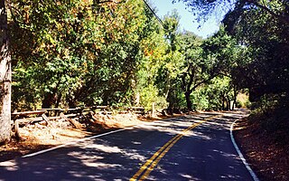
Silverado is an unincorporated community and census-designated place (CDP) in Silverado Canyon, which is located in the Santa Ana Mountains in eastern Orange County, California. Portions of the town sit on a former Mexican land grant Rancho Lomas de Santiago. Silverado is located at the boundaries of Cleveland National Forest. The site is a California Historical Landmark, and is located near the village site of Puhú.
The Santiago Canyon Fire of 1889 was a massive wildfire in California, which burned large parts of Orange County, Riverside County, and San Diego County during the last week of September 1889. The fire reportedly started in Fremont Canyon, a canyon close to what today is Irvine Lake. Until 2018, it was possibly the single largest wildfire in the recorded history of California, with at least 300,000 acres (1,200 km2) of land burned. In mid-August 2018, the Ranch Fire in the Mendocino Complex Fire surpassed the Santiago Canyon Fire's assumed acreage.
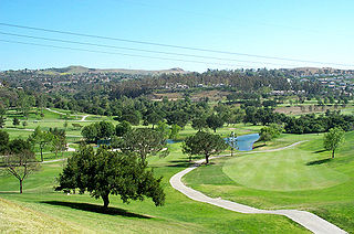
Anaheim Hills is a planned community encompassing the eastern portions of the city of Anaheim, in Orange County, California.

At least 9,093 separate wildfires charred 1,520,362 acres (6,152.69 km2) of land in the US state of California in 2007. Thirty of those wildfires were part of the Fall 2007 California firestorm, which burned approximately 972,147 acres of land from Santa Barbara County to the U.S.–Mexico border. At the peak of the wildfire activity in October 2007, the raging wildfires were visible from space.

The Santiago Fire was a wildfire located near Santiago Canyon in Orange County, California, United States, and one of thirty California wildfires of October 2007. The fire was intentionally started.

The October 2007 California wildfires, also known as the Fall 2007 California firestorm, were a series of about thirty wildfires that began igniting across Southern California on October 20. At least 1,500 homes were destroyed and approximately 972,147 acres of land was burned from Santa Barbara County to the U.S.–Mexico border, surpassing the October 2003 California wildfires in scope, which were estimated to have burned 800,000 acres (3,200 km2). The wildfires killed a total of 14 people, with nine of them dying directly from the fires; 160 others were injured, including at least 124 firefighters. At their height, the raging fires were visible from space. These fires included the vast majority of the largest and deadliest wildfires of the 2007 California wildfire season. The only wildfire in 2007 that surpassed any of the individual October 2007 fires in size was the Zaca Fire.

The Thomas Fire was a massive wildfire that affected Ventura and Santa Barbara Counties, and one of multiple wildfires that ignited in Southern California in December 2017. It burned approximately 281,893 acres before being fully contained on January 12, 2018, making it the largest wildfire in modern California history at the time. It was surpassed by the Ranch Fire, part of the Mendocino Complex, in August 2018. The fire is currently the eighth-largest wildfire in modern California history, as of 2025. The fire was officially declared out on June 1, 2018, after more than two months in which no hotspots were detected. The Thomas Fire destroyed at least 1,063 structures, while damaging 280 others; and the fire caused over $2.2 billion in damages, including $230 million in suppression costs, becoming the seventh-most destructive wildfire in state history at the time. As of August 2020, the Thomas Fire is California's tenth-most destructive wildfire. Ventura's agriculture industry suffered at least $171 million in losses due to the Thomas Fire.

The Creek Fire was a large wildfire that burned in Kagel Canyon and the Angeles National Forest north of Sylmar, a neighborhood in Los Angeles, California, United States, and one of multiple wildfires that broke out across Southern California in December 2017. The Creek Fire burned 15,619 acres (63 km2) and destroyed 123 structures, including 60 homes, before being contained on January 9, 2018, following heavy rainfall from a winter storm. The fire threatened the communities of Santa Clarita, Glendale, Olive View, Lake View Terrace, Sunland-Tujunga, Shadow Hills, Sylmar, Pacoima, Lopez Canyon, and Kagel Canyon, as well as the Olive View–UCLA Medical Center. During the wildfire, 115,000 residents were forced to evacuate their homes.
A series of 29 wildfires ignited across Southern California in December 2017. Six of the fires became significant wildfires, and led to widespread evacuations and property losses. The wildfires burned over 307,900 acres (1,246 km2), and caused traffic disruptions, school closures, hazardous air conditions, and power outages; over 230,000 people were forced to evacuate. The largest of the wildfires was the Thomas Fire, which grew to 281,893 acres (1,140.78 km2), and became the largest wildfire in modern California history, until it was surpassed by the Ranch Fire in the Mendocino Complex, in the following year.
The Holy Fire was a wildfire that burned in the Cleveland National Forest in Orange and Riverside Counties, California. The wildfire started on August 6, 2018, at around 1:15 PM PDT, in the vicinity of Trabuco Canyon. A suspected arsonist was booked into the Orange County jail in Santa Ana, California but found not guilty in 2023. The blaze burned 23,136 acres (94 km2) and destroyed 18 buildings, before it was fully contained on September 13, 2018. While the fire was actively spreading in early and mid-August, residents of the nearby cities of Corona, Temescal Valley, and Lake Elsinore were placed under evacuation orders.

The Woolsey Fire was a wildfire that started in Los Angeles County and spread north to neighboring Ventura County, both located in the U.S. state of California. The fire ignited on November 8, 2018 and was not fully contained until November 21, 2018. The fire burned 96,949 acres of land, destroyed 1,643 structures, killed three people, and prompted the evacuation of more than 295,000 people. It was one of several fires in California that ignited on the same day, along with the nearby Hill Fire and the destructive Camp Fire in Northern California.

The Tick Fire was a wildfire that burned in Los Angeles County, California. The fire broke out on October 24, 2019, and burned several thousand acres. The fire forced the mass evacuation of 40,000 people from the Santa Clarita Valley.

The Maria Fire was a wildfire that burned the south of the community of Santa Paula in the area of Somis, California on the top of South Mountain in Ventura County. The fire ignited in the evening hours of Thursday, October 31, 2019, and consumed well over 4,000 acres (16 km2) within its first several hours of burning. Despite the aggressive initial attack by first responders, the fire exploded rapidly due to a strong Santa Ana wind event that was occurring in the area during its ignition.

The Bobcat Fire was a large wildfire in Los Angeles County during the 2020 California wildfire season. The fire ignited on September 6, 2020, and burned 115,997 acres (46,942 ha) before it was fully contained by November 27. The Bobcat Fire primarily burned in the central San Gabriel Mountains, in and around the Angeles National Forest, and is one of the largest fires on record in Los Angeles County to date.

The Bond Fire was a wildfire that burned 6,686 acres (2,706 ha) in the Santiago Canyon area of Orange County, California in December 2020. The fire caused evacuations of 25,000 residents and injured 2 firefighters. The fire was very close to the burn scar of the Silverado Fire, which took place in October 2020.

Whiting Ranch Wilderness Park is a 2,500 acre public regional park within the city of Lake Forest in southern Orange County, California. Whiting Ranch features riparian, oak woodland, grassland, chaparral, and coastal sage scrub environments throughout various canyons and hillscapes. The park is home to over 17 miles of trail spread out over 23 different paths, making the location a popular destination for mountain bikers, hikers, and horseback riders.

The Kinneloa Fire was a destructive wildfire in Los Angeles County, Southern California in October 1993. The fire destroyed 196 buildings in the communities of Altadena, Kinneloa Mesa, and Sierra Madre in the foothills of the San Gabriel Mountains, becoming at the time the twelfth-most destructive wildfire in California's history and one of the most destructive wildfires in Los Angeles County history. The fire caused a multitude of minor injuries, one direct fatality, and two indirect fatalities.

The 1993 Laguna Fire or Laguna Canyon Fire was a destructive wildfire in Orange County, California. After igniting on October 27, the fire burned more than 16,000 acres and destroyed hundreds of homes in Laguna Beach and Emerald Bay before it was fully contained on October 31. The fire forced almost 25,000 people to evacuate and caused approximately $528 million in damage, becoming one of the most costly fires in United States history. It was part of a larger outbreak of wildfires that week in Southern California, largely driven by Santa Ana winds.

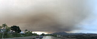
The Airport Fire was a wildfire that burned 23,526 acres (9,521 ha) in the Santa Ana Mountains in Southern California in September and October 2024. The fire destroyed 160 structures in Orange and Riverside counties and caused 21 non-fatal injuries. At its peak, 20,780 structures were threatened by the fire.

The Eaton Fire was a highly-destructive wildfire in Los Angeles County, Southern California. The fire began on the evening of January 7, 2025, in the Eaton Canyon in the San Gabriel Mountains, and was driven by powerful Santa Ana winds into foothill communities, particularly Altadena. The fire killed at least 17 people and destroyed more than 9,000 buildings, becoming the fifth deadliest and the second most destructive wildfire in the history of the state of California. The cause of the fire is under investigation; news reports and lawsuits have focused on the possible involvement of power lines operated by electrical utility Southern California Edison. The fire was fully contained on January 31st after burning for 24 days.


