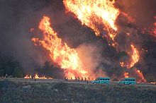
The Mendocino National Forest is located in the Coastal Mountain Range in northwestern California and comprises 913,306 acres (3,696.02 km2). It is the only national forest in the state of California without a major paved road entering it. There are a variety of recreational opportunities — camping, hiking, mountain biking, paragliding, backpacking, boating, fishing, hunting, nature study, photography, and off-highway vehicle travel.

The Angeles National Forest (ANF) of the U.S. Forest Service is located in the San Gabriel Mountains and Sierra Pelona Mountains, primarily within Los Angeles County in southern California. The ANF manages a majority of the San Gabriel Mountains National Monument.
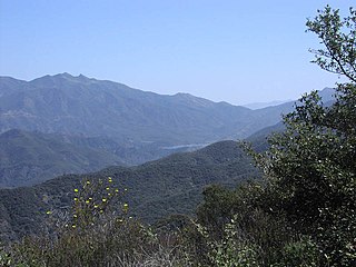
Los Padres National Forest is a United States national forest in southern and central California. Administered by the United States Forest Service, Los Padres includes most of the mountainous land along the California coast from Ventura to Monterey, extending inland. Elevations range from sea level to 8,847 feet (2,697 m).

The Topatopa Mountains are a mountain range in Ventura County, California, north of Ojai, Santa Paula, and Fillmore. They are part of the Transverse Ranges of Southern California.

Sespe Creek is a stream, some 61 miles (98 km) long, in Ventura County, southern California, in the Western United States. The creek starts at Potrero Seco in the eastern Sierra Madre Mountains, and is formed by more than thirty tributary streams of the Sierra Madre and Topatopa Mountains, before it empties into the Santa Clara River in Fillmore.

The Chumash Wilderness is a 38,150 acres (15,440 ha) wilderness area within the southern Los Padres National Forest. It is located in the Transverse Ranges, in northern Ventura County and southwestern Kern County in California.

The Sespe Condor Sanctuary is a 53,000-acre (210 km2) wildlife refuge in the Topatopa Mountains, in northeastern Ventura County, California. It is within the Sespe Wilderness in the southern Los Padres National Forest.

The Dick Smith Wilderness is a wilderness area in the mountains of eastern Santa Barbara County, California, United States, with a portion in Ventura County. It is completely contained within the Los Padres National Forest, and is northeast of the city of Santa Barbara and north of the city of Ojai. It is most easily accessible from two trailheads off State Route 33, which runs north from Ojai. It is adjacent to the large San Rafael Wilderness on the west and the Matilija Wilderness on the south. Across Highway 33 to the east, and also in the Los Padres National Forest, is the large Sespe Wilderness.

The Zaca Fire was a wildfire in the San Rafael Mountains, northeast of the Santa Ynez Valley in Santa Barbara County, California. It was the single largest wildfire of the 2007 California wildfire season. The fire started on July 4, 2007, and by August 31, it had burned over 240,207 acres (972.083 km2), making it California's second largest fire in recorded history at that time after the Cedar Fire of 2003. As of 2023, it is California's 12th-largest recorded fire in modern history. The fire was contained on September 4, 2007, with the fire being brought under control on October 29, 2007.

The Silver Peak Wilderness is located in the southwestern corner of Monterey County in the Santa Lucia Mountains along the Central Coast of California. It southern boundary largely follows the Monterey County/San Luis Obispo County line. Its eastern boundary is defined by Ft. Hunter Liggett, while on the west it follows closely along Highway 1 and the Big Sur coastline. It is one of ten wilderness areas within the Los Padres National Forest and managed by the US Forest Service.
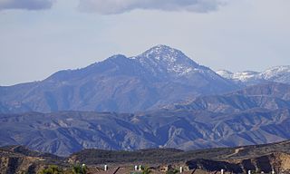
Cobblestone Mountain is a peak in the Topatopa Mountains, in Ventura County, about 14 mi (23 km) north of Piru, California. At 6,738 feet (2,054 m), it is the highest peak of the Topatopa Mountains. Second highest is Hines Peak. Snow frequently falls on the mountain during winter.
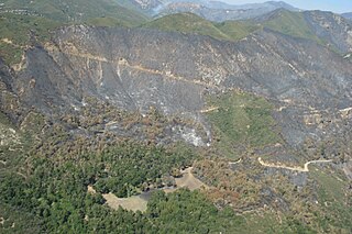
The Indians Fire was a wildfire in the Ventana Wilderness of the Los Padres National Forest in the Santa Lucia Range which that started on June 8, 2008 and burned uncontained until July 10 scorching 81,378 acres (329.33 km2) of land. This fire burned predominantly within the Los Padres National Forest, Monterey Ranger District, inside the Ventana Wilderness. Other affected properties include portions of Fort Hunter Liggett military base and private property. The suppression cost exceeded $40.7 million, not including resource damages and rehabilitation costs.

The La Brea Fire was a fast-moving 2009 wildfire which occurred in Southern California in the United States. The fire began near La Brea Creek in Santa Barbara County, in the Los Padres National Forest. The fire started burning on August 8, and just 5 days later on August 13 had grown by 10,000 acres, or 40 km2. When the wildfire was finally contained on August 22, it had burned 89,489 acres of land. The huge Zaca Fire burned in the same region as the La Brea Fire, and occurred just two years prior in 2007.
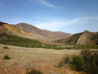
The Sespe Wilderness is a 219,700-acre (88,900 ha) wilderness area in the eastern Topatopa Mountains and southern Sierra Pelona Mountains, within the Los Padres National Forest (LPNF), in Ventura County, Southern California. The wilderness area is primarily located within the Ojai and Mt. Pinos ranger districts of the LPNF.

The Soberanes Fire was a large wildfire that burned from July to October 2016 in the Santa Lucia Mountains of Monterey County, California. It destroyed 57 homes and killed a bulldozer operator, and cost about $260 million to suppress, making it at the time the most expensive wildfire to fight in United States history. At the fire's peak, over 5,000 personnel were assigned to the blaze. The fire was the result of an illegal campfire in Garrapata State Park. By the time it was finally extinguished, the fire had burned 132,127 acres (53,470 ha) along the Big Sur coast in the Los Padres National Forest, Ventana Wilderness, and adjacent private and public land in Monterey County, ranking it 18th on the list of the largest California wildfires in terms of acreage burned.

A series of 29 wildfires ignited across Southern California in December 2017. Six of the fires became significant wildfires, and led to widespread evacuations and property losses. The wildfires burned over 307,900 acres (1,246 km2), and caused traffic disruptions, school closures, hazardous air conditions, and power outages; over 230,000 people were forced to evacuate. The largest of the wildfires was the Thomas Fire, which grew to 281,893 acres (1,140.78 km2), and became the largest wildfire in modern California history, until it was surpassed by the Ranch Fire in the Mendocino Complex, in the following year.
The Matilija Wilderness is a 29,207-acre (11,820 ha) wilderness area in Ventura and Santa Barbara Counties, Southern California. It is managed by the U.S. Forest Service, being situated within the Ojai Ranger District of the Los Padres National Forest. It is located adjacent to the Dick Smith Wilderness to the northwest and the Sespe Wilderness to the northeast, although it is much smaller than either one. The Matilija Wilderness was established in 1992 in part to protect California condor habitat.
The Matilija Fire was a major wildfire that burned nearly 220,000 acres (89,000 ha) in the Santa Barbara National Forest of Southern California, during the autumn of 1932. The fire is named for Matilija Creek, near the location from which it originated.
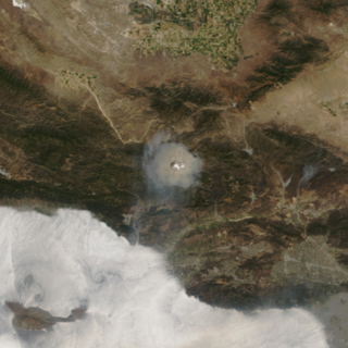
The Wolf Fire was a large wildfire in Southern California's Ventura County, north of the city of Ojai, in June of 2002. The fire was ignited on June 1 by the careless use of firearms for target shooting in dry grass and burned 21,645 acres, destroying six structures before it was completely contained on June 14. The cost of containing the fire came to $15 million. No fatalities or serious injuries occurred, but the fire impacted large parts of the Sespe Wilderness and the Los Padres National Forest, causing road and campground closures while threatening Native American cultural sites and wildlife habitat.

