Reading Fire

Last updated

Reading Fire
Cropped pano of Reading Fire from Mount Harkness.jpg
The Reading Fire seen on August 7, 2012 from Mount Harkness, with Lassen Peak to the left
Date(s)
  • July 23, 2012 (2012-07-23)
  • August 22, 2012 (2012-08-22)
  • (31 days)
Location Shasta County, Northern California, United States
Coordinates 40°29′42″N121°27′14″W / 40.495°N 121.454°W / 40.495; -121.454
Statistics
Burned area28,079 acres (11,363 ha; 44 sq mi; 114 km2)
Impacts
Deaths0
Non-fatal injuries2
Structures destroyed0
Damage
  • $17 million
  • (equivalent to about $22 million in 2023)
Ignition
CauseLightning
Map
2012 Reading Fire map 1.png
The footprint of the fire in Lassen Volcanic National Park and the Lassen National Forest
USA California location map.svg
FireIcon.svg
The general location of the fire in Shasta County, Northern California

The 2012 Reading Fire was a large wildfire in Lassen Volcanic National Park and the Lassen National Forest in Northern California. Ignited by a lightning strike on July 23, the fire was managed for ecological benefits by park officials until shifts in the weather caused the fire to jump its intended control lines. The Reading Fire ultimately burned 28,079 acres (11,363 hectares), partially outside the borders of the park, before it was fully contained on August 22, 2012.

Contents

The fire destroyed no structures and caused no fatalities or even serious injuries, but the fire's unintended escape led members of the public and several California politicians to criticize park officials for allowing the fire to go unsuppressed after its discovery. The Reading Fire was one of 7,950 wildfires that burned a total of 869,599 acres (351,914 ha) during California's 2012 wildfire season.

Background

Burn scars in tree rings suggest that wildfires historically burned in the area that is now Lassen Volcanic National Park with a return interval of between five and 15 years, and with mixed severities. This baseline changed dramatically beginning in 1905, when fire suppression efforts began in earnest. The new fire regime lasted until park policy changed in the 1980s, and Lassen Volcanic National Park began managing lightning-ignited fires for their ecological benefits within the Lassen Volcanic Wilderness. [1] [2] Wildfires in the park have a "strong tendency" to burn from southwest to northeast. [3] :34

A scant winter snowpack leading up to the 2012 fire season in Northern California drove the moisture levels in all dead fuels (including large fuels that take longer to dry out, such as dead fallen trees and brush piles) to record low levels. The low fuel moistures contributed to 'spotting' fire behavior on the Reading Fire, where wind-blown firebrands or embers start new fires where they land. [4] [3] :24–26

Progression

On July 23, 2012, thunderstorms developed over Lassen Volcanic National Park. Lightning struck a single red fir tree on a north-facing slope, at about 7,100 ft (2,200 metres) in elevation, and ignited it at approximately 5:09 p.m. PDT. [5] [6] The ignition point was located in a designated wilderness area, approximately one mile (1.6 kilometres) northeast of Paradise Meadows and 2.5 miles (4.0 km) east of Lassen Peak, south of the Lassen National Park Highway. [6] [3] :13,44 The fire was named for Reading Peak, which lay nearby. [6]

A park fire management officer and a member of the Forest Service hiked in to the fire, directed by a reconnaissance aircraft. [6] At that point, late in the day, the fire had hardly expanded beyond the lone red fir tree and its behavior was subdued—a later report described the fire at this point as being three feet (0.91 m) by five feet (1.5 m) and "smoldering". [3] :44 After evaluating local topographical features and other conditions (such as a dearth of dense vegetation, a cooler northern slope, ridges and roads at which to limit fire spread, etc.), the personnel at the scene concluded the area was potentially conducive to a managed wildfire and deferred the decision of whether to extinguish the fire or not to the following day. [6]

On July 24, park personnel conversed among themselves and with experts (including the National Park Service’s regional fire ecologist) before receiving permission from the Lassen Volcanic National Park superintendent to manage the fire. [6] The initial goal was to confine the fire to an area of just 700 acres (280 hectares), bounded by two drainages and by Lassen National Park Highway to the north. [3] :44 The Reading Fire was initially managed by a Type 4 incident management team and approximately 16 firefighters. [3] :13 By July 30, one week after ignition, the fire had grown to three acres (1.2 hectares). [3] :13 During that week the fire behaved as predicted, slowly spreading downhill while only consuming surface fuels/vegetation. [6]

As the calendar turned to August, the fire began to expand at a greater pace. By the 3rd of the month, it had burned 50 acres (20 ha), and by the following day, 94 acres (38 ha). On August 6, as management of the fire was being handed over to a Type 3 incident management team, the Reading Fire spotted (jumped, via windblown embers) across the park highway where personnel had intended to hold the fire. The fire took root in the Hat Creek drainage and continued to expand, reaching 1,010 acres (410 ha) by the end of the day. [3] :14–15

Firefighters scout for spot fires in a meadow on August 5, 2012 Reading fire 2012 - Firefighters scouting for spot fires.jpg
Firefighters scout for spot fires in a meadow on August 5, 2012

On August 7, continued winds out of the south pushed the fire north and out of the park itself, and the Reading Fire became established on Badger Mountain in the Lassen National Forest. [3] :15 Air tankers attacked the resulting spot fires. [7] Fire growth continued to accelerate: on the 8th the fire had burned 2,000 acres (810 ha), by the 10th more than 9,000 acres (3,600 ha), and by August 12, the fire had burned more than 15,000 acres (6,100 ha). On August 13, a Type 1 incident management team took control of the suppression effort and began to perform firing operations to contain the fire indirectly. [3] :16 Meanwhile, a spot fire was detected just four miles (6.4 km) south of Old Station. [6]

The Reading Fire (top) and Chips Fire (bottom) are shown in this MODIS satellite view on August 13, 2012 Reading and Chips fires via MODIS on 2012-08-13.jpg
The Reading Fire (top) and Chips Fire (bottom) are shown in this MODIS satellite view on August 13, 2012

Firefighters began conducting burning operations "day and night" to halt the fire's spread. [8] On August 17th the fire's growth was "minimal" and confined to its eastern and southern flanks, remaining four miles (6.4 km) from Old Station. Aircraft continued to drop fire retardant on the eastern edge, aiding ground crews constructing fire lines near Twin Lakes. [9] Firefighters held the containment lines on Prospect Peak. [3] :17 By August 18, aided by good weather and water-dropping helicopters, the containment lines on the fire's north and west sides were completed and the fire's overall containment rose to 32 percent. [10] The remaining areas of active fire on the east and southeast sides of the fire were addressed by firefighters constructing containment lines by hand in designated wilderness areas, helped by less dense fuels—the effects of other wildfires in the two decades prior. [3] :17

The fire was declared fully contained on August 22. [11] [3] :17 The firefighting effort involved more than 1,200 personnel at its peak, at a total cost of $17 million (equivalent to about $22 million in 2023). [3] :10–11 The fire was declared controlled on October 23, 2012. [3] :17 The total burned area was 28,079 acres (11,363 ha). This footprint comprised 16,993 acres (6,877 ha) burned in Lassen Volcanic National Park, 11,071 acres (4,480 ha) burned in the Hat Creek Ranger District of the Lassen National Forest, and 75 acres (30 ha) of private land. [12]

Effects

There were no fatalities or serious injuries associated with the Reading Fire. According to the National Park Service review of the fire, only two minor firefighter injuries occurred. [3] :39

The Reading Fire caused the closure of the Lassen Park Highway for 20 days, as well as the closure of about 30 miles (48 km) of trails in and near the park. [13] [14] The Pacific Crest Trail closed to hikers between Lower Twin Lake to the south and Old Station to the north (outside the Lassen National Forest). [15] The park itself did not close to visitors. [16]

No structures were lost in the Reading Fire. [3] :3 The fire burned through multiple trails in Lassen Volcanic National Park, including the Twin Lakes Loop Trail, the Nobles Emigrant Trail, and parts of the Pacific Crest Trail. [17]

Environmental impacts

The effects of the Reading Fire from the main park road, north of Summit Lake, on August 22, 2012 Reading fire 2012 - Effects from park road.jpg
The effects of the Reading Fire from the main park road, north of Summit Lake, on August 22, 2012

Of the ~11,000 acres (4,500 ha) that the fire burned in the Lassen National Forest, 65 percent of them experienced a moderate-to-high soil burn severity. The other 35 percent experienced low to very low soil burn severity. For the ~17,000 acres (6,900 ha) that the Reading Fire burned in the National Park, 49 percent experienced a moderate-to-high soil burn severity and 51 percent low to unburned soil burn severity. [12]

A preliminary report found that 30 percent of the fire's footprint recorded a moderate vegetation burn severity, and 35 percent recorded a high vegetation burn severity. [18] Park staff reported that "pretty good regeneration" had already begun in the predicted areas by June of 2013. [19]

Political response

Following a request by members of the Shasta County board of supervisors, U.S. Congressional representatives Wally Herger (CA-02) and Tom McClintock (CA-04) called an informal hearing at the California State Capitol in Sacramento on October 24, 2012, inviting testimony from the Park Service, the Forest Service, and the California Department of Forestry and Fire Protection (Cal Fire). Both representatives heavily criticized the Park Service for their decision to manage the fire. The director of fire and aviation management for the Pacific Southwest Region of the Forest Service and the deputy director of Cal Fire both said they would have extinguished the fire immediately had it ignited in their areas of responsibility. Shasta County residents also spoke at the hearing, largely to air their view that the Reading Fire had negatively impacted tourism income. [14] [17] [20]

The following summer, Lassen Volcanic National Park officials announced they would not manage natural lightning fires or set any prescribed fires in the park for the season, citing drought conditions and "lessons learned from the previous year’s Reading Fire". [21]

Growth and containment

Fire containment status
Gray: contained; Red: active; %: percent contained
DateTotal area burnedPersonnelContainment
Jul 23<1 acre (<1 ha)......
Jul 24<1 acre (<1 ha)......
Jul 25<1 acre (<1 ha)......
Jul 26<1 acre (<1 ha)......
Jul 27<1 acre (<1 ha)......
Jul 28 [3] :45<1 acre (<1 ha)......
Jul 29<1 acre (<1 ha)......
Jul 30 [3] :453.3 acres (1 ha)......
Jul 31 [3] :465.1 acres (2 ha)......
Aug 1 [3] :4624 acres (10 ha)......
Aug 2 [3] :4644 acres (18 ha)......
Aug 3 [3] :4750 acres (20 ha)......
Aug 4 [3] :4794 acres (38 ha)......
Aug 5 [3] :48140 acres (57 ha)......
Aug 6 [3] :151,010 acres (409 ha)......
Aug 7 [22] 1,400 acres (567 ha)300 personnel
10%
Aug 8 [15] 2,000 acres (809 ha)331 personnel
5%
Aug 9 [7] 3,700 acres (1,497 ha)492 personnel
5%
Aug 10 [23] 9,063 acres (3,668 ha)...
5%
Aug 11.........
Aug 12 [3] :1615,491 acres (6,269 ha)......
Aug 13 [24] >20,600 acres (8,337 ha)1,218 personnel
10%
Aug 14 [8] 23,958 acres (9,695 ha)...
15%
Aug 15 [25] 23,958 acres (9,695 ha)1,191 personnel
23%
Aug 16 [16] 25,242 acres (10,215 ha)1,083 personnel
28%
Aug 17 [9] 27,777 acres (11,241 ha)994 personnel
32%
Aug 18 [10] 27,777 acres (11,241 ha)933 personnel
32%
Aug 19.........
Aug 20.........
Aug 21 [26] 27,887 acres (11,285 ha)...
79%
Aug 22 [3] :1728,079 acres (11,363 ha)...
100%

See also

Related Research Articles

<span class="mw-page-title-main">Lassen Volcanic National Park</span> National park in California, United States

Lassen Volcanic National Park is an American national park in northeastern California. The dominant feature of the park is Lassen Peak, the largest plug dome volcano in the world and the southernmost volcano in the Cascade Range. Lassen Volcanic National Park is one of the few areas in the world where all four types of volcanoes can be found: plug dome, shield, cinder cone, and stratovolcano.


The Duck Lake Fire occurred north of the Village of Newberry in Luce County, Michigan in the eastern half of the Upper Peninsula of Michigan. The fire started with a lightning strike on Wednesday, May 23, 2012 near Duck Lake. The Duck Lake Fire was reported 100% contained by the Michigan DNR on 15 June 2012 with 21,135 acres burned. The Duck Lake Fire was reported as the third worst fire in Michigan since 1881. It was the second major fire in Luce County within five years. On May 25, 2012, Governor Rick Snyder declared a state of disaster in Luce and Schoolcraft counties, which included a ban of fireworks and an outdoor burning ban in 49 counties, including all counties located in the Upper Peninsula and much of the northern half of the Lower Peninsula as a result of abnormally dry conditions. The fire caused the closure of Tahquamenon Falls State Park during the Memorial Day weekend.

<span class="mw-page-title-main">2012 Colorado wildfires</span>

The 2012 Colorado wildfires were an unusually devastating series of Colorado wildfires, including several separate fires that occurred throughout June, July, and August 2012. At least 34,500 residents were evacuated in June.

<span class="mw-page-title-main">Whaleback Fire</span> 2018 wildfire in Northern California

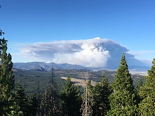
The Whaleback Fire was a wildfire that burned on Whaleback Mountain in Spaulding, approximately 20 miles northwest of Susanville in Lassen County, California, in the United States. First reported on July 27, 2018, the Whaleback Fire burned 18,703 acres (76 km2), before it was fully contained on August 7. The fire caused evacuations in the community of Spaulding and led to closures of portions of Lassen National Forest.

<span class="mw-page-title-main">Lake Fire (2020)</span> 2020 wildfire in Southern California

The Lake Fire was a wildfire that burned during the 2020 California wildfire season in the Angeles National Forest in Los Angeles County in the state of California in the United States. The fire, which was first reported on August 12, 2020, burned 31,089 acres (12,581 ha) near Lake Hughes. It was fully contained on September 28. The cause of the fire remains unknown. The fire has damaged 3 structures, destroyed 12 structures and 21 outbuildings, and injured 4 firefighters.

<span class="mw-page-title-main">Loyalton Fire</span> 2020 wildfire in California and Nevada

The 2020 Loyalton Fire was a large wildfire in Lassen, Plumas and Sierra counties in California and Washoe County in Nevada. After it was ignited by lightning on August 14, 2020, the fire burned 47,029 acres (19,032 ha) in the Tahoe National Forest and the Humboldt-Toiyabe National Forest before it was fully contained on August 26. The Loyalton Fire was notable for generating three fire tornadoes on August 15, necessitating first-of-their-kind warnings by the National Weather Service.

<span class="mw-page-title-main">August Complex fire</span> 2020 wildfire in Northern California

The August Complex was a massive wildfire that burned in the Coast Range of Northern California, in Glenn, Lake, Mendocino, Tehama, Trinity, and Shasta Counties. The complex originated as 38 separate fires started by lightning strikes on August 16–17, 2020. Four of the largest fires, the Doe, Tatham, Glade, and Hull fires, had burned together by August 30. On September 9, the Doe Fire, the main fire of the August Complex, surpassed the 2018 Mendocino Complex to become both the single-largest wildfire and the largest fire complex in recorded California history. On September 10, the combined Doe Fire also merged with the Elkhorn Fire and the Hopkins Fire, growing substantially in size. By the time it was extinguished on November 12, the August Complex fire had burned a total of 1,032,648 acres (417,898 ha), or 1,614 square miles (4,180 km2), about 1% of California's 100 million acres of land, an area larger than the state of Rhode Island.

<span class="mw-page-title-main">El Dorado Fire</span> 2020 wildfire in Southern California

The El Dorado Fire was a wildfire that burned 22,744 acres in San Bernardino and Riverside counties of California from September to November 2020. It was ignited on September 5 by a pyrotechnic device at a gender reveal party in El Dorado Ranch Park; it quickly spread to the San Gorgonio Wilderness Area of the San Bernardino National Forest. Burning over a 71-day period, the fire destroyed 20 structures and resulted in one firefighter fatality, for which the couple hosting the party were charged with involuntary manslaughter.

<span class="mw-page-title-main">SQF Complex</span> 2020 wildfire in Central California

The SQF Complex fire—also called the SQF Lightning Complex—was a wildfire complex that burned in Tulare County in Central California in 2020. Comprising the Castle and Shotgun fires, it affected Sequoia National Forest and adjacent areas. Both fires began on August 19, 2020, and burned a combined total of 175,019 acres before the complex as a whole was declared 100 percent contained on January 6, 2021. In the course of the fires, 232 structures were destroyed. There were no fatalities.

<span class="mw-page-title-main">2020 Lassen County wildfires</span> 2020 wildfire sub-season that burned in Lassen County

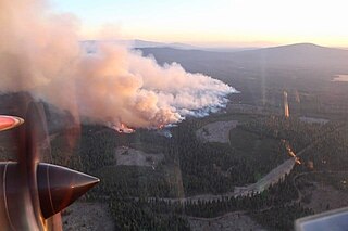
The 2020 Lassen County wildfire season included seven large wildfires that burned entirely or in part in Lassen County. A total of 203,296 acres (82,271 ha) of land was burned in Lassen County, making it one of the larger clusters of fires in the 2020 California wildfire season.

<span class="mw-page-title-main">Dixie Fire</span> 2021 wildfire in Northern California

The 2021 Dixie Fire was an enormous wildfire in Butte, Plumas, Lassen, Shasta, and Tehama counties in Northern California. Named after a nearby Dixie Road, the fire began in the Feather River Canyon near Cresta Dam in Butte County on July 13, 2021, and burned 963,309 acres (389,837 ha) before it was declared 100 percent contained on October 25, 2021. It was the largest single source wildfire in recorded California history, and the second-largest wildfire overall, The fire damaged or destroyed several communities, including Greenville on August 4, Canyondam on August 5, and Warner Valley on August 12.

<span class="mw-page-title-main">Beckwourth Complex fires</span> 2021 wildfire in Northern California

The Beckwourth Complex was a wildfire complex that burned in the Plumas National Forest in Plumas and Lassen counties. The two major fires of the complex, the Dotta Fire and the Sugar Fire, started on June 30 and July 2 northeast of Beckwourth, California. Started by lightning strikes, the two fires collectively burned 105,670 acres (42,763 ha). The complex resulted in the evacuation of numerous residential areas and the closure of portions of Plumas National Forest. In the community of Doyle, California, 33 homes were destroyed.

<span class="mw-page-title-main">Washburn Fire</span> 2022 wildfire in Central California

The Washburn Fire was a wildfire that burned in Yosemite National Park near the Mariposa Grove of giant sequoias. The fire was reported on July 7, 2022, in the lower Mariposa Grove area near the Washburn trail, for which the fire is named. The fire quickly attracted national attention due in part to the role the Mariposa Grove played in the establishment of Yosemite National Park and the National Park Service.

<span class="mw-page-title-main">Windy Fire</span> 2021 wildfire in Central California

The 2021 Windy Fire was a large wildfire in the Sequoia National Forest in Central California's Tulare County. Begun by a lightning strike in the southern Sierra Nevada on September 9, the fire burned 97,528 acres (39,468 ha) over the course of a month, threatening communities like Ponderosa and Johnsondale. Multiple atmospheric rivers in October and November eventually subdued the fire, which was declared fully contained in mid-November. Total firefighting costs came to $78.4 million. The Windy Fire was the eight-largest fire of California's 2021 wildfire season.

<span class="mw-page-title-main">Storrie Fire</span> 2000 wildfire in Northern California

The Storrie Fire was a sizeable wildfire in Northern California's Plumas County and the second-largest of California's 2000 wildfire season. The fire began on August 17, 2000, and was fully contained by September 9; it burned 55,261 acres in total and resulted in minimal property damage or casualties. The cost of containing the Storrie Fire amounted to $22 million.

<span class="mw-page-title-main">KNP Complex Fire</span> 2021 wildfire in Central California

The 2021 KNP Complex Fire was a large wildfire complex in Sequoia National Park and the Sequoia National Forest in Central California's Tulare County. After lightning ignited several fires in the southern Sierra Nevada on September 9, two of them burned together and spread to 88,307 acres. The fire was not declared contained until mid-December after several atmospheric rivers curbed its growth. Firefighting costs surpassed $170 million.

<span class="mw-page-title-main">McCash Fire</span> 2021 wildfire in Northern California

The 2021 McCash Fire was a large wildfire in Siskiyou County in Northern California. Part of the 2021 California wildfire season, the fire was ignited by lightning on July 31 and burned 94,962 acres before its containment on October 27. The fire burned within the Klamath National Forest and the Six Rivers National Forest.

<span class="mw-page-title-main">Wolf Fire</span> 2002 wildfire in Southern California

The Wolf Fire was a large wildfire in Southern California's Ventura County, north of the city of Ojai, in June of 2002. The fire was ignited on June 1 by the careless use of firearms for target shooting in dry grass and burned 21,645 acres, destroying six structures before it was completely contained on June 14. The cost of containing the fire came to $15 million. No fatalities or serious injuries occurred, but the fire impacted large parts of the Sespe Wilderness and the Los Padres National Forest, causing road and campground closures while threatening Native American cultural sites and wildlife habitat.

References

  1. "Contemporary Fire History". www.nps.gov. Lassen Volcanic National Park. Archived from the original on February 2, 2023. Retrieved February 26, 2024.
  2. "Early Fire History". www.nps.gov. Lassen Volcanic National Park. Archived from the original on February 23, 2024. Retrieved February 26, 2024.
  3. 1 2 3 4 5 6 7 8 9 10 11 12 13 14 15 16 17 18 19 20 21 22 23 24 25 26 27 28 Lassen Volcanic National Park (December 18, 2012). Reading Fire Review (PDF) (Report). Archived (PDF) from the original on August 16, 2021. Retrieved January 30, 2023 via Wildfire Today.
  4. "Dead Fuel Moisture | Did You Know? | National Centers for Environmental Information (NCEI)". www.ncei.noaa.gov. National Centers for Environmental Information. Archived from the original on February 27, 2024. Retrieved February 27, 2024.
  5. "Reading Fire Information". InciWeb. Archived from the original on September 8, 2012.
  6. 1 2 3 4 5 6 7 8 Tullis, Paul (September 19, 2013). "Into the Wildfire". The New York Times Magazine . ISSN   0362-4331. Archived from the original on January 24, 2024. Retrieved February 23, 2024.
  7. 1 2 "Meeting set to probe Reading Fire in Lassen Volcanic National Park". Red Bluff Daily News . August 10, 2012. Archived from the original on August 14, 2022. Retrieved March 1, 2024.
  8. 1 2 "Meeting tonight regarding Reading Fire near Lassen Park". The Reporter (Vacaville) . August 14, 2012. Archived from the original on February 29, 2024. Retrieved February 29, 2024.
  9. 1 2 "9 p.m. update: Lassen park about a third contained". Humboldt Times-Standard . August 17, 2012. Archived from the original on March 1, 2024. Retrieved March 1, 2024.
  10. 1 2 "Containment lines keep Lassen Park fire under control". Chico Enterprise-Record . August 19, 2012. Archived from the original on March 1, 2024. Retrieved March 1, 2024.
  11. "Reading Fire". www.fire.ca.gov. California Department of Forestry and Fire Protection (Cal Fire). Archived from the original on January 27, 2023. Retrieved February 23, 2024.
  12. 1 2 "Restoration process begins in Reading Fire area". www.nps.gov. Lassen Volcanic National Park. September 26, 2012. Archived from the original on May 29, 2017. Retrieved March 1, 2024.
  13. "Lightning-Caused Fire Managed for Forest Health in Lassen Volcanic National Park to be Suppressed". www.nps.gov. Lassen Volcanic National Park. August 7, 2012. Archived from the original on February 23, 2024. Retrieved February 29, 2024.
  14. 1 2 Arthur, Damon (October 24, 2012). "Lawmakers blast National Park Service for letting Reading Fire burn". Redding Record Searchlight . Archived from the original on January 30, 2023. Retrieved February 29, 2024.
  15. 1 2 "Lightning-Caused Fire Managed for Forest Health in Lassen Volcanic National Park to be Suppressed Update 8/8". www.nps.gov. Lassen Volcanic National Park. August 8, 2012. Archived from the original on February 13, 2021. Retrieved March 1, 2024.
  16. 1 2 "8 p.m. update: Fire still burning in Lassen Park, not spreading rapidly". Santa Cruz Sentinel . August 16, 2012. Archived from the original on February 29, 2024. Retrieved February 29, 2024.
  17. 1 2 "United States Reps. Wally Herger, Tom McClintock rip National Park Service for Reading blaze". The Reporter . Associated Press. October 25, 2012. Archived from the original on February 24, 2024. Retrieved February 26, 2024.
  18. Greene, Rich (February 28, 2013). "Lassen Volcanic National Park official defends Reading fire strategy". Red Bluff Daily News . Archived from the original on February 9, 2023. Retrieved February 26, 2024.
  19. Montano, Stephanie (June 11, 2013). "Lassen Volcanic National Park gives tour of the burn area left by the 2012 Reading fire". KRCR-TV . Archived from the original on February 26, 2024. Retrieved February 26, 2024.
  20. Gabbert, Bill (October 25, 2012). "Congressmen hold hearing about Lassen National Park's Reading Fire". Wildfire Today. Archived from the original on December 2, 2023. Retrieved February 29, 2024.
  21. "Lassen Volcanic National Park will not use burn management". Chico Enterprise-Record . June 17, 2013. Archived from the original on March 1, 2024. Retrieved March 1, 2024.
  22. "Wildfire closes main road in Lassen National Park". The Press Democrat . Associated Press. August 7, 2012. Archived from the original on February 29, 2024. Retrieved February 29, 2024.
  23. "Two-week-old fire in Lassen Park continues to grow". Chico Enterprise-Record . Archived from the original on March 1, 2024. Retrieved March 1, 2024.
  24. "Lassen fire erupts to more than 20,600 acres". The Reporter (Vacaville) . August 13, 2012. Archived from the original on February 29, 2024. Retrieved February 29, 2024.
  25. "Lassen Park fire steady; Clear Lake 70 percent contained". Daily Democrat . August 15, 2012. Archived from the original on February 29, 2024. Retrieved February 29, 2024.
  26. Watson, Mike (August 21, 2012). "Containment Rises on Reading Fire". KRCR-TV . Archived from the original on March 1, 2024. Retrieved March 1, 2024.