
2014 saw several notable wildfires igniting in California, especially during the month of May, when multiple fires were ablaze concurrently in Southern California, and during September, when several massive wildfires were burning in Northern California. In the context of the 2012–13 North American drought, as well as powerful Santa Ana winds, weather conditions were ideal for wildfires. A total of 7,865 wildfires ignited throughout the year, which burned at least 625,540 acres (2,531.5 km2) of land. The wildfires caused a total of 146 injuries and 2 fatalities, in addition to causing at least $204.05 million in damage.
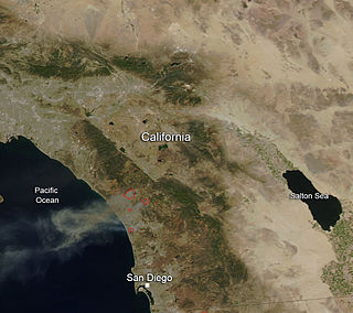
The May 2014 San Diego County wildfires were a swarm of 20 wildfires that erupted during May 2014, in San Diego County, California, during severe Santa Ana Wind conditions, historic drought conditions, and a heat wave. The main event during mid-May was preceded by a precursor fire that ignited on May 5. The Bernardo Fire has been declared accidental, and officials believe the Cocos Fire was intentionally set. The causes of the other fires are still under investigation by multiple agencies, and a joint task force was formed to coordinate the investigations and facilitate communications. Six injuries and one fire-related fatality were reported.

The Gate Fire was a wildfire that burned in the Dulzura area southeast of Jamul along Highway 94 in the southern part of San Diego County, California in May 2017. Within the day, the fire spread from an initially reported 10 acres (4.0 ha) to then 1,500 acres (610 ha) in a matter of a few hours, as the fire was pushed by strong winds and dry grasslands mixed with chaparral. The wildfire resulted in evacuation of 500 campers from the Pio Pico RV Resort and Campground. Highway 94 was also closed to the public due to the fire. The fire was named the Gate incident due to its proximity to a landmark pink gate in the Dulzura area.

The Manzanita Fire was a wildfire that burned south of the towns of Beaumont and Banning near Highway 79 in Riverside County, California during June 2017. The fire had consumed some 6,309 acres (2,553 ha) and was burning eastward towards the community of Poppet Flats and Highway 243. Fanned by Red Flag conditions, the Manzanita fire ignited from a traffic collision that grew to over 1,200 acres (490 ha) within several hours of burning. The communities of Poppet Flats, Silent Valley and Highland Springs were threatened for a time but no structural damage occurred during this incident. The fire was fully contained on Friday, June 30.
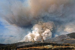
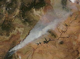
The Detwiler Fire was a wildfire that burned across Highway 49, east and south of Lake McClure, in Mariposa County, California. Ignited shortly before 4 p.m. on Sunday, July 16, 2017, the fire consumed up to 2,500 acres (1,000 ha) within its first day of burning. By Thursday morning, on July 20, the fire was over 70,000 acres (28,000 ha) in size with only 7 percent containment.
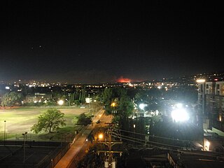
The Skirball Fire was a wildfire that burned in the Bel Air neighborhood of Los Angeles, California, United States, and one of multiple wildfires that broke out across Southern California in December 2017. The fire burned 422 acres of land on the slopes of the Sepulveda Pass on its east or Bel Air side, causing the closure of Interstate 405, a major traffic artery in the city. The Skirball Cultural Center, Bel-Air Country Club, Getty Center, Santa Monica-Malibu Unified School District, and various private schools were closed as a result of the fire. Classes were cancelled at the University of California, Los Angeles (UCLA) and Santa Monica College, while Mount Saint Mary's University evacuated from its Brentwood campus to its downtown Los Angeles location. The fire destroyed six structures and damaged 12. On December 10, at about 1 p.m. PST, all evacuation orders and road closures for the Skirball Fire were lifted, as containment of the wildfire increased to 85%. Late on December 15, it was reported that the Skirball Fire had been 100% contained, at 422 acres (171 ha).
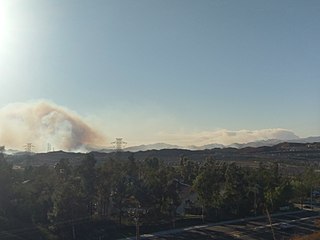
The Rye Fire was a wildfire that burned in Santa Clarita, California, in the United States, and one of multiple wildfires that broke out across Southern California in December 2017. The fire threatened over 5,000 structures, including Six Flags Magic Mountain, threatened the city of Santa Clarita and impacted traffic on Interstate 5. The Rye Fire burned a total of 6,049 acres (24.48 km2), before it was fully contained on December 12. The fire destroyed six buildings, including minor structures located at the Peter J. Pitchess Detention Center.

A series of 29 wildfires ignited across Southern California in December 2017. Six of the fires became significant wildfires, and led to widespread evacuations and property losses. The wildfires burned over 307,900 acres (1,246 km2), and caused traffic disruptions, school closures, hazardous air conditions, and power outages; over 230,000 people were forced to evacuate. The largest of the wildfires was the Thomas Fire, which grew to 281,893 acres (1,140.78 km2), and became the largest wildfire in modern California history, until it was surpassed by the Ranch Fire in the Mendocino Complex, in the following year.

The Lilac Fire was a fire that burned in northern San Diego County, California, United States, and the second-costliest one of multiple wildfires that erupted in Southern California in December 2017. The fire was first reported on December 7, 2017, burned 4,100 acres (1,659 ha), and destroyed 157 structures, before it was fully contained on December 16. The fire cost at least $8.9 million, including $5 million in firefighting expenses and property damage, and an additional $3.9 million in cleanup and erosion control costs. The fire threatened the communities of Bonsall, Oceanside, Vista, Fallbrook, and Camp Pendleton. During the fire, an estimated 10,000 residents were forced to evacuate, while a total of over 100,000 residents were forced to or advised to evacuate. On December 7, the Lilac Fire also cut the power to 20,000 people.

The Waverly Fire was a wildfire near Linden in the San Joaquin County, California, in the United States. The fire was first reported on June 29, 2018. It burned a total of 12,300 acres (50 km2), before being contained on July 2. The fire impacted traffic on Highway 26, Highway 4 and the community of Milton.
The Quail Fire was a wildfire that burned during the 2020 California wildfire season southwest of Winters and north of Vacaville in Solano County, California in the United States. Igniting on Saturday, June 6, within the rural confines of Quail Canyon, the fire ballooned to an estimated 1,837 acres (743 ha) and destroyed three structures including one residential property. The fire was fully contained on Wednesday, June 10, 2020, and the cause remains under investigation.
The Mangum Fire was a wildfire in Kaibab National Forest in Arizona in the United States. The fire, which started on June 8, 2020 approximately 16 miles north of the North Rim of Grand Canyon National Park, burned a total of 71,450 acres (28,915 ha). The fire threatened the community of Jacob Lake, Arizona, resulting in its evacuation. Select highways were closed, including Highway 67, which resulted in closure of the North Rim of the Grand Canyon. Additionally, areas of the Paria Canyon-Vermilion Cliffs Wilderness were inaccessible due to closures. Four buildings were destroyed, including two historic cabins. The exact cause of the fire remains under investigation, however, fire officials have confirmed it was human caused.

The Crews Fire was a wildfire that burned east of the city of Gilroy in Santa Clara County, California, in the United States. The fire started on July 5, 2020. It burned 5,513 acres (2,231 ha) and was extinguished on July 13, 2020. Burning approximately three miles east of Highway 101, the fire caused the evacuation approximately 20 homes and 70 residents. One structure was destroyed, one was damaged, and one firefighter was injured. It threatened 30 structures and farm and ranch lands in southeast Gilroy in the San Juan Valley. Mandatory evacuations were ordered on July 5, and they were lifted on July 8.

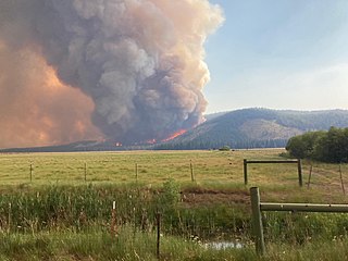
The Apple Fire was a wildfire that burned during the 2020 California wildfire season in Cherry Valley south of Oak Glen and north of Beaumont and Banning in Riverside County, California in the United States. The fire ignited on Friday, July 31, 2020 as three separate smaller blazes within the rural canyons along Oak Glen Road before merging and rapidly expanded to 1,900 acres (769 ha) and destroyed at least one home and two outbuildings in the Cherry Valley area. It now covers at least 33,424 acres (13,526 ha) and created "a plume of smoke so massive that it generated its own winds." The fire was sparked by a diesel-burning vehicle that emitted burning carbon. The fire was named after one of the roadways close to the ignition site, which is named Apple Tree Lane.

The Lake Fire was a wildfire that burned during the 2020 California wildfire season in the Angeles National Forest in Los Angeles County in the state of California in the United States. The fire, which was first reported on August 12, 2020, burned 31,089 acres (12,581 ha) near Lake Hughes. It was fully contained on September 28. The cause of the fire remains unknown. The fire has damaged 3 structures, destroyed 12 structures and 21 outbuildings, and injured 4 firefighters.

The Oak Fire was a wildfire that burned north of Brooktrails in Mendocino County, California in the United States. The fire was first reported on September 7, 2020 and was contained on September 14, 2020. It burned 1,100 acres (445 ha). The fire resulted in the evacuation of over 3,200 people just north of the city of Willits. It damaged 1 and destroyed 56 structures. The cause of the fire remains under investigation.

The El Dorado Fire was a wildfire that burned 22,744 acres in San Bernardino and Riverside counties of California from September to November 2020. It was ignited on September 5 by a pyrotechnic device at a gender reveal party in El Dorado Ranch Park; it quickly spread to the San Gorgonio Wilderness Area of the San Bernardino National Forest. Burning over a 71-day period, the fire destroyed 20 structures and resulted in one firefighter fatality, for which the couple hosting the party were charged with involuntary manslaughter.
The Tennant Fire was a wildfire that burned in the Klamath National Forest in Siskiyou County, California, in the United States as part of the 2021 California wildfire season. The fire was first reported just east of Highway 97, three miles northwest of Bray, California on June 28, 2021. The fire was contained on July 12, 2021. The fire burned 10,580 acres (4,282 ha), destroyed five structures, and caused evacuations in Macdoel, California. The cause remains under investigation. The Tennant Fire was one of three fires burning at the same time in the Lake Shasta region, the others being the Lava Fire and the Salt Fire.
The French Fire was a wildfire that burned 26,535 acres (10,738 ha) near Shirley Meadows west of Lake Isabella in Kern County, California in the United States during the 2021 California wildfire season. The fire was initially reported on Wednesday, August 18, 2021, and ended around October 24, 2021. The fire threatened the communities of Shirley Meadows, Alta Sierra and Wofford Heights. The fire reportedly destroyed some 18 structures, including 9 residences. The fire was determined, as of September 13, 2021, to have been human-caused and suspicious in nature.

The Border 32 Fire was a destructive wildfire that burned amid the 2022 California wildfire season, in the Barrett Junction area along Highway 94 due north of the United States-Mexican border in San Diego County, California during a statewide heatwave. The fire started on August 31, 2022, and proceeded to destroy ten structures and eventually grow to 4,456 acres (1,803 ha) within the rugged chaparral-dense hillsides throughout the area.

