Southside Gympie, Queensland | |||||||||||||||
---|---|---|---|---|---|---|---|---|---|---|---|---|---|---|---|
Coordinates | 26°12′40″S152°38′45″E / 26.2111°S 152.6458°E | ||||||||||||||
Population | 5,737 (2016 census) [1] | ||||||||||||||
• Density | 308.4/km2 (798.9/sq mi) | ||||||||||||||
Postcode(s) | 4570 | ||||||||||||||
Area | 18.6 km2 (7.2 sq mi) | ||||||||||||||
Time zone | AEST (UTC+10:00) | ||||||||||||||
Location | |||||||||||||||
LGA(s) | Gympie Region | ||||||||||||||
State electorate(s) | Gympie | ||||||||||||||
Federal division(s) | Wide Bay | ||||||||||||||
|
Southside is a semi-rural locality in the Gympie Region, Queensland, Australia. [2] In the 2016 census, Southside had a population of 5,737 people. [1]
Southside is on the south-western bank of the Mary River. Its name reflects its location south of the Gympie town centre. [3]
The locality was originally known as Gympie South. [4]
Gympie South Side State School opened on 4 July 1910. On 13 May 1954 it was renamed Gympie South State School. [5]
In November 1937, the Methodist Church at Chatsworth was relocated to a new 0.5-acre (0.20 ha) site adjacent to the South Side State School (about 6 miles (9.7 km) away, where it was officially opened by Reverend Ira Menear. [6] [7] It originally opened as Chatsworth Wesleyan Methodist Church opened on Sunday 16 August 1885 and was on the Chatsworth Road (now the Bruce Highway). [8] [9] [10] [11]
Cooloola Christian College opened in 1992. [5]
Gympie Wesleyan Methodist Church opened on 15 January 2006. A congregation was formed as a church plant of the Mary Valley Wesleyan Methodist Church (based in Amamoor) in March 1990. [12] Services were initially held in the CWA hall in Gympie, before moving 3km to another hall. In February 2003 the congregation purchased a 2-acre (0.81 ha) block in a residential development in Southside, holding its first service in its newly constructed church on 15 January 2006. [13]
In the 2006 census, Southside had a population of 4,838 people. [14]
In the 2016 census, Southside had a population of 5,737 people. [1]
Southside has the following heritage listings:
Gympie South State School is a government primary (Prep-6) school for boys and girls at 50 Exhibition Road ( 26°11′59″S152°38′43″E / 26.1998°S 152.6454°E ). [16] [17] In 2017, the school had an enrolment of 532 students with 45 teachers (38 full-time equivalent) and 34 non-teaching staff (20 full-time equivalent). [18] It includes a special education program. [16] [19]
Cooloola Christian College is a private primary and secondary (Prep-12) school for boys and girls at 1 College Road ( 26°11′53″S152°38′32″E / 26.1981°S 152.6421°E ). [16] [20] In 2017, the school had an enrolment of 396 students with 38 teachers (33 full-time equivalent) and 33 non-teaching staff (24 full-time equivalent). [18] It is operated by a not-for-profit company established by four churches: Baptist Church, Church of Christ, Presbyterian Church and Wesleyan Methodist Church. [21]
There is no government secondary school in Southside. The nearest government secondary schools are Gympie State High School and James Nash State High School both located in neighbouring Gympie to the north and north-east. [3]
Glastonbury SES Facility is at 1 Rodian Street ( 26°12′23″S152°38′54″E / 26.2064°S 152.6484°E ). [22]
Gympie Wesleyan Methodist Church is at 70 Exhibition Road ( 26°12′08″S152°38′37″E / 26.2022°S 152.6436°E ). It is part of the Wesleyan Methodist Church of Australia. [23]
The Gympie Corps of the Salvation Army is at 42 Stumm Road ( 26°11′43″S152°38′45″E / 26.1954°S 152.6458°E ). [24]
Gympie Christian Fellowship has its church at 2A Sorensen Road ( 26°12′49″S152°39′57″E / 26.2136°S 152.6658°E ). It is an outreach church of Sunshine Coast Christian Fellowship in Forest Glen. [25]
Gympie Ward of the Church of Jesus Christ of Latter-day Saints meets at 28 Sorensen Road ( 26°12′56″S152°39′43″E / 26.2155°S 152.6620°E ). [26]
Gympie Racecourse and the Adrian McClintock Park showgrounds are at 77 Exhibition Road ( 26°12′12″S152°38′48″E / 26.2032°S 152.6466°E ). [3] The park is named after a former mayor of the Shire of Widgee.[ citation needed ]
Gunabul Homestead Golf Course is an 18-hole golf course and driving range at 9 Power Road ( 26°11′58″S152°39′25″E / 26.1995°S 152.6569°E ). [27] [28]
Gympie is a city and a locality in the Gympie Region, Queensland, Australia. In the Wide Bay-Burnett District, Gympie is about 170.7 kilometres (110 mi) north of the state capital, Brisbane. The city lies on the Mary River, which floods Gympie occasionally. The locality of Gympie is the central business district for the city of Gympie and also the administrative centre for the Gympie Region local government area. As of June 2021, Gympie had a population of 53,851.
Glass House Mountains is a rural hinterland town and locality in the Sunshine Coast Region, Queensland, Australia. In the 2016 census, the locality of Glass House Mountains had a population of 5,065 people.
Caboolture is a town and suburb in the City of Moreton Bay, Queensland, Australia. In the 2021 census, the suburb of Caboolture had a population of 29,534 people. It is located on the northern side of the Caboolture River.
Goomeri is a rural town and locality in the Gympie Region, Queensland, Australia. In the 2016 census, the locality of Goomeri had a population of 664 people.
Bray Park is a suburb in the City of Moreton Bay, Queensland, Australia. In the 2016 census, Bray Park had a population of 10,246 people.
Everton Hills is a suburb in the City of Moreton Bay, Queensland, Australia. In the 2016 census, Everton Hills had a population of 5,938 people.
Cooloola is a coastal locality in the Gympie Region, Queensland, Australia. In the 2016 census, Cooloola had a population of 3 people.
Chatsworth is a rural locality in the Gympie Region, Queensland, Australia. In the 2016 census Chatsworth had a population of 1,055 people.
Tin Can Bay is a coastal town and locality in the Wide Bay–Burnett region in Queensland, Australia. The locality is split between the Fraser Coast Region and the Gympie Region, but the town itself is within Gympie Region. In the 2016 census, Tin Can Bay had a population of 2,242 people.
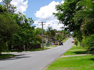
Araluen is a residential locality in Gympie in the Gympie Region, Queensland, Australia. In the 2016 census, Araluen had a population of 614 people.
Veteran is a rural residential locality in the Gympie Region, Queensland, Australia. In the 2016 census Veteran had a population of 892 people.
Victory Heights is a rural residential locality in the Gympie Region, Queensland, Australia. In the 2016 census Victory Heights had a population of 555 people.
Tamaree is a rural residential locality in the Gympie Region, Queensland, Australia. In the 2016 census Tamaree had a population of 880 people.
Monkland is a rural locality in the Gympie Region, Queensland, Australia. In the 2016 census Monkland had a population of 1,125 people.
The Dawn is a rural residential locality in the Gympie Region, Queensland, Australia. In the 2016 census The Dawn had a population of 545 people.
Imbil is a rural town and locality in the Gympie Region, Queensland, Australia. In the 2016 census, Imbil had a population of 924 people.
Amamoor is a rural town and locality in the Gympie Region, Queensland, Australia. In the 2016 census the locality of Amamoor had a population of 636 people.
Kia Ora is a rural locality in the Gympie Region, Queensland, Australia. In the 2016 census, Kia Ora had a population of 205 people.
Cooloola Cove is a coastal locality in the Gympie Region, Queensland, Australia. In the 2016 census, Cooloola Cove had a population of 2633 people.
Maryborough West is a mixed-use locality in the Fraser Coast Region, Queensland, Australia. In the 2016 census, Maryborough West had a population of 531 people.
{{cite web}}
: CS1 maint: unfit URL (link)