The Kent and East Sussex Railway (K&ESR) refers to both a historical private railway company in Kent and East Sussex in England, as well as a heritage railway currently running on part of the route of the historical company. The railway runs between Tenterden Town and Bodiam.
The Leicester and Swannington Railway (L&SR) was one of England's first railways, built to bring coal from West Leicestershire collieries to Leicester, where there was great industrial demand for coal. The line opened in 1832, and included a tunnel over a mile in length, and two rope-worked inclined planes; elsewhere it was locomotive-operated, and it carried passengers.

The Hastings line is a secondary railway line in Kent and East Sussex, England, linking Hastings with the main town of Tunbridge Wells, and London via Tonbridge and Sevenoaks. Although primarily carrying passengers, the railway also serves a gypsum mine which is a source of freight traffic. SE Trains operates passenger trains on the line, and it is one of their busiest lines.

Headcorn railway station is on the South Eastern Main Line in England, serving the village of Headcorn, Kent. It is 45 miles 20 chains (72.8 km) down the line from London Charing Cross. The station and all trains that serve the station are operated by Southeastern.

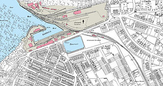
Queenborough railway station is on the Sheerness Line, on the Isle of Sheppey in northern Kent, and serves the town of Queenborough. It is 49 miles 22 chains (79.3 km) down the line from London Victoria.

The Cuckoo Trail is a 14-mile (23 km) footpath and cycleway which runs from Hampden Park to Heathfield in East Sussex. It passes through the towns of Polegate and Hailsham, as well as the villages of Hellingly and Horam.

Christ's Hospital railway station is near Horsham in West Sussex, England. It is 40 miles 7 chains (64.5 km) down the line from London Bridge via Redhill. It was opened in 1902 by the London, Brighton and South Coast Railway and was intended primarily to serve Christ's Hospital, a large private school which had moved to the area in that year. It now also serves the rural area to the west of Horsham.
The Canterbury and Whitstable Railway, sometimes referred to colloquially as the "Crab and Winkle Line", was an early British railway that opened in 1830 between Canterbury and Whitstable in the county of Kent, England.
Granborough Road railway station was a station serving the village of Granborough, to the north of Quainton in Buckinghamshire, England.

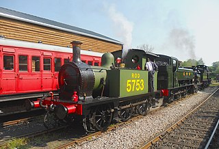
Rolvenden railway station is a heritage railway station on the Kent and East Sussex Railway in Tenterden, Kent, in the United Kingdom.

The Hawkhurst branch line was a short railway line in Kent that connected Hawkhurst, Cranbrook, Goudhurst and Horsmonden with the town of Paddock Wood and the South Eastern and Medway Valley lines, a distance of 11 miles 24 chains.
Stanbridgeford railway station on the London and North Western Railway's branch line to Dunstable served the Bedfordshire villages of Stanbridge, Totternhoe, Eaton Bray and Tilsworth from 1849 to 1964. Once popular with visitors to the nearby Totternhoe Knolls and ramblers, the station closed against a background of falling passenger numbers and declining freight returns. The station building has survived into private ownership, but a section of the alignment to the east and west of the site has been taken into the A505 Leighton Southern Bypass. National Cycle Network route 6 runs to the east over the bypass as far as the outskirts of Dunstable.
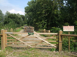
Junction Road Halt, also known as Junction Road (for Hawkhurst), was a halt station on the Kent and East Sussex Railway. It was located on the eastern side of the level crossing across the B2244 Junction Road near the hamlet of Udiam in East Sussex, England. Closed for passengers in 1954 and freight in 1961 with the line, The line through Junction Road Halt may yet be revived as the Rother Valley Railway, a preservation society, is proposing to reopen the line from Robertsbridge to Bodiam.

Salehurst Halt was a halt station on the Kent and East Sussex Railway which served the village of Salehurst in East Sussex, England. The station was reached by a footpath leading south from the village church in Salehurst. Closed in 1954, Salehurst Halt may yet see trains again as the Rother Valley Railway, a preservation society, is proposing to reopen the line from Robertsbridge to Bodiam, including the line through the halt.

Wittersham Road is a railway station on the Kent and East Sussex Railway. It is located to the north-east of the level crossing on Maytham Road which links the Kentish villages of Rolvenden and Wittersham. Having served the area for over sixty years, the station closed for regular passengers in 1954 and completely in 1961. It was later rebuilt and reopened in 1977 by the Kent and East Sussex Railway heritage organisation.
Dixter Halt was a short-lived halt station on the Kent and East Sussex Railway on an unmade road leading to Great Dixter house near Northiam in East Sussex. Opened in May 1981 it was used for occasional special services to and from Bodiam until the line from Northiam was finally reopened for regular passenger services to Bodiam in 2000.

Bledlow railway station was an intermediate station on the Wycombe Railway which served the Buckinghamshire village of Bledlow from 1862 to 1963. It was one of two stations to serve the village, the other being Bledlow Bridge Halt on the Watlington and Princes Risborough Railway, which was 0.75 miles (1.21 km) to the south and closer to the village. The possibility of reopening the line through Bledlow, which is now part of a long-distance footpath, has been explored by Chiltern Railways, the franchise holder for the Chiltern Main Line which runs through Princes Risborough.

Towersey Halt railway station was an intermediate station on the Wycombe Railway which served the Oxfordshire village of Towersey from 1933 to 1963. The opening of the halt was part of an attempt by the Great Western Railway to encourage more passengers on the line at a time when competition from bus services was drawing away patronage. The possibility of reopening the line through Towersey Halt, which is now part of a long-distance footpath, has been explored by Chiltern Railways, the franchise holder for the Chiltern Main Line which runs through Princes Risborough.

Northiam railway station is on the Kent and East Sussex Railway. It is located to the west of the level crossing on the A28 road linking the Kentish village of Newenden and the East Sussex village of Northiam. Having served the area for over sixty years, the station closed with the line in 1961, but was later reopened in 1990 by the Kent and East Sussex Railway heritage organisation.

Willersey Halt railway station served the village of Willersey, Gloucestershire, England between 1904 and 1960.

