Related Research Articles

Riverside Drive is a major road in Ottawa, Ontario, Canada that follows along the eastern bank of the Rideau River. Its northern terminus is at the Transitway/Via Rail underpass just south of the Queensway, and the road proceeds south to Limebank Road where it continues as River Road until the city limits. North of the Queensway, Riverside continues as Vanier Parkway, which travels through Vanier until Beechwood Avenue. The Vanier Parkway name is linked to Vanier, Ontario, which was named for former Governor General of Canada Georges Vanier.

Rideau Street is a major street in downtown Ottawa, Ontario, Canada and one of Ottawa's oldest and most famous streets running from Wellington Street in the west to Montreal Road in the east where it connects to the Vanier district. Rideau Street is home to the Château Laurier, the CF Rideau Centre and the Government Conference Centre. Along with Wellington Street and Sussex Drive it was among the first streets in Ottawa to be host to businesses; it was created with the founding of the early town. The Plaza Bridge by the Rideau Canal is at its westmost point and the Cummings Bridge is at its eastmost point.
Russell Road is an arterial road in Eastern Ontario, Canada. It begins in Ottawa in the Riverview neighbourhood and runs eastward through the rural communities of Ramsayville, Carlsbad Springs and Bearbrook in Ottawa and through the Municipality of Clarence-Rockland, connecting the communities of Cheney and Bourget, ending at Boundary Road on the eastern border of Clarence Rockland. In Ottawa it is officially Ottawa Road #26, and in Clarence-Rockland as United Counties of Prescott and Russell County Road #2.
King's Highway 417, commonly referred to as Highway 417 and the Queensway through Ottawa, is a 400-series highway in the Canadian province of Ontario. It connects Montreal with Ottawa, and is the backbone of the transportation system in the National Capital Region. Within Ottawa, it forms part of the Queensway west from Highway 7 to Ottawa Regional Road 174. Highway 417 extends from the Quebec border to Arnprior, where it continues westward as Highway 17. Aside from the urban section through Ottawa, Highway 417 passes through farmland that dominates much of the fertile Ottawa Valley.

Carling Avenue is a major east–west arterial road in the west end of Ottawa, Ontario, Canada. It runs from March Road in Kanata to Bronson Avenue in the Glebe. The road is named for John Carling, founder of Carling Brewery and Conservative MP and Senator, Postmaster General and Minister of Agriculture.

Alta Vista Drive is a suburban road in Ottawa, Ontario, Canada. It runs from Bank Street in the south to Industrial Avenue in the north covering the neighbourhoods of Ridgemont, Alta Vista and Riverview.
Innes Road is one of the most important streets in the east end of the City of Ottawa, Ontario, Canada, running through the former cities of Gloucester and Cumberland. It is the main route serving Blackburn Hamlet and south Orleans, as well as several industrial and commercial areas in east Ottawa. This road has changed considerably over the years.

Ottawa station, or Ottawa Train Station, is the main inter-city train station in Ottawa, Ontario, Canada operated by Via Rail. It is located 4 km to the east of downtown Ottawa in the Eastway Gardens neighbourhood and serves inter-city trains connecting to Toronto, Kingston, Montreal and Quebec City on Via Rail's Corridor Route.
St. Laurent Boulevard is an arterial road in Ottawa, Ontario, Canada. Beginning at the Royal Canadian Mounted Police college complex at Sandridge Road in the Manor Park neighbourhood, St. Laurent Boulevard runs in a straight line, slightly east of south, until it reaches Walkley Road. It then curves west and intersects with Conroy Road and Don Reid Drive. In Ottawa, the name of the street is pronounced exclusively in French, even among Anglophones, as it honours former Canadian Prime Minister Louis St. Laurent. Prior to urbanization, it was known as Hawthorne Road.

Bronson Avenue is a major north-south arterial road in Ottawa, Ontario, Canada. It starts as a continuation of the Airport Parkway, which is an expressway to the Macdonald-Cartier International Airport. It continues past Carleton University, the Glebe, north through Centretown, and ends downtown at Sparks Street.
Lower Town (also spelled "Lowertown" is a neighbourhood in Rideau-Vanier Ward in central Ottawa, Ontario, Canada, to the east of downtown. It is the oldest part of the city. It is bounded by Rideau Street to the south, the Ottawa River to the west and north and the Rideau River to the east. It includes the commercial Byward Market area in the south-western part, and is predominantly residential in the north and east.
Overbrook is an urban neighbourhood situated in Rideau-Rockcliffe Ward, in the east end of Ottawa, Ontario, Canada. It is located across the Rideau River from the neighbourhood of Sandy Hill and is just to the south of Vanier. To the east of Overbrook is the former City of Gloucester. It was constituted as a police village in 1922 and was annexed by the City of Ottawa in 1950.

Montreal Road is a major east-west Ottawa road that links Lowertown to Vanier, and eastern neighbourhoods of Ottawa. Until downloading in 1998, it was part of the provincially managed Highway 17B.

Ottawa Central Station is the main inter-city bus station in Ottawa, Ontario, Canada. It is located 1.5 km south of downtown Ottawa in the Centretown neighbourhood and serves buses from Greyhound Canada, Ontario Northland, Autobus Gatineau and Transcollines.
King Edward Avenue is a major thoroughfare in the eastern part of Ottawa, Ontario, Canada. Despite being a municipal road, a portion of the street is designated as part of Canada's National Highway System, as part of an interconnecting route between Ontario Highway 417 in Ottawa and Quebec Autoroute 5 in Gatineau.
Robertson Road is a road in Ottawa's west end. It runs approximately 6.1 km (3.8 mi) between Baseline Road east of Bells Corners and Eagleson Road in Kanata where the road continues west as Hazeldean Road. At Baseline Road it continues east as Richmond Road.

Parkdale Avenue is an arterial road located west of downtown Ottawa, Ontario, Canada. It runs in a north-south direction between the Sir John A. Macdonald Parkway and Carling Avenue in the Hintonburg and Civic Hospital neighbourhoods. It is an extremely busy road providing access to Tunney's Pasture, the Parkdale Market, the Ottawa Civic Hospital, and the Central Experimental Farm. Furthermore, it has direct connections to other major east-west arteries such as Scott Street, Wellington Street West, Gladstone Avenue, and Highway 417.
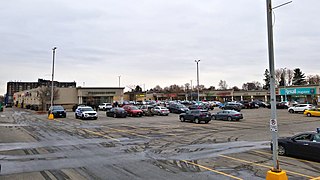
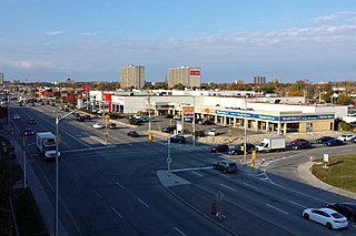
Elmvale Acres Shopping Centre is an open-air mall located in the Elmvale Acres neighbourhood of Ottawa, Ontario, Canada. It opened in 1961, making it one of the oldest shopping centres in the city.
References
- ↑ Dwight Williams (2010). "Ottawa's Alphabet Village".
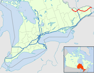
Route map:
| KML file (edit • help) |