
Bank Street is the major commercial north-south street in Ottawa, Ontario, Canada. It runs south from Wellington Street in downtown Ottawa, south through the neighbourhoods of Centretown, The Glebe, Old Ottawa South, Alta Vista, Hunt Club, and then through the villages of Blossom Park, Leitrim, South Gloucester, Greely, Metcalfe, Spring Hill, and Vernon before exiting the city limits at Belmeade Road.

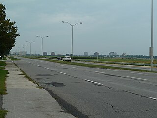
Riverside Drive is a major road in Ottawa, Ontario, Canada that follows along the eastern bank of the Rideau River. Its northern terminus is at the Transitway/Via Rail underpass just south of the Queensway, and the road proceeds south to Limebank Road where it continues as River Road until the city limits. North of the Queensway, Riverside continues as Vanier Parkway, which travels through Vanier until Beechwood Avenue.

Laurier Avenue(French: Avenue Laurier) is a central east west street running through Ottawa, Ontario, Canada. Originally known as "Maria Street" and "Theodore Street", it was renamed in honour of Canadian Prime Minister Sir Wilfrid Laurier. Laurier House, the residence of Prime Ministers Laurier and William Lyon Mackenzie King, is located at the corner of Laurier Avenue East and Chapel Street.
Baseline Road is a road in Ottawa, Ontario, Canada.

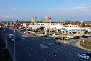
Carling Avenue is a major east–west arterial road in the west end of Ottawa, Ontario, Canada. It runs from March Road in Kanata to Bronson Avenue in the Glebe. The road is named for John Carling, founder of Carling Brewery and Conservative MP and Senator, Postmaster General and Minister of Agriculture.
Ottawa West was a federal and provincial electoral district in Ontario, Canada, that was represented in the House of Commons of Canada from 1935 to 1997 and in the Legislative Assembly of Ontario from 1908 to 1926 and from 1955 to 1999. It covered the western part of the Ottawa area.

The Sir John A. Macdonald Parkway, formerly the Ottawa River Parkway, is a four-lane scenic parkway along the Ottawa River in Ottawa, Ontario, Canada. It runs from Carling Avenue near Connaught Avenue, to Booth Street at the Canadian War Museum and National Holocaust Monument. It is maintained by the National Capital Commission. The speed limit is 60 km/h (37 mph). Bicycles are allowed on the road and on a parallel recreational path along the parkway.
St. Laurent Boulevard is an arterial road in Ottawa, Ontario, Canada. Beginning at the Royal Canadian Mounted Police college complex at Sandridge Road in the Manor Park neighbourhood, St. Laurent Boulevard runs in a straight line, slightly east of south, until it reaches Walkley Road. It then curves west and intersects with Conroy Road and Don Reid Drive. In Ottawa, the name of the street is pronounced exclusively in French, even among Anglophones, as it honours former Canadian Prime Minister Louis St. Laurent. Prior to urbanization, it was known as Hawthorne Road.

Island Park Drive is an important and scenic north-south thoroughfare in Ottawa, Ontario, Canada with a length of about 4 km. It is one of several parkways in Ottawa administered by the National Capital Commission providing scenic routes throughout Canada's capital region.

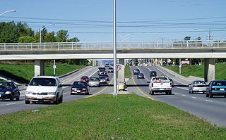
Bronson Avenue is a major north-south arterial road in Ottawa, Ontario, Canada. It starts as a continuation of the Airport Parkway, which is an expressway to the Macdonald-Cartier International Airport. It continues past Carleton University, the Glebe, north through Centretown, and ends downtown at Sparks Street.
Woodroffe Avenue is a major north-south arterial road in Ottawa, Ontario, Canada's west end. It runs south from the Sir John A. Macdonald Parkway through Baseline Road and Barrhaven to just short of Prince of Wales Drive near Manotick. The road runs through the heart of Nepean in Ottawa's west end. A satellite Via Rail station is also located at the intersection of Fallowfield Road.
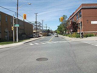
Booth Street is a major street just to the west of downtown Ottawa, Ontario, Canada. North of Albert Street, Booth Street is designated as a city arterial road which proceeds to the Chaudière Bridge, connecting Ottawa to Gatineau. Once in Gatineau, it becomes Rue Eddy. This northernmost part of the street proceeds through the Lebreton Flats past the Canadian War Museum and the under construction National Holocaust Monument.

Merivale Road is an arterial road in the western part of Ottawa, Ontario, Canada. It starts at Island Park Drive just north of Highway 417 and continues south until it ends at Prince of Wales Drive in Rideau Glen. South of Clyde Avenue, Merivale is known as Ottawa Road #17, while north of Clyde it is Ottawa Road #63.
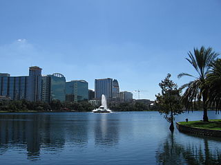
State Road 527 is a major arterial road through the Orlando MSA extending 20 miles (32 km) through Orange County. It is partially unsigned from the southern terminus to SR 482.
Carlington is a neighbourhood located in River Ward in the west-end of Ottawa, Ontario, Canada.

Parkdale Avenue is an arterial road located west of downtown Ottawa, Ontario, Canada. It runs in a north-south direction between the Sir John A. Macdonald Parkway and Carling Avenue in the Hintonburg and Civic Hospital neighbourhoods. It is an extremely busy road providing access to Tunney's Pasture, the Parkdale Market, the Ottawa Civic Hospital, and the Central Experimental Farm. Furthermore, it has direct connections to other major east-west arteries such as Scott Street, Wellington Street West, Gladstone Avenue, and Highway 417.
Moodie Drive is a road in Ottawa's west end. It runs approximately 18.4 km (11.4 mi) south from Carling Avenue in Crystal Beach through Bells Corners, to Brophy Drive south of the Ottawa urban area. It is a four-lane route from Crystal Beach through Bells Corners but becomes a two-lane road at the intersection with Richmond Road. Here it also changes route numbers from 59 on its northern section to 11 on its southern section.

Braemar Park is a neighbourhood in College Ward in the west end of Ottawa, Ontario, Canada. It is bounded on the north by the Queensway, east on Maitland Drive, south by the Central Experimental Pathway and west by J. H. Putman Public School.
Copeland Park is a neighbourhood located in College Ward in the west end of Ottawa, Canada. It is bounded to the west by Agincourt Road, to the south by Baseline Road, to the east by Clyde Avenue and to the north by the Central Experimental Farm Pathway.
McKellar Heights is a small neighbourhood located in Kitchissippi Ward, in the west end of Ottawa, Ontario, Canada. It is bounded on the north by Carling Avenue, on the west by Maitland Avenue, on the south by The Queensway and on the east by Clyde Avenue. The population as of the 2011 Census was 557.