Related Research Articles

Kanata is one of the largest suburbs of Ottawa, Ontario, Canada. It is about 22 km (14 mi) west of the city's downtown. As of 2016, Kanata had a population of 90,806 and is growing rapidly. Before it was amalgamated into Ottawa in 2001, it was one of the fastest growing cities in Canada and the fastest growing community in Eastern Ontario. Located just to the west of the National Capital Commission Greenbelt, it is one of the largest of several communities that surround central Ottawa. It is a planned community and an important high tech centre.

Riverside Drive is a major road in Ottawa, Ontario, Canada that follows along the eastern bank of the Rideau River. Its northern terminus is at the Transitway/Via Rail underpass just south of the Queensway, and the road proceeds south to Limebank Road where it continues as River Road until the city limits. North of the Queensway, Riverside continues as Vanier Parkway, which travels through Vanier until Beechwood Avenue.

Rideau Street is a major street in downtown Ottawa, Ontario, Canada and one of Ottawa's oldest and most famous streets running from Wellington Street in the west to Montreal Road in the east where it connects to the Vanier district. Rideau Street is home to the Château Laurier, the CF Rideau Centre and the Government Conference Centre. Along with Wellington Street and Sussex Drive it was among the first streets in Ottawa to be host to businesses; it was created with the founding of the early town. The Plaza Bridge by the Rideau Canal is at its westmost point and the Cummings Bridge is at its eastmost point.

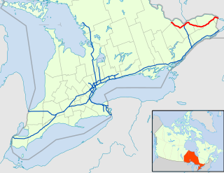
King's Highway 417, commonly referred to as Highway 417 and the Queensway through Ottawa, is a 400-series highway in the Canadian province of Ontario. It connects Montreal with Ottawa, and is the backbone of the transportation system in the National Capital Region. Within Ottawa, it forms part of the Queensway west from Highway 7 to Ottawa Regional Road 174. Highway 417 extends from the Quebec border to Arnprior, where it continues westward as Highway 17. Aside from the urban section through Ottawa, Highway 417 passes through farmland that dominates much of the fertile Ottawa Valley.

Colonel By Drive is an 8.1 km (5.0 mi) long scenic parkway in Ottawa, Ontario, Canada named after Colonel John By. It runs along the Rideau Canal from the end of Sussex Drive at Rideau Street. It then continues 8 km (5.0 mi) south and west to Hog's Back Road, winding through several residential areas and going past Dow's Lake and Carleton University. To the north, the road passes Department of National Defence Headquarters, the Ottawa Congress Centre and the Westin Hotel before ending at Wellington Street and Rideau Street. The rear door of the Government Conference Centre can be accessed from the street as well, after it passes under the Mackenzie King Bridge. It is named for Lieutenant-Colonel John By, who built the Rideau Canal. The winding two-lane road has a speed limit of 60 km/h (37 mph).

Carling Avenue is a major east–west arterial road in the west end of Ottawa, Ontario, Canada. It runs from March Road in Kanata to Bronson Avenue in the Glebe. The road is named for John Carling, founder of Carling Brewery and Conservative MP and Senator, Postmaster General and Minister of Agriculture.

Elgin Street is a street in the Downtown core of Ottawa, Ontario, Canada. Originally named Biddy's Lane, it was later named after Lord Elgin.
Terry Fox station is a bus stop on Ottawa, Ontario, Canada's transitway served by OC Transpo buses and named after cancer research activist Terry Fox. It is located in the western transitway section and is the main western terminal of routes 61 and 62 for all trips not extended to/from Stittsville.
Hazeldean Road is a major road in Ottawa's west end. This road runs between the junction of Highway 7 west of Stittsville and Eagleson Road in Kanata, where it becomes Robertson Road east of the intersection and proceeds towards Bells Corners in the former city of Nepean, Ontario as a four-lane rural route through the Greenbelt.

Eagleson Road is a northwest-southeast road in Ottawa's west end in Kanata. It starts at Highway 417 and ends at Brophy Drive south of Richmond. North of Highway 417 it becomes March Road. It is a key link, primarily for residents of Bridlewood, between both ends of Kanata where housing developments are growing steadily in the north and the south. The primary segment of Eagleson Road is divided and six lanes wide between Highway 417 and Abbeyhill Drive, while between Abbeyhill Drive and just south of Stonehaven Drive it is a four-lane divided arterial. South of that, Eagleson is a two-lane undivided rural road.

Kanata Lakes also known as Marchwood-Lakeside is a neighbourhood in Kanata North Ward in the west end of the city of Ottawa, Ontario, Canada. Prior to amalgamation in 2001, it was located within the City of Kanata. It is located north of the Queensway, west of Beaverbrook, east of Terry Fox Drive, and south of Morgan's Grant. Kanata Lakes is located about 20 km (12 mi) west-southwest of Downtown Ottawa.
Morgan's Grant is a suburban neighbourhood located in Kanata, Ottawa, Ontario, Canada. It is north of the Kanata North Business Park, west of March Road, and north of Terry Fox Drive.
Terry Fox Drive is a major arterial road in Ottawa, Ontario named for the late Canadian humanitarian, activist, and athlete Terry Fox. Located in the suburb of Kanata in the city's west end, the road is a major route for residents traveling to/from the north end of Kanata. Starting in the Kanata North Technology Park at an intersection with Herzberg Road, it crosses March Road and Innovation Drive and bisects an old-growth forest, before heading south past Kanata Centrum. It crosses Highway 417, passes Katimavik-Hazeldean and Glen Cairn, and ends at Eagleson Road, where it continues east as Hope Side Road. Currently, Terry Fox Drive is a four lane arterial between just north of Richardson Side Road and just south of Winchester Drive, and a two lane undivided road elsewhere.

Hazeldean Mall is a shopping centre located in the Kanata district of Ottawa, Ontario, Canada. It is located at the intersection of Eagleson Road and Hazeldean Road, where Hazeldean Road turns into Robertson Road. It was the first enclosed shopping centre constructed in Kanata. The development of the mall was approved shortly before the incorporation of the (then) City of Kanata, and its approval led to a legal battle between the constituent parts of the new municipality over the appropriate location of what would at that time be the new city's main commercial hub.
Teron Station is an OC Transpo Transitway Station in Ottawa, Ontario. The station is located in the suburb of Kanata on Campeau Drive just east of the intersection with Teron Road from which it takes its name, which in turn was named after William Teron, who was responsible for developing Kanata. It is near the western off-ramp of Highway 417 at March Road and an overpass north of Eagleson Station and Park and Ride. Teron was officially included in the Transitway system in the 2007 fall schedules.
Robertson Road is a road in Ottawa's west end. It runs approximately 6.1 km (3.8 mi) between Baseline Road east of Bells Corners and Eagleson Road in Kanata where the road continues west as Hazeldean Road. At Baseline Road it continues east as Richmond Road.
Glen Cairn is a neighbourhood in Kanata South Ward in the west end of Ottawa, Ontario, Canada. It is also the name of a public school in the area. Prior to amalgamation in 2001, it was located in the City of Kanata. It is located in South Kanata, about 22 km (14 mi) west of Downtown Ottawa. It was one of the original neighbourhoods in Kanata. The community was built in the 1960s, and was part of Goulbourn Township until the creation of Kanata in 1978. As of the Canada 2011 Census, there were 9,406 people living in Glen Cairn.
Katimavik-Hazeldean is a neighbourhood in Kanata South Ward in the west end of Ottawa, Ontario, Canada. It is located in the former City of Kanata which amalgamated into Ottawa in 2001. It is located in south-central Kanata, bounded by Eagleson Road to the east, Hazeldean Road to the south, the Carp River to the west, and Highway 417 to the north.
The Kanata Town Centre is a three-storey office building with a smaller one-storey retail component in the city of Ottawa, Ontario, Canada. It is located at 150 Katimavik Road, south of Highway 417, in the Katimavik-Hazeldean community of the Kanata area. It contains approximately 10,000 square metres (110,000 sq ft) of gross floor area. Once intended as the first phase of a central business district for the (then) City of Kanata, the focal point of the planned commercial core for Kanata was later shifted to lands to the north of Highway 417. The office component of the Kanata Town Centre served as the City of Kanata's first permanent city hall.

Kanata—Carleton is a federal electoral district in Ottawa, Ontario.
References
Route map:
| KML file (edit • help) |
| This Ontario road-related article is a stub. You can help Wikipedia by expanding it. |