
Bank Street is the major commercial north-south street in Ottawa, Ontario, Canada. It runs south from Wellington Street in downtown Ottawa, south through the neighbourhoods of Centretown, The Glebe, Old Ottawa South, Alta Vista, Hunt Club, and then through the villages of Blossom Park, Leitrim, South Gloucester, Greely, Metcalfe, Spring Hill, and Vernon before exiting the city limits at Belmeade Road.

Main Street is an arterial road in Ottawa, Ontario, Canada.

Laurier Avenue(French: Avenue Laurier) is a central east west street running through Ottawa, Ontario, Canada. Originally known as "Maria Street" and "Theodore Street", it was renamed in honour of Canadian Prime Minister Sir Wilfrid Laurier. Laurier House, the residence of Prime Ministers Laurier and William Lyon Mackenzie King, is located at the corner of Laurier Avenue East and Chapel Street.
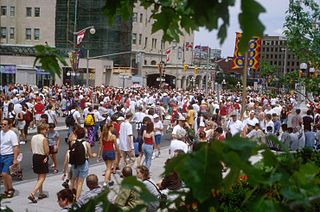
Wellington Street is a major street in Ottawa, Ottawa, Canada. The street is notable for being the main street of the Parliamentary Precinct of the Parliament of Canada. It is one of the first two streets laid out in Bytown in 1826. The street runs from Vimy Place, just west of Booth Street, to the Rideau Canal where it connects with Rideau Street and delimits the northern border of the downtown core. It is named after the Duke of Wellington, in recognition of his role in the creation of the Rideau Canal, and therefore of Ottawa.

Osgoode Hall is a landmark building in downtown Toronto, Ontario, Canada. The original 2 1⁄2-storey building was started in 1829 and finished in 1832 from a design by John Ewart and William Warren Baldwin. The structure was named after William Osgoode, the first Chief Justice of Upper Canada.

Carling Avenue is a major east–west arterial road in the west end of Ottawa, Ontario, Canada. It runs from March Road in Kanata to Bronson Avenue in the Glebe. The road is named for John Carling, founder of Carling Brewery and Conservative MP and Senator, Postmaster General and Minister of Agriculture.

Lees Avenue is both a road and a neighbourhood in Ottawa, Ontario, Canada. The area lies in the narrow stretch between the Rideau Canal and Rideau River south of Sandy Hill and the Queensway and is part of Old Ottawa East. The neighbourhood is dominated by five large apartment buildings, some of the largest in Ottawa. These buildings range from low cost to moderate cost and mostly house new immigrants, students and young professionals. Across the Rideau River to the east Hurdman is a more recently built such area.

Carleton is a federal electoral district in Ontario, Canada, represented in the House of Commons of Canada from 1867 to 1968 and since 2015. It was represented in the Legislative Assembly of Upper Canada from 1821 to 1840 and in the Legislative Assembly of the Province of Canada from 1841 until 1866.

Elgin Street is a street in the Downtown core of Ottawa, Ontario, Canada. Originally named Biddy's Lane, it was later named after Lord Elgin.
St. Laurent Boulevard is an arterial road in Ottawa, Ontario, Canada. Beginning at the Royal Canadian Mounted Police college complex at Sandridge Road in the Manor Park neighbourhood, St. Laurent Boulevard runs in a straight line, slightly east of south, until it reaches Walkley Road. It then curves west and intersects with Conroy Road and Don Reid Drive. In Ottawa, the name of the street is pronounced exclusively in French, even among Anglophones, as it honours former Canadian Prime Minister Louis St. Laurent. Prior to urbanization, it was known as Hawthorne Road.
Fourth Line Road is a designated arterial road in the rural portion of Ottawa, Ontario, Canada. The street follows one of the meridian lines first laid out when Carleton County was surveyed. It begins southeast of Richmond, Ontario at Brophy Drive, and runs southeast until it hits the Rideau River, where it turns into Donnelly Drive at Reevcraig Road South. Fourth Line Road passes through the heart of North Gower, Ontario, and when in that town it is known as "Main Street." The road runs just to the west of Highway 416, which is the more important north-south route.The southern portion of it was originally part of Ontario Highway 16.
Albion Road is an important north–south road in the southern part of Ottawa, Ontario, Canada. The street begins in the north as Albion Road North, at Walkley Road.

Montreal Road is a major east-west Ottawa road that links Lowertown to Vanier, and eastern neighbourhoods of Ottawa. Until downloading in 1998, it was part of the provincially managed Highway 17B.
Richmond Road is a major road in Eastern Ontario, Canada.
Carp Road is an arterial road in Ottawa, Ontario, Canada that runs between Fitzroy Harbour and Stittsville, through the village of Carp. The road is located in the city's west end, beginning in Fitzroy Harbour at Galetta Side Road and ending in Stittsville at Stittsville Main Street. Most of the route is rural with the exception of Stittsville where the road travels in a residential development. Ottawa Regional Road #5 continues as Stittsville Main Street south of Carp Road, then becomes Huntley Road south of Stittsville toward the town of Richmond.

Gladstone Avenue is a street in Ottawa running east from the Rideau Canal west to Parkdale Avenue. It is a historically residential street running just south of the downtown core, with a number of small houses in the downtown section now converted to commercial uses. The local pronunciation is phonetic, unlike that of William Ewart Gladstone's surname.
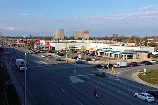
Robertson Road is a road in Ottawa's west end. It runs approximately 6.1 km (3.8 mi) between Baseline Road east of Bells Corners and Eagleson Road in Kanata where the road continues west as Hazeldean Road. At Baseline Road it continues east as Richmond Road.