
Bank Street is the major commercial north-south street in Ottawa, Ontario, Canada. It runs south from Wellington Street in downtown Ottawa, south through the neighbourhoods of Centretown, The Glebe, Old Ottawa South, Alta Vista, Hunt Club, and then through the villages of Blossom Park, Leitrim, South Gloucester, Greely, Metcalfe, Spring Hill, and Vernon before exiting the city limits at Belmeade Road.

Heron Road is a major road in Ottawa, Ontario, Canada. It runs from Walkley Road at an angle to the Rideau River, where it turns into Baseline Road. Heron is home to the Public Works and Government Services Canada headquarters, the Sir Leonard Tilley Building, the Canada Post headquarters, and the Edward Drake Building. It is also home to St. Patrick's Intermediate High School and Herongate Mall.
Sussex Drive is a major street in Ottawa, Ontario, Canada, and one of the city's major ceremonial and institutional routes.

Laurier Avenue(French: Avenue Laurier) is a central east west street running through Ottawa, Ontario, Canada. Originally known as "Maria Street" and "Theodore Street", it was renamed in honour of Canadian Prime Minister Sir Wilfrid Laurier. Laurier House, the residence of Prime Ministers Laurier and William Lyon Mackenzie King, is located at the corner of Laurier Avenue East and Chapel Street.
Wellington Street is a major street in Ottawa, Ottawa, Canada. The street is notable for being the main street of the Parliamentary Precinct of the Parliament of Canada. It is one of the first two streets laid out in Bytown in 1826. The street runs from Vimy Place, just west of Booth Street, to the Rideau Canal where it connects with Rideau Street and delimits the northern border of the downtown core. It is named after the Duke of Wellington, in recognition of his role in the creation of the Rideau Canal, and therefore of Ottawa.
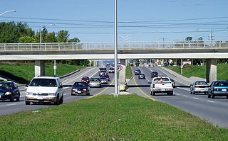
Russell Road is a road in Eastern Ontario, Canada.
Osgoode Main Street is the name of a street in the city of Ottawa, Ontario, Canada. Until recently it was known as Main Street. The name was changed however to Osgoode Main Street so as not to confuse it with the Main Street located a little closer to the city centre. Osgoode Main Street is actually located in the Town of Osgoode, Ontario, but is within the City of Ottawa jurisdiction due to a recent amalgamation. This consequently resulted in its name change. Osgoode Main Street serves as the Main Street of Osgoode, and it is also known as Ottawa Road #114. It runs from River Road in the west to Stagecoach Road in the east. The eastern junction is in the community of West Osgoode, Ontario.

Hawthorne Avenue is a short street in Ottawa, Ontario, Canada. Although short, the western half of the street serves as a major connector for residents of Old Ottawa East and Old Ottawa South with the downtown core, as Hawthorne becomes the Pretoria Bridge in the west which crosses over the Rideau Canal in The Glebe. It also intersects Main Street which runs through Old Ottawa East and Old Ottawa South. Hawthorne Avenue continues east of Main Street only as a one-way street until Concord Street South, where it ends as a dead end before an offramp of the Queensway. Hawthorne Avenue runs parallel to the south of the Queensway for its entire length.
Baseline Road is a road in Ottawa, Ontario, Canada.
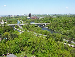
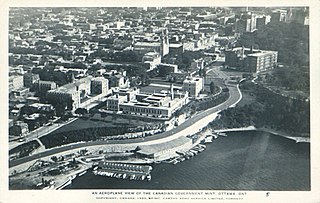
Colonel By Drive is an 8.1 km (5.0 mi) long scenic parkway in Ottawa, Ontario, Canada named after Colonel John By. It runs along the Rideau Canal from the end of Sussex Drive at Rideau Street. It then continues 8 km (5.0 mi) south and west to Hog's Back Road, winding through several residential areas and going past Dow's Lake and Carleton University. To the north, the road passes Department of National Defence Headquarters, the Ottawa Congress Centre and the Westin Hotel before ending at Wellington Street and Rideau Street. The rear door of the Government Conference Centre can be accessed from the street as well, after it passes under the Mackenzie King Bridge. It is named for Lieutenant-Colonel John By, who built the Rideau Canal. The winding two-lane road has a speed limit of 60 km/h (37 mph).

Somerset Street is a street in Ottawa, Ontario, Canada. It is divided into Somerset Street East and Somerset Street West by the Rideau Canal.

Lees Avenue is both a road and a neighbourhood in Ottawa, Ontario, Canada. The area lies in the narrow stretch between the Rideau Canal and Rideau River south of Sandy Hill and the Queensway and is part of Old Ottawa East. The neighbourhood is dominated by five large apartment buildings, some of the largest in Ottawa. These buildings range from low cost to moderate cost and mostly house new immigrants, students and young professionals. Across the Rideau River to the east Hurdman is a more recently built such area.

Alta Vista Drive is a suburban road in Ottawa, Ontario, Canada. It runs from Bank Street in the south to Industrial Avenue in the north covering the neighbourhoods of Ridgemont, Alta Vista and Riverview.
Woodroffe Avenue is a major north-south arterial road in Ottawa, Ontario, Canada's west end. It runs south from the Sir John A. Macdonald Parkway through Baseline Road and Barrhaven to just short of Prince of Wales Drive near Manotick. The road runs through the heart of Nepean in Ottawa's west end. A satellite Via Rail station is also located at the intersection of Fallowfield Road.
Fourth Line Road is a designated arterial road in the rural portion of Ottawa, Ontario, Canada. The street follows one of the meridian lines first laid out when Carleton County was surveyed. It begins southeast of Richmond, Ontario at Brophy Drive, and runs southeast until it hits the Rideau River, where it turns into Donnelly Drive at Reevcraig Road South. Fourth Line Road passes through the heart of North Gower, Ontario, and when in that town it is known as "Main Street." The road runs just to the west of Highway 416, which is the more important north-south route.The southern portion of it was originally part of Ontario Highway 16.

Montreal Road is a major east-west Ottawa road that links Lowertown to Vanier, and eastern neighbourhoods of Ottawa. Until downloading in 1998, it was part of the provincially managed Highway 17B.

Prince of Wales Drive is a road serving Ottawa, Ontario, named after the eponymous road in Battersea, London, U.K. The northern section is a low-speed street running along the west bank of the Rideau River, while southern portions of the road were formerly Highway 16.

Dwyer Hill Road is the longest road within the municipal jurisdiction of the city of Ottawa, Ontario, Canada.
Smyth Road, is a main road in eastern Ottawa, Ontario, Canada. It runs from Riverside Drive to St. Laurent Boulevard. This residential area was developed in the 1950s. The street was originally lined with large elm trees, giving the area the name Elmvale Acres.
King Edward Avenue is a major thoroughfare in the eastern part of Ottawa, Ontario, Canada. Despite being a municipal road, a portion of the street is designated as part of Canada's National Highway System, as part of an interconnecting route between Ontario Highway 417 in Ottawa and Quebec Autoroute 5 in Gatineau.

