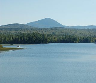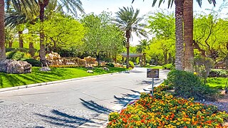
Ohio is a town in Herkimer County, New York, United States. The population was 1,002 at the 2010 census. The town is named after the state of Ohio. The town is in the northern part of the county and northeast of Utica. Part of Ohio is within the Adirondack Park.

Webb is the northernmost town in Herkimer County, New York, United States. As of the 2010 census it had a population of 1,807.

West Texas is a loosely defined part of the U.S. state of Texas, generally encompassing the arid and semiarid lands west of a line drawn between the cities of Wichita Falls, Abilene, and Del Rio.

Mount Blue is a mountain in Maine, USA. It gives its name to Mount Blue State Park in Weld and Mount Blue High School in Farmington.
Sun City Palm Desert is a gated community located in Riverside County, California, in the Palm Springs area, approximately 11 miles (18 km) east of Palm Springs in the Coachella Valley. The ZIP Code is 92211, and the community is inside area codes 442 and 760.

Hawkesbury is an electoral district of the Legislative Assembly in the Australian state of New South Wales. It is represented by Robyn Preston of the Liberal Party.

Park Hill is a neighborhood in Denver, Colorado, U.S. Located in the northeastern quadrant of the city, it is bordered by Colorado Boulevard on the west, East Colfax Avenue on the south, Quebec Street on the east, and East 52nd Avenue on the north. The entire Park Hill neighborhood is located in the area known as East Denver. It is further divided by the City and County of Denver into three administrative neighborhoods, South Park Hill, North Park Hill, and Northeast Park Hill.
Webb Mountain Park is a 135 acre municipal park that offers hiking trails, rock climbing, nature study, and campsites in Monroe, Connecticut. The park backs up onto land where a historic castle building and residences for nuns are located. Webb Mountain Discovery Zone nature center with its own 170 acre park is adjacent. The park has diverse flora including numerous kinds of trees, shrubs, and ferns that not only add to the aesthetic value of the place but provide an ideal setting for some amateur as well as scientific study of the local plants. The park is adjacent to the town-owned Webb Mountain Discovery Zone.

The Gates of Firestorm Peak is an adventure module for the second edition of the Advanced Dungeons & Dragons fantasy role-playing game. The adventure was published in 1996, and was written by Bruce Cordell, with cover art by Jeff Easley and interior art by Arnie Swekel.

Webb Hill is a hill located in St. George, Utah, in Washington County. The hill houses numerous radio and television tower facilities that serve the local area. The hill's geology is common with the surrounding region. In 1998, the skeletal remains of a male were found on the mountain.

The Paugussett Trail is a 9.2-mile (14.8 km) Blue-Blazed hiking trail "system" in the lower Housatonic River valley in Fairfield County and, today, is entirely in Shelton and Monroe, Connecticut. Much of the trail is in Indian Well State Park and the Town of Monroe's Webb Mountain Park. The mainline trail is primarily southeast to northwest with three short side or spur trails.

McCauley Mountain is a summit and ski resort in the Town of Webb, Herkimer County, New York. It is located just outside the hamlet of Old Forge, in the central Adirondack Mountains.

Moose Mountain (10,059 feet is located in the northern Teton Range in the U.S. state of Wyoming. The peak is on the border of Grand Teton National Park and the Jedediah Smith Wilderness of Caribou-Targhee National Forest. Moose Mountain is at the western end of Webb Canyon.

The MacDonald Highlands are a series of highly affluent residential neighborhoods in Henderson, Nevada in the foothills of Black Mountain. The neighborhood is part of the Las Vegas Valley.

Barney and Betty Hill were an American couple who claimed they were abducted by extraterrestrials in a rural portion of the state of New Hampshire from September 19 to September 20, 1961. It was the first widely publicized report of an alien abduction in the United States.

Wheeler Springs is an unincorporated community in Ventura County, California. It is located 6 miles north of the Ojai Valley, within Los Padres National Forest. It is named for Wheeler Blumberg, who was the founder of town in 1891, and the many natural hot springs.

McKee Hill is a mountain located in the Catskill Mountains of New York west of North Kortright. Quaker Hill is located northeast, Webb Hill is located northwest, Dutch Hill is located northwest, and Gunhouse Hill is located east of Quaker Hill.

Dutch Hill is a mountain located in the Catskill Mountains of New York east of Davenport Center. Webb Hill is located northwest, and Mine Hill is located southwest of Dutch Hill.

Maple Hill is a summit located in Central New York Region of New York located in the Town of Webb in Herkimer County, north-northwest of Stillwater Reservoir. Alder Bed Mountain is located southeast of Maple Hill.


