Wellington, Utah

Last updated

Wellington, Utah
WellingtonUtahCabin.jpeg
Historical cabin in Wellington City Park, built 1882
Carbon County Utah incorporated and unincorporated areas Wellington highlighted.svg
Location in Carbon County and the state of Utah
Map of USA UT.svg
Location of Utah in the United States
Coordinates: 39°32′22″N110°43′47″W / 39.53944°N 110.72972°W / 39.53944; -110.72972
Country United States
State Utah
County Carbon
Settled1878
Founded byJefferson Tidwell
Named for Justus Wellington Seeley, Jr.
Area
[1]
  Total5.11 sq mi (13.25 km2)
  Land5.11 sq mi (13.25 km2)
  Water0.00 sq mi (0.00 km2)
Elevation
[2]
5,391 ft (1,643 m)
Population
 (2010)
  Total1,676
  Estimate 
(2019) [3]
1,620
  Density316.78/sq mi (122.31/km2)
Time zone UTC-7 (Mountain (MST))
  Summer (DST) UTC-6 (MDT)
ZIP code
84542
Area code 435
FIPS code 49-82510 [4]
GNIS feature ID2412208 [2]
Website wellingtonutah.gov

Wellington is a city in Carbon County, Utah, United States. The population was 1,676 at the 2010 census. [5] The community was settled in 1878 by a band of thirteen Mormons led by Jefferson Tidwell. The town was named for Justus Wellington Seeley, Jr., of the Emery County Court. [6] Many residents commute to nearby Price for their jobs, or work in one of the various coal mines in the area.

Contents

Geography

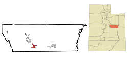
Wellington is located southwest of the center of Carbon County at 39°32′22″N110°43′47″W / 39.539476°N 110.729667°W / 39.539476; -110.729667 (39.539476, -110.729667), [7] along U.S. routes 6/191, which leads northwest 6 miles (10 km) to Price, the county seat, and southeast 57 miles (92 km) to Green River.

According to the United States Census Bureau, the city has a total area of 5.1 square miles (13.3 km2), all land. [5] It is just north of the Price River, a southeast-flowing tributary of the Green River.

Climate

This climatic region is typified by large seasonal temperature differences, with warm to hot (and often humid) summers and cold (sometimes severely cold) winters. According to the Köppen Climate Classification system, Wellington has a humid continental climate, abbreviated "Dfb" on climate maps. [8]

Demographics

Historical population
CensusPop.Note
1900 311
1910 35815.1%
1920 3610.8%
1930 348−3.6%
1940 67493.7%
1950 84525.4%
1960 1,06626.2%
1970 922−13.5%
1980 1,40652.5%
1990 1,63216.1%
2000 1,6662.1%
2010 1,6760.6%
2019 (est.)1,620 [3] −3.3%
U.S. Decennial Census [9]

As of the census [4] of 2000, there were 1,666 people, 576 households, and 459 families residing in the city. The population density was 473.9 people per square mile (182.7/km2). There were 661 housing units at an average density of 188.0 per square mile (72.5/km2). The racial makeup of the city was 94.72% White, 0.12% African American, 1.08% Native American, 0.18% Asian, 0.12% Pacific Islander, 2.04% from other races, and 1.74% from two or more races. Hispanic or Latino of any race were 4.92% of the population.

There were 576 households, out of which 47.2% had children under the age of 18 living with them, 62.3% were married couples living together, 13.0% had a female householder with no husband present, and 20.3% were non-families. 17.9% of all households were made up of individuals, and 6.9% had someone living alone who was 65 years of age or older. The average household size was 2.89 and the average family size was 3.27.

In the city, the population was spread out, with 33.3% under the age of 18, 13.1% from 18 to 24, 25.1% from 25 to 44, 19.9% from 45 to 64, and 8.7% who were 65 years of age or older. The median age was 28 years. For every 100 females, there were 96.2 males. For every 100 females age 18 and over, there were 91.4 males.

The median income for a household in the city was $36,979, and the median income for a family was $40,521. Males had a median income of $41,053 versus $17,167 for females. The per capita income for the city was $14,721. About 10.7% of families and 14.7% of the population were below the poverty line, including 20.6% of those under age 18 and 4.7% of those age 65 or over.

Education

Wellington is located in the Carbon School District and is home to an elementary school. Students attend middle school and high school in Price.

See also

Related Research Articles

<span class="mw-page-title-main">McCammon, Idaho</span> City in Idaho, United States

McCammon is a city in Bannock County, Idaho, United States. It is part of the Pocatello, Idaho Metropolitan Statistical Area'. The population was 809 at the 2010 census. In 1892, McCammon became the junction point between the Oregon Short Line Railroad and Utah and Northern Railway, and city gained the nickname Junction City.

<span class="mw-page-title-main">Paris, Idaho</span> City in Idaho, United States

Paris is a city and county seat of Bear Lake County, Idaho, United States. Located on the western side of the Bear Lake Valley, the city's population was 513 at the 2010 census, down from 576 in 2000. Paris was settled on September 26, 1863, by pioneer settlers of the Church of Jesus Christ of Latter-day Saints.

<span class="mw-page-title-main">Wellington, Kansas</span> City in Sumner County, Kansas

Wellington is a city in and the county seat of Sumner County, Kansas, United States. As of the 2020 census, the population of the city was 7,715.

<span class="mw-page-title-main">Stanley, North Dakota</span> City in North Dakota, United States

Stanley is a city in Mountrail County, North Dakota, United States. It is the county seat of Mountrail County. The population was 2,321 at the 2020 census, making it the 22nd largest city in North Dakota. Stanley was founded in 1902. The town's economy is heavily connected to the nearby oil-rich Bakken Formation.

<span class="mw-page-title-main">Minersville, Utah</span> Town in the state of Utah, United States

Minersville is a town in southeastern Beaver County, Utah, United States. The population was 807 at the 2020 census, down from the 2010 figure of 907.

<span class="mw-page-title-main">Portage, Utah</span> Town in Utah, United States

Portage is a town in Box Elder County, Utah, United States. The population was 245 at the 2010 census. The town received its name from Lorenzo Snow, an apostle of the Church of Jesus Christ of Latter-day Saints. He named it Portage after his birthplace of Portage County, Ohio.

<span class="mw-page-title-main">Lewiston, Utah</span> City in Utah, United States

Lewiston is a city in Cache County, Utah, United States. It is situated at the northern Utah border and borders the state of Idaho. The population was 1,939 at the 2020 census. It is included in the Logan, Utah-Idaho (partial) Metropolitan Statistical Area.

<span class="mw-page-title-main">Millville, Utah</span> City in Utah, United States

Millville is a city in Cache County, Utah, United States. The population was 2,222 at the 2020 census, with an estimated population of 2,300 in 2022. It is included in the Logan, Utah-Idaho Metropolitan Statistical Area.

<span class="mw-page-title-main">Trenton, Utah</span> Town in Utah, United States

Trenton is a town in Cache County, Utah, United States. The population was 512 at the 2020 census. It is included in the Logan, Utah-Idaho (partial) Metropolitan Statistical Area.

<span class="mw-page-title-main">East Carbon, Utah</span> Former city in Carbon County, Utah, United States

East Carbon was a city in Carbon County, Utah, United States. The population was 1,556 at the 2020 census. East Carbon was incorporated on July 23, 1973, from the merger of the two struggling mining towns of Dragerton and Columbia. On January 1, 2014, the city merged with the neighboring city of Sunnyside to become East Carbon-Sunnyside, but later changed to East Carbon City.

<span class="mw-page-title-main">Helper, Utah</span> City in Utah, United States

Helper is a city in Carbon County, Utah, United States, approximately 110 miles (180 km) southeast of Salt Lake City and 7 miles (11 km) northwest of the city of Price. The population was 2,201 at the 2010 census.

<span class="mw-page-title-main">Price, Utah</span> City in Utah, United States

Price is a city in the U.S. state of Utah and the county seat of Carbon County. The city is home to Utah State University Eastern, as well as the USU Eastern Prehistoric Museum. Price is located within short distances of both Nine Mile Canyon and the Manti-La Sal National Forest.

<span class="mw-page-title-main">Hatch, Utah</span> Town in the state of Utah, United States

Hatch is a town in Garfield County, Utah, United States. The population was 132 at the 2020 census. It is 260 miles (420 km) south of Salt Lake City.

<span class="mw-page-title-main">Big Water, Utah</span> Town in the state of Utah, United States

Big Water is a town in Kane County, Utah, United States. The population was 475 at the 2010 census, up from 417 at the 2000 census. It is located 17 miles (27 km) northwest of Page, Arizona, on US-89 near Lake Powell and the Glen Canyon Dam. It was originally called Glen Canyon City and housed workers who built the dam in the 1950s.

<span class="mw-page-title-main">Junction, Utah</span> Town in the state of Utah, United States

Junction is a town in and the county seat of Piute County, Utah, United States. The population was 191 at the 2010 census.

<span class="mw-page-title-main">Marysvale, Utah</span> Town in the United States

Marysvale is a town in Piute County, Utah, United States. The population was 408 at the 2010 census. Marysvale is a trail head for the Paiute ATV Trail.

<span class="mw-page-title-main">New Harmony, Utah</span> Town in the state of Utah, United States

New Harmony is a town in northern Washington County, Utah, United States. The population was 207 at the 2010 census.

<span class="mw-page-title-main">Bicknell, Utah</span> Town in the state of Utah, United States

Bicknell is a town along State Route 24 in Wayne County, Utah, United States. As of the 2010 census, the town population was 327.

<span class="mw-page-title-main">Cairo, West Virginia</span> Town in West Virginia, United States

Cairo is a town in Ritchie County, West Virginia, United States, along West Virginia Route 31, the North Fork of the Hughes River, and the North Bend Rail Trail. The population was 174 at the 2020 census.

<span class="mw-page-title-main">Bedford, Wyoming</span> Census-designated place in Wyoming, United States

Bedford is a census-designated place (CDP) in Lincoln County, Wyoming, United States. The population was 465 at the 2020 census.

References

  1. "2019 U.S. Gazetteer Files". United States Census Bureau. Retrieved August 7, 2020.
  2. 1 2 U.S. Geological Survey Geographic Names Information System: Wellington, Utah
  3. 1 2 "Population and Housing Unit Estimates". United States Census Bureau. May 24, 2020. Retrieved May 27, 2020.
  4. 1 2 "U.S. Census website". United States Census Bureau . Retrieved January 31, 2008.
  5. 1 2 "Geographic Identifiers: 2010 Census Summary File 1 (G001): Wellington city, Utah". U.S. Census Bureau, American Factfinder. Archived from the original on February 13, 2020. Retrieved August 10, 2015.
  6. Lund, Anthon Henrik (1922). The Utah Genealogical and Historical Magazine. Geneal. Society of Utah. p. 41.
  7. "US Gazetteer files: 2010, 2000, and 1990". United States Census Bureau. February 12, 2011. Retrieved April 23, 2011.
  8. Climate Summary for Wellington, Utah
  9. "Census of Population and Housing". Census.gov. Retrieved June 4, 2015.