Wolf Creek, Wisconsin | |
---|---|
Coordinates: 45°33′22″N92°43′22″W / 45.55611°N 92.72278°W Coordinates: 45°33′22″N92°43′22″W / 45.55611°N 92.72278°W | |
Country | United States |
State | Wisconsin |
County | Polk |
Elevation | 249 m (817 ft) |
Time zone | UTC-6 (Central (CST)) |
• Summer (DST) | UTC-5 (CDT) |
Area code(s) | 715 & 534 |
GNIS feature ID | 1576928 [1] |
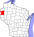
Wolf Creek is an unincorporated community located in the town of Sterling, Polk County, Wisconsin, United States. [1]
Wolf Creek is located along the River Road, approximately 12 miles north of St Croix Falls, Wisconsin. The community derives its name from the Wolf Creek, that flows through and joins the St Croix River approximately .5 miles SW of the community.
Wolf Creek was initially a trading post and then a stopping place on the River Road from the Falls of St Croix to the pineries to the north. It was the distance a team of oxen could travel in one day.
In the 1840s it remained a stopping place. In 1854, Dr. Samuel Deneen and William Trimmer and families settled the area, building a mill and hotel. In 1855, the Township of Sterling was organized and Wolf Creek became the post office and trading center.
Wolf Creek remained a quiet small town with a boom in the late 1880s with the construction of nearby Nevers Dam on the St Croix River. The logging era lasted until 1914.
At its peak, Wolf Creek had several stores, a bar, a community hall, a Methodist church, a public school, post office, blacksmith shop and other businesses including the water-powered flour and saw mill. [2]
Polk County is a county in the U.S. state of Wisconsin. As of the 2020 census, the population was 44,977. Its county seat is Balsam Lake. The county was created in 1853.
Lyme is a town in New London County, Connecticut, United States, situated on the eastern side of the Connecticut River. The population was 2,352 at the 2020 census.
Sunrise Township is a township in Chisago County, Minnesota, United States. The population was 1,994 at the 2010 census, up from 1,594 in 2000.
Elcho is a town in Langlade County, Wisconsin, United States. The population was 1,233 at the 2010 census. The census-designated places of Elcho, Post Lake, and part of Summit Lake are located in the town.
Park Falls is a city in Price County, Wisconsin, United States. The population was 2,462 at the 2010 census. Located in the woods of north central Wisconsin, primarily the Chequamegon National Forest, Park Falls is a small community divided by the North Fork of the Flambeau River, a popular destination for fishing, canoeing and whitewater rafting.
The St. Croix River is a tributary of the Mississippi River, approximately 169 miles (272 km) long, in the U.S. states of Wisconsin and Minnesota. The lower 125 miles (201 km) of the river form the border between Wisconsin and Minnesota. The river is a National Scenic Riverway under the protection of the National Park Service. A hydroelectric plant at the Saint Croix Falls Dam supplies power to the Minneapolis–St. Paul metropolitan area.
River Falls is a city in Pierce and St. Croix counties in the U.S. state of Wisconsin. It is adjacent to the Town of River Falls in Pierce County and the Town of Kinnickinnic in St. Croix County. River Falls is the most populous city in Pierce County. The population was 16,182 at the 2020 census, with 11,851 residing in Pierce County and 3,149 in St. Croix County. It is part of the Minneapolis-St. Paul metropolitan area and located approximately 30 miles (48 km) east of the center of that region.
The Cherokee Path was the primary route of English and Scots traders from Charleston to Columbia, South Carolina in Colonial America. It was the way they reached Cherokee towns and territories along the upper Keowee River and its tributaries. In its lower section it was known as the Savannah River. They referred to these towns along the Keowee and Tugaloo rivers as the Lower Towns, in contrast to the Middle Towns in Western North Carolina and the Overhill Towns in present-day southeastern Tennessee west of the Appalachian Mountains.
Wild River State Park is a state park of Minnesota, United States, curving along 18 miles (29 km) of the St. Croix River. This long, narrow park is shaped somewhat like a sideways 'S', with development largely concentrated in the lower third. The remote upper sections flank the mouth of a tributary called the Sunrise River. The park is managed to provide quieter, more nature-oriented recreation as a counterpoint to the busier William O'Brien and Interstate State Parks downstream.
Sycamore is an unincorporated community in eastern Ozark County in the Ozarks of southern Missouri, United States. It is located on Route 181, approximately fourteen miles northeast of Gainesville. The old townsite is located on a ridge on the west side of Bryant Creek, a major tributary of the North Fork River. The old Hodgson Mill and spring lie on Bryant Creek 0.8 mi (1.3 km) to the northeast. The mill was nominated to the National Register of Historic Places as Aid-Hodgson Mill in 2001.
Lake Lena is an unincorporated community and Native American village in Ogema Township, Pine County, Minnesota, United States, located along the Lower Tamarack River. It currently is the administrative center for the Mille Lacs Indian Reservation, District III.
Hoehne is an unincorporated town, a post office, and a census-designated place (CDP) located in and governed by Las Animas County, Colorado, United States. The Hoehne post office has the ZIP Code 81046. At the United States Census 2010, the population of the Hoehne CDP was 111.
Almelund is an unincorporated community in Amador Township, Chisago County, Minnesota, United States.
Stephensville is a small unincorporated community located entirely within the town of Ellington in west-central Outagamie County, Wisconsin, United States. Stephensville is classified as a Class U6 Community by the USGS, being a populated place located wholly or substantially outside the boundaries of any incorporated place or CDP with a recognized authoritative common name.
Cushing is an unincorporated community in Polk County, Wisconsin, United States. Cushing is located on Wisconsin Highway 87 north of St. Croix Falls, in the towns of Laketown and Sterling. Cushing has a post office with ZIP code 54006 and a telephone prefix of 648.
Venado is an unincorporated community in Sonoma County, California, United States, and is located about 12 miles west of Healdsburg, along Mill Creek Road, below the north slope of Knoll Ridge, on the south bank of Gray Creek, at an elevation of 1,102 feet. The community had a post office from 1921 to 1941. Venado was devastated by the Walbridge Fire in 2020, part of the larger LNU Lightning Complex fire. The Walbridge Fire destroyed many homes and structures in the area, including the Venado Post Office and Daniels School.
The Clam River is a 63.4-mile-long (102.0 km) tributary of the St. Croix River in northwestern Wisconsin in the United States. In its history, it has been known by the names Kayeskikan, Kiesca-seba, and "Shell River".
The Trade River is a 50.8-mile-long (81.8 km) tributary of the St. Croix River in northwestern Wisconsin in the United States. In its history, it has been known by the names "Atanwa" or "Ottoway" River, both of which are Anglicized versions of an Ojibwe language word meaning "trade". Beneath the mouth of the Trade River, the St. Croix River was once known as the Grave-marker River.
Cloverton is an unincorporated community in New Dosey Township, Pine County, Minnesota, United States.
Franconia is an unincorporated community in Franconia Township, Chisago County, Minnesota, United States.