Fitzroy Provincial Park

Last updated
Fitzroy Provincial Park
Fitzroy Harbour.jpg
View of Fitzroy Harbour from park playground
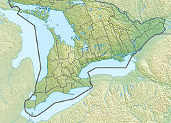
Canada Southern Ontario relief location map.jpg
Red pog.svg
Location Fitzroy Harbour
Nearest city Ottawa, Ontario
Coordinates 45°27′N76°08′W / 45.45°N 76.14°W / 45.45; -76.14
Area185 hectares (460 acres)
Governing body Ontario Parks

Fitzroy Provincial Park is a provincial park on the Ottawa River in Ontario, Canada, designated as recreational-class by Ontario Parks. White pine covers much of the park. The park has century-old trees and a stand of 300-year-old bur oaks by the Carp River. There are two campgrounds within the park, both with comfort stations, a boat launch and park store. The main campgrounds have 235 campsites, 107 with electrical service, 205 with room for trailers, and a separate area with facilities for group camping and picnicking.

Contents

Cross-country skiing is available in the winter on trails maintained by the West Carleton Nordic Ski Club. [1]

Shale pillar along Terraces Trail Shale pillar, Fitzroy.jpg
Shale pillar along Terraces Trail

See also

Related Research Articles

<span class="mw-page-title-main">Tourism in Canada</span> Overview of tourism in Canada

Canada has a large domestic and foreign tourism industry. The second largest country in the world, Canada's wide geographical variety is a significant tourist attractor. Much of the country's tourism is centred in the following regions: Toronto, Montreal, Quebec City, Vancouver/Whistler, Niagara Falls, Vancouver Island, Canadian Rockies, British Columbia's Okanagan Valley, Churchill, Manitoba and the National Capital Region of Ottawa-Gatineau. The large cities are known for their culture, diversity, as well as the many national parks and historic sites.

<span class="mw-page-title-main">Algonquin Provincial Park</span> Provincial park in Ontario, Canada

Algonquin Provincial Park is an Ontario provincial park located between Georgian Bay and the Ottawa River, mostly within the Unorganized South Part of Nipissing District. Established in 1893, it is the oldest provincial park in Canada. Additions since its creation have increased the park to its current size of about 7,653 km2 (2,955 sq mi). The park is contiguous with several smaller, administratively separate provincial parks that protect important rivers in the area, resulting in a larger total protected area.

<span class="mw-page-title-main">Achray, Ontario</span> Place in Ontario, Canada

Achray is an unincorporated place and former railway point in geographic Stratton Township in the Unorganized South Part of Nipissing District in northeastern Ontario, Canada. It lies in northern Algonquin Provincial Park on the northern shore of Grand Lake, part of the Barron River system, and functions today as a campground site.

<span class="mw-page-title-main">Lake Superior Provincial Park</span> Provincial park in Ontario, Canada

Lake Superior Provincial Park is one of the largest provincial parks in Ontario, covering about 1,550 square kilometres (600 sq mi) along the northeastern shores of Lake Superior between Sault Ste. Marie and Wawa in Algoma District in Northeastern Ontario, Canada. Ontario Highway 17 now runs through the park. When the park was established by Ontario in 1944, there was no road access.

<span class="mw-page-title-main">Barron River (Ontario)</span> River in Ontario, Canada

The Barron River is a river in the Saint Lawrence River drainage basin in Nipissing District and Renfrew County, Ontario, Canada. It flows from Clemow Lake in northern Algonquin Provincial Park and joins the Petawawa River, whose southern branch it forms, in the municipality of Laurentian Hills, near the municipality of Petawawa.

Dunrobin is a community in West Carleton-March Ward in the City of Ottawa, Ontario, Canada. It is located about 35 kilometres northwest of Downtown Ottawa. Dunrobin lies within a valley, nestled between the Ottawa River and the Carp escarpment, and is located at 45.18° latitude and 75.55° longitude. Dunrobin is located on the former boundary between West Carleton Township and Kanata. Dunrobin was amalgamated with the city of Ottawa in 2000. Dunrobin is expanding steadily with a current population of about 1,000 people.

<span class="mw-page-title-main">Vermilion Provincial Park</span> Provincial park in Alberta, Canada

Vermilion Provincial Park is a provincial park located in east-central Alberta, Canada, in the County of Vermilion River. It is located on the outskirts of the town of Vermilion, which is at the junction of Highways 16 (Yellowhead) and 41, between Edmonton and Lloydminster.

<span class="mw-page-title-main">Whiteshell Provincial Park</span> Provincial park in Manitoba, Canada

Whiteshell Provincial Park is a provincial park in southeast Manitoba, approximately 120 kilometres (75 mi) east of the city of Winnipeg. The park is considered to be a Class II protected area under the IUCN protected area management categories. It is 275,210 hectares in size.

<span class="mw-page-title-main">Beatton Provincial Park</span> Canadian provincial park

Beatton Provincial Park is a provincial park in the Peace River Country of northeastern British Columbia, Canada.

<span class="mw-page-title-main">E. C. Manning Provincial Park</span> Provincial park in British Columbia, Canada

E.C. Manning Provincial Park is a provincial park in British Columbia, Canada. It is usually referred to as Manning Park, although that nomenclature is also used to refer to the resort and ski area at the park's core. The park covers 83,671 hectares and was the second most visited provincial park in 2017-18 after Cypress Provincial Park. The park lies along British Columbia Highway 3, and occupies a large amount of land between Hope and Princeton along the Canada-United States border.

<span class="mw-page-title-main">Kettle Moraine State Forest</span> State forest in Wisconsin, United States

The Kettle Moraine State Forest is a state forest in southeastern Wisconsin. The chief feature of the reserve is the Kettle Moraine, a highly glaciated area. The area contains very hilly terrain and glacial landforms, such as kettles, kames and eskers. The 56,000-acre (23,000 ha) forest is divided into two large and three small units, which are spread across a hundred miles.

<span class="mw-page-title-main">Sheep River Provincial Park</span> Provincial park in Alberta, Canada

Sheep River Provincial Park is a provincial park located in Alberta, Canada, 23 kilometres (14 mi) west of Diamond Valley on highway 546. It is part of the Kananaskis Country park system and encompasses a portion of the Sheep River valley.

<span class="mw-page-title-main">Mactaquac Provincial Park</span>

Mactaquac Provincial Park is a Canadian provincial park with an area of 5.25 square kilometres (2.03 sq mi). It is located on the Saint John River 15 kilometres west of Fredericton, New Brunswick in the community of Mactaquac.

<span class="mw-page-title-main">Neys Provincial Park</span> Provincial park in Ontario, Canada

Neys Provincial Park is a natural environment-class provincial park on the north shore of Lake Superior, just west of Marathon, Ontario, Canada. This 5,383-hectare (13,300-acre) park includes the historic Coldwell Peninsula and the surrounding island system, consisting of Pic Island, Detention Island, and the Sullivan Islands.

<span class="mw-page-title-main">Rainbow Falls Provincial Park</span> Provincial park in Ontario, Canada

Rainbow Falls Provincial Park is a recreation-class provincial park within the Ontario Parks system. This 575-hectare (1,421-acre) park consists of two non-contiguous parts: Whitesand Lake campground in the main park, and the historic Rossport Campground, east of the fishing community of Rossport, Ontario, which provides campsites along the rough and rocky shorelines of Lake Superior.

<span class="mw-page-title-main">Blackstrap Provincial Park</span> Provincial park in Saskatchewan, Canada

Blackstrap Provincial Park is a provincial park in the Canadian province of Saskatchewan in the RM of Dundurn No. 314. Prior to the park's establishment in 1986, it was a provincial recreation site. The park runs along the eastern shore of Blackstrap Lake and consists of a conservation area, campground, beaches, Mount Blackstrap, cross country ski trails, biking and hiking trails, and several picnicking areas. It is about 8.5 kilometres (5.3 mi) east of the town of Dundurn and accessed via Highway 211. Mount Blackstrap is a man-made mountain built as a ski hill for the 1971 Canada Winter Games. It continued to operate as a ski hill until 2007.

<span class="mw-page-title-main">Driftwood Provincial Park</span> Provincial park in Ontario, Canada

Driftwood Provincial Park is a provincial park on the south shore of the Ottawa River, about 40 kilometres (25 mi) west of Deep River, in Ontario, Canada. It is administered by Ontario Parks which classifies it as a "recreation park".

<span class="mw-page-title-main">Voyageur Provincial Park</span> Provincial park in Ontario, Canada

Voyageur Provincial Park is a provincial park located in eastern Ontario, Canada, opposite the once furious Long Sault rapids of the Ottawa River around which voyageurs portaged on their way upstream. Established in 1966, the park was formerly known as Carillon Provincial Park.

<span class="mw-page-title-main">Lac La Ronge Provincial Park</span> Provincial park in Saskatchewan, Canada

Lac La Ronge Provincial Park is located in the boreal forest of the north central part of the Canadian province of Saskatchewan within the Canadian Shield. Situated in the Churchill River system, this provincial park has close to 100 lakes and more than 30 canoe routes, many of which follow old fur trade routes. Summer activities include camping, hiking, boating, fishing, and swimming. In the winter, there's cross-country skiing, snowmobiling, and ice fishing. Saskatchewan's highest waterfall is in the park. Nistowiak Falls are located north of Lac La Ronge along the Rapid River.

Great Blue Heron Provincial Park is a recreational park in the central region of the Canadian province of Saskatchewan in the boreal forest ecozone of Canada. It is adjacent to the eastern boundary of Prince Albert National Park, about 50 kilometres (31 mi) north of the city of Prince Albert. The provincial park was established in 2013 from two pre-existing provincial recreation sites – Emma Lake and Anglin Lake Recreation Sites – and the addition of a large tract of Crown land.

References

  1. Pearson, Matthew (26 December 2017). "Happy trails: Places where you can XC ski, right in Ottawa". Ottawa Citizen . Postmedia Network. Retrieved 9 November 2022.