
Algonquin Provincial Park is a provincial park located between Georgian Bay and the Ottawa River in Ontario, Canada, mostly within the Unorganized South Part of Nipissing District. Established in 1893, it is the oldest provincial park in Canada. Additions since its creation have increased the park to its current size of about 7,653 km2 (2,955 sq mi). The park is contiguous with several smaller, administratively separate provincial parks that protect important rivers in the area, resulting in a larger total protected area.
Killarney is a municipality located on the northern shore of Georgian Bay in the Sudbury District of Ontario, Canada. Killarney is commonly associated with Killarney Provincial Park, which is a large wilderness park located to the east of the townsite which occupies much of the municipality's expanded boundary.

The Sudbury District is a district in Northeastern Ontario in the Canadian province of Ontario. It was created in 1894 from townships of eastern Algoma District and west Nipissing District.
Sudbury East was a provincial electoral riding in the Canadian province of Ontario, that was represented in the Legislative Assembly of Ontario from 1967 to 1999. It served the easternmost portion of the former city of Sudbury, the eastern portion of the Regional Municipality of Sudbury, and several rural communities to the east and southeast of the city. The riding only existed in provincial elections — for federal elections, most of Sudbury East was part of either Nickel Belt or Timiskaming—French River.

Killarney Provincial Park is a provincial park in central Ontario, Canada.
The Obabika River Provincial Park is a provincial park in Ontario, Canada, straddling across the boundaries of the Sudbury, Nipissing, and Timiskaming Districts. While it is named after and includes the Obabika River, the bulk of the park extends north of Obabika Lake to the eastern boundary of Lady Evelyn-Smoothwater Provincial Park.

Long Lake Provincial Park is located in Halifax, Nova Scotia, Canada. It was initiated in 1981 by then Premier John Buchanan after Halifax's water supply had been shifted from the Spruce Hill/Long Lake/Chain Lakes watershed to the Pockwock Lake watershed near Hammonds Plains. The 2,095-hectare (5,180-acre) park, formally established in 1984, constitutes the bulk of these former watershed lands. Other portions were deeded to the municipality of Halifax, and the area around the Chain Lakes is still administered by the Halifax Regional Water Commission, since the Chain Lakes remain the city's emergency water supply.

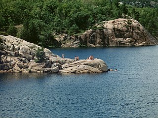
The La Cloche Silhouette Trail is a 78-kilometre (48 mi) backpacking loop across the white quartzite peaks of the La Cloche mountain range. The trail is situated in Killarney Provincial Park, Ontario, Canada. The trail is named for Group of Seven painter Franklin Carmichael's painting "La Cloche Silhouette." Wildlife can be seen throughout the trail - black bears, moose, wolverines, mountain lions, lynx, fishers, snakes, porcupines, beavers, river otters, among other animals, can be encountered at various points along the way.
Lake Panache is a lake in the Canadian province of Ontario. It is located in the Sudbury District, although a small portion of the lake lies within the southernmost city limits of Greater Sudbury, approximately 10 kilometres south of the community of Whitefish.

The Whitefish River is a river in Sudbury District in northeastern Ontario, Canada and a tributary of Lake Huron.
An Area of Natural and Scientific Interest is an official designation by the provincial Government of Ontario in Canada applied to contiguous geographical regions within the province that have geological or ecological features which are significantly representative provincially, regionally, or locally. Some sites with this designation were assessed through the International Biological Program between 1964 and 1974. As of 2014, over 1000 sites covering 460,000 hectares (4,600 km2) have been designated in the province.

Mont-Tremblant National Park is a provincial park in Canada located north of the town of Mont-Tremblant, and the village of Saint-Donat and Saint-Côme, in the administrative regions of Laurentides and Lanaudière, in Quebec, in Canada.

The Sturgeon River Provincial Park is a provincial park in northern Ontario, Canada, that protects about 70 kilometres (43 mi) long section of the Sturgeon River and its banks, from Woods Lake to the Sudbury-Nipissing District boundary. It was established in 1989 and expanded in 2005. It protects outstanding water routes that provide recreational canoe camping opportunities. Other activities include hunting and fishing.

The eastern forest–boreal transition is a temperate broadleaf and mixed forests ecoregion of North America, mostly in eastern Canada. It is a transitional zone or region between the predominantly coniferous Boreal Forest and the mostly deciduous broadleaf forest region further south.
Daisy Lake Uplands Provincial Park is a provincial park in the Canadian province of Ontario. Surrounding Daisy Lake in the city of Greater Sudbury, the park serves to protect a recovering ecosystem scarred by pollution from the city's mining industry; one of the industry's first roasting beds in the region was located just east of the park boundaries. The park's ecosystem includes white birch trees, grasses, sedges, rock barrens and bog vegetation. The site is designated as a control area for ecological research — unlike in other parts of the city, where extensive environmental mitigation and recovery programs have been undertaken since the 1970s, Daisy Lake Uplands is set aside for study of the site's ability to recover on its own without human intervention. The park was first proposed for creation in 2003, and was officially designated by an amendment to the Ontario Provincial Parks Act in 2006.

Gould Lake Conservation Area is a rural conservation area located in the Canadian Shield northwest of the community of Sydenham in the Township of South Frontenac, Frontenac County, in eastern Ontario, Canada. The area was created to manage water resources, preserve wildlife habitat, and provide recreational and educational opportunities, and is managed by the Cataraqui Region Conservation Authority. The conservation area contains much of Gould Lake.
Point Grondine Park is a First Nations-owned nature park on the northern shore of Lake Huron in Sudbury District, Ontario, which occupies the unpopulated historic Point Grondine 3 Indian reserve. It is a ceded reserve of the Wiikwemkoong First Nation, having been reserved under the terms of the Robinson Huron Treaty in 1850.
Birch Island Provincial Park is a remote provincial park located on Lake Winnipegosis in Manitoba, Canada. The park is bordered on its western boundary by the Swan-Pelican Provincial Forest and on its eastern side by Chitek Lake Anishinaabe Provincial Park.

La Cloche Provincial Park is a provincial park at the boundary of Algoma and Sudbury Districts in Ontario, Canada. The park consists of an unspoiled section of the La Cloche Mountains that stretch along the North Channel of Georgian Bay, as well as several islands in the channel.
Abitibi-De-Troyes Provincial Park is in Cochrane District of Northern Ontario, Canada. It was established in 1985 and provides backcountry canoeing, camping, hunting, fishing and nature viewing activities. The park is named after Pierre de Troyes who may have portaged across Long Point during his Hudson Bay expedition in 1686.

