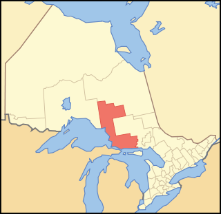
Algoma District is a district and census division in Northeastern Ontario in the Canadian province of Ontario.

The French River is a river in Central Ontario, Canada. It flows 110 kilometres (68 mi) from Lake Nipissing southwest to Georgian Bay. The river largely follows the boundary between the Parry Sound District and the Sudbury District, and in most contexts is considered the dividing line between Northern and Southern Ontario. The French River was designated a Canadian Heritage River in 1986.
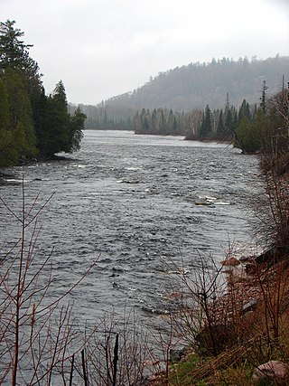
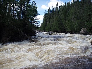
The Mississagi River is a river in Algoma and Sudbury Districts, Ontario, Canada, that originates in Sudbury District and flows 266 kilometres (165 mi) to Lake Huron at Blind River, Algoma District.

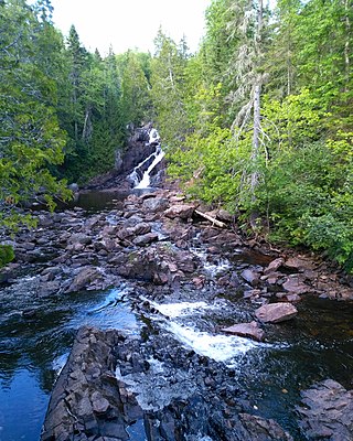
Chutes Provincial Park is a recreation class provincial park in Sables-Spanish Rivers, Ontario, Canada, near the community of Massey. The park is named after a logging chute that diverted logs around the waterfall on the River aux Sables. The waterfall is considered the main attraction at the park, along with the Seven Sisters Rapids found upstream from the waterfall.

Awenda Provincial Park is a provincial park in Tiny Township, Simcoe County in Central Ontario, Canada, located on a peninsula jutting into Georgian Bay north of Penetanguishene. The park occupies an area of 2,915 hectares and was established in 1975. It is classified as a Natural Environment Park and therefore all land is protected.
The Massasauga Provincial Park is a provincial park in Parry Sound District, Ontario, Canada, stretching from the town of Parry Sound south to the Moon River. The park has an area of 131.05 km2 (50.60 sq mi).
The Obabika River Provincial Park is a provincial park in Ontario, Canada, straddling across the boundaries of the Sudbury, Nipissing, and Timiskaming Districts. While it is named after and includes the Obabika River, the bulk of the park extends north of Obabika Lake to the eastern boundary of Lady Evelyn-Smoothwater Provincial Park.

Lady Evelyn-Smoothwater Provincial Park is a remote wilderness park in northeastern Ontario, Canada, north of Lake Temagami. This operating park, requiring permits for all visitors, encompasses "rugged topography, clear lakes, stunning waterfalls, and rushing rivers".
White Lake Provincial Park is a park in the Thunder Bay District of Northern Ontario, Canada, along Highway 17, north of Lake Superior.

Neys Provincial Park is a natural environment-class provincial park on the north shore of Lake Superior, just west of Marathon, Ontario, Canada. This 5,383-hectare (13,300-acre) park includes the historic Coldwell Peninsula and the surrounding island system, consisting of Pic Island, Detention Island, and the Sullivan Islands.
Rainbow Falls Provincial Park is a recreation-class provincial park within the Ontario Parks system. This 575-hectare (1,421-acre) park consists of two non-contiguous parts: Whitesand Lake campground in the main park, and the historic Rossport Campground, east of the fishing community of Rossport, Ontario, which provides campsites along the rough and rocky shorelines of Lake Superior.
Balsam Lake Provincial Park is a provincial park located in south-central Ontario, Canada, on Balsam Lake. The park is situated along the Trent-Severn Waterway, a few kilometres southwest of Coboconk. It is an all-seasons recreation area offering camping, boating and fishing, and while closed in winter it is also used for skiing and snowshoeing.
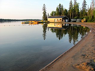
Caliper Lake Provincial Park is a small provincial park in northwestern Ontario, near the township of Nestor Falls. The park occupies 147 hectares alongside Caliper Lake. The facility is open for day use and overnight camping from mid-May to mid-September. The park features 83 campsites, many with electrical hookups, and some which may be rented for the entire season. The park offers many amenities, including a sandy beach, hiking trails, playground equipment, fish cleaning facilities, boat launches, bathrooms, and showers. Canoes, kayaks, and bicycles are available for rental.
The Little White River is a river in the Unorganized North Part of Algoma District in Northeastern Ontario, Canada. It is in the Great Lakes Basin and is a left tributary of the Mississagi River.
The Makobe River is a river in northeastern Ontario, Canada. It is in the Saint Lawrence River drainage basin, and is a left tributary of the Montreal River.
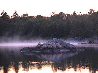
Solace Provincial Park is a remote provincial park in Sudbury District, Ontario, Canada. It was established in 1985 and protects a series of lakes that provide backcountry canoeing opportunities. It is characterized by boreal forest, mostly jack pine conifer forest with mixed forest including white birch. The roadless park, with topography and scenery similar to the adjacent Lady Evelyn-Smoothwater Provincial Park, is considered as "one of the most isolated, wild places in Ontario."
The Algoma Headwaters Provincial Park is a large provincial park in Algoma and Sudbury Districts, Ontario, Canada. It is undeveloped remote wilderness located about 90 kilometres (56 mi) northeast of Sault Ste. Marie, with little road access.
Nagagamisis Provincial Park is a provincial park in Algoma District, Ontario, Canada. It is located 32 kilometres (20 mi) north of Hornepayne, along Highway 631. It protects a large piece of land surrounding Nagagamisis Lake, as well as long linear sections along the Foch and Nagagami Rivers.
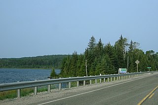
Matinenda Provincial Park is a provincial park in Algoma District, Ontario, Canada. It is located 15 kilometres (9.3 mi) north of the Town of Blind River. It is a large, elongated, irregularly shaped park, centered around Matinenda Lake.

The Oxtongue River is a river in Nipissing and Muskoka Districts, Ontario, Canada. It is a tributary of the Muskoka River via Lake of Bays, flowing in a mostly south-westerly direction through undisturbed mixed forest that is home to many native mammal species.