
Dundas is a community and town in Hamilton, Ontario, Canada. It is nicknamed the Valley Town because of its topographical location at the bottom of the Niagara Escarpment on the western edge of Lake Ontario. The population has been stable for decades at about twenty thousand, largely because it has not annexed rural land from the protected Dundas Valley Conservation Area.
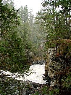
The Amable du Fond River is a river in Nipissing District, in Northern Ontario, Canada.
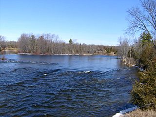
The Crowe River is a river in the counties of Haliburton, Hastings, Northumberland and Peterborough in southern Ontario, Canada. It is in the Lake Ontario drainage basin and is a tributary of the Trent River.
The Pukaskwa River is a river in Thunder Bay District and Algoma District in Northern Ontario, Canada. It is in the Great Lakes Basin and is a tributary of Lake Superior, which it enters at the south end of Pukaskwa National Park. It is a remote, pristine, free-flowing, medium-sized Shield river, with lots of whitewater, best travelled in spring.

Grand Portage State Park is a state park at the northeastern tip of the U.S. state of Minnesota, on the Canada–United States border. It contains a 120-foot (37 m) waterfall, the tallest in the state, on the Pigeon River. The High Falls and other waterfalls and rapids upstream necessitated a historically important portage on a fur trade route between the Great Lakes and inland Canada. This 8.5-mile (13.7 km) path as well as the sites of historic forts at either end are preserved in nearby Grand Portage National Monument.

Hilton Falls Conservation Area located in Campbellville, Ontario on the Niagara Escarpment is a conservation area known for its ten-metre waterfall, hiking trails and small glacial pothole. It constitutes 645 hectares and offers mountain biking as well as cross-country skiing. It is owned and operated by Conservation Halton. The Bruce Trail runs through the area.

Limerick Lake is a lake in the Trent River and Lake Ontario drainage basins in the township of Limerick, Hastings County, Ontario, Canada, about 3 kilometres (1.9 mi) northwest of the community of St. Ola, 2.5 kilometres (1.6 mi) northeast of Highway 62, and 25 kilometres (16 mi) southeast of the town of Bancroft. In 1934, the building of St. Ola Dam raised the level of Big Salmon Lake by two metres. The lake was then renamed, as part of a process in Ontario to give each large lake a unique name. The original concrete dam was assessed in 2002 and significant cracking was found. The dam was replaced in 2004 with a new concrete dam. The waterway falls under the jurisdiction of the Crowe Valley Conservation Authority which has responsibility for furthering the conservation, development, and management of natural resources, but whose main activity is flood control.

The Hamilton Conservation Authority maintains the greenspace, trails, parks and some attractions in the Hamilton, Ontario, Canada.

The Elora Gorge is a popular tourist attraction located at the western edge of Elora, Ontario, Canada, which is 25 km north from the city of Guelph.
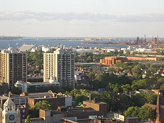
Hamilton is located on the western end of the Niagara Peninsula and wraps around the westernmost part of the Lake Ontario. Most of the city including the downtown section lies along the south shore. Situated in the geographic centre of the Golden Horseshoe, it lies roughly midway between Toronto and Buffalo. The two major physical features are Hamilton Harbour marking the northern limit of the city and the Niagara Escarpment running through the middle of the city across its entire breadth, bisecting the city into 'upper' and 'lower' parts.

The Eramosa Karst is a provincially significant Earth Science Area of Natural and Scientific Interest in Ontario, Canada, located in Stoney Creek, a constituent community of the City of Hamilton, and immediately south of the Niagara Escarpment.
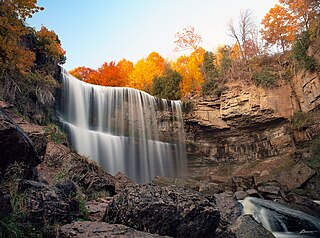
Webster's Falls, noted for its panoramas, is a 22-metre-high (72 ft) classical curtain/ plunge waterfall found in the Spencer Gorge/Webster's Falls Conservation Area in Hamilton, Ontario, Canada. The water flows down Spencer Creek. In the past the falls have been known by various names such as Dr. Hamilton's Falls, Spencer Falls, Hart Falls, Fisher Falls and Flamborough Falls.
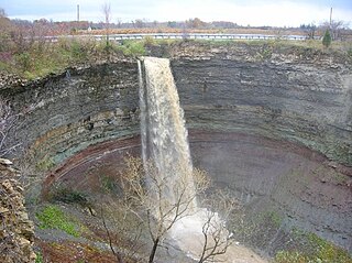
Devil's Punch Bowl is a 37-metre ribbon waterfall on the Niagara Escarpment, in the Stoney Creek community of Hamilton, Ontario, Canada. It is found in the Devil's Punchbowl Conservation Area, maintained by the Hamilton Conservation Authority, and features an escarpment access trail with connections to a recently improved section of the Bruce Trail. Stoney Creek's Dofasco 2000 Trail is nearby. The Punch Bowl is also known as Horseshoe Falls for the distinctive shape of the cliff-face, which somewhat resembles its much larger cousin in Niagara Falls.
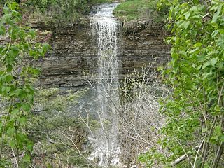
Borer's Falls is a 15-metre-high (49 ft) ribbon-style waterfall found in the Borer's Falls Conservation Area in Dundas, Hamilton, Ontario, Canada. Its source is Borer's Creek. A very picturesque waterfall featured on many Hamilton waterfall postcards over the years. Named after the Borer family who ran a sawmill for over a century. This mill was the lifeblood of the village of Rock Chapel. Also known as Rock Chapel Falls. The area is a hiker's haven and also an ice-climbing destination in the winter when the weather is cold enough to freeze the Falls.

Darnley Cascade is a 4-metre-high (13 ft) cascade waterfall located at Crooks Hollow Conservation Area in Greensville, Hamilton, Ontario, Canada. Nearby attractions include Bruce Trail, Dundas Valley Conservation Area, Spencer Gorge/Webster's Falls Conservation Area, Hermitage ruins, Royal Botanical Gardens, Dundurn Castle, Christie Lake Conservation Area, Dundas Historical Society Museum and Carnegie Gallery.

Dundas Valley Conservation Area is located on the Niagara Escarpment in Dundas, Ontario, a constituent community of Hamilton, Ontario, and is owned and operated by the Hamilton Conservation Authority. Its 40-kilometre trail system provides a connection to the Bruce Trail. The area contains a trailhead of the Hamilton-Brantford-Cambridge Trails, Canada's first fully developed interurban multi-use trail system, which is a part of the Trans Canada Trail.
Lower Westcliffe Falls is a 7.9-metre-high (26 ft) complex classic cascade waterfall found near the Chedoke Civic Golf Course in Hamilton, Ontario, Canada.

King Street starts off as a collector road in the east-end of town in Dundas, Hamilton, Ontario, Canada beside Cootes Paradise and the Desjardins Canal at Olympic Drive and switches to an arterial road at York Street and cuts through the town of Dundas where it ends in the west-end by the CN railway tracks at the base of the Niagara Escarpment. It is a two-way street throughout.

Spencer Creek is a creek in Flamborough, Ontario. Banks of the Creek is made up of residential homes, farms and business.


