
The Mattawa River is a river in central Ontario, Canada. It flows east from Trout Lake east of North Bay and enters the Ottawa River at the town of Mattawa. Counting from the head of Trout Lake, it is 76 km in length. The river's name comes from the Algonquin word for "meeting of waterways".

The Missinaibi River is a river in northern Ontario, Canada, which flows northeast from Missinaibi Lake, north of Chapleau, and empties into the Moose River, which drains into James Bay. This river is 755 kilometres (469 mi) in length. It is one of the longest free-flowing and undeveloped rivers in Ontario.

The Ogoki River is a river in the Thunder Bay and Cochrane Districts of Ontario. It springs from the wilderness just east of Savant Lake, flowing north of Lake Nipigon to Ogoki, where it joins the Albany River which empties into James Bay. The river is 480 kilometres (300 mi) long.

The Boundary Waters, also called the Quetico-Superior Country, is a region of wilderness straddling the Canada–United States border between Ontario and Minnesota, in the area just west of Lake Superior. While "Boundary Waters" is a common name for this region, the two nations also share extensive boundary waters along their border, beyond this region. This region is part of the Superior National Forest in northeastern Minnesota, and in Canada it includes La Verendrye and Quetico Provincial Parks in Ontario. Voyageurs National Park in Minnesota may also be considered part of the Boundary Waters. The name "Boundary Waters" is often used in the U.S. to refer specifically to the U.S. Wilderness Area protecting its southern extent, the Boundary Waters Canoe Area Wilderness.

Canoe camping, also known as touring, tripping or expedition canoeing, is a combination of canoeing and camping. Like backpacking, canoe campers carry enough with them to travel and camp for several days, but do so via a canoe or kayak.
The Black Sturgeon River is a river in Thunder Bay District, Northwestern Ontario, Canada, located west of the Nipigon River, that flows to Lake Superior.
The Brightsand River is a river in the James Bay drainage basin in Unorganized Thunder Bay District in northwestern Ontario, Canada.
Atikaki Provincial Park is a wilderness park in Manitoba, Canada located east of Lake Winnipeg along the Ontario boundary in the Canadian Shield. The area of Atikaki Provincial Park is 3,981 km2. Atikaki Provincial Park is north of Nopiming Provincial Park and borders the Woodland Caribou Provincial Park in Ontario.
Tweedsmuir North Provincial Park and Protected Area is a provincial park in British Columbia, Canada, which along with Tweedsmuir South Provincial Park and Entiako Provincial Park were once part of Tweedsmuir Provincial Park, then B. C.'s largest park, 9,810 square kilometres (3,790 sq mi) located in the Coast Range.
The Obabika River Provincial Park is a provincial park in Ontario, Canada, straddling across the boundaries of the Sudbury, Nipissing, and Timiskaming Districts. While it is named after and includes the Obabika River, the bulk of the park extends north of Obabika Lake to the eastern boundary of Lady Evelyn-Smoothwater Provincial Park.

Lady Evelyn-Smoothwater Provincial Park is a remote wilderness park in northeastern Ontario, Canada, north of Lake Temagami. It is one of five provincial parks located in the Temagami area.
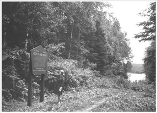
Height of Land Portage is a portage along the historic Boundary Waters route between Canada and the United States. Located at the border of the Canadian province of Ontario and the U.S. state of Minnesota, the path is a relatively easy crossing of the Laurentian Divide separating the Hudson Bay and Great Lakes-St. Lawrence watersheds.

Woodland Caribou Provincial Park is a provincial park in Northwestern Ontario, Canada, west of the municipality of Red Lake. It borders Atikaki Provincial Park and Nopiming Provincial Park in eastern Manitoba, and is made up of Canadian Shield and boreal forest. Woodland Caribou Provincial Park is a wilderness park of 450,000 hectares, and it became part of the Pimachiowin Aki UNESCO World Heritage Site in 2018.
Smoothrock Lake is a lake in the Unorganized Part of Thunder Bay District in Northern Ontario, Canada. It is in the James Bay drainage basin and lies in Wabakimi Provincial Park. The lake has three major inflows: the Caribou River at Caribou Bay at the east; and the Boiling Sand River and the Lookout River, at the south. A secondary inflow is Berry Creek at the southwest. The main outflow is the Berg River from Outlet Bay at the north centre, and leads north to the Ogoki River. A secondary outflow, unnamed and at the northeast, heads from Lonebreast Bay north through a series of lakes to Whitewater Lake, further downstream on the Ogoki River. The Ogoki River flows via the Albany River to James Bay.

The Central Canadian Shield forests are a taiga ecoregion of Eastern Canada, as defined by the World Wildlife Fund (WWF) categorization system.

The Grass River is a historically important waterway in the Hudson Bay drainage basin in the Northern Region of Manitoba, Canada. It begins at the Cranberry Lakes approximately 27 kilometres (17 mi) east of Cranberry Portage and runs northeast 500 kilometres (310 mi) to its mouth on the Nelson River. The river was a critical route for earlier European explorers and was part of the "Upper Tract" of the fur trade into Canadian interior.

Gary and Joanie McGuffin are Canadian explorers, conservation photographers, writers, motivational speakers, documentarians and conservationists. Their most documented adventures have been about canoeing on waterways throughout North America, bicycling from the Arctic to the Pacific to the Atlantic oceans, backpacking the entire length of the Appalachian Trail, circumnavigating Lake Superior by canoe and paddling across Northern Ontario in the footsteps of Grey Owl. The McGuffins are noted primarily for their popular paddle sports instructional books on canoeing and kayaking, and their documentary film based on their research about the Group of Seven artists. Between adventures, the McGuffins are ambassadors of the wilderness, touring the world through speaking events, photo exhibitions, book tours, eco-tourism development, and educational seminars on conservation. In 2000, the Ontario government officially appointed Gary and Joanie as Champions of the Coast under the Great Lakes Heritage Coast program. In 2003, they were the recipients of the Premier's Award and the Queen's Golden Jubilee Medal for wilderness preservation and environmental education achievements for their province and their country.
West English River Provincial Park is a provincial park in Kenora District, Ontario, Canada. It spans 65 kilometres (40 mi) along the English River from Barnston Lake to Tide Lake and also includes all the shores and waters of Wegg, Goose, Wilcox, Unexpected, Oak, and Maynard Lakes. The park's notable features include old growth red and white pine stands at the northern extent of their range, and migmatites that are provincially-significant examples of metatexitic and diatexitic metasedimentary rocks. It borders on Tide Lake and Maynard Lake Provincial Nature Reserves.
The East English River Provincial Park is a linear waterway park in Kenora District, Ontario, Canada. It includes a 200 metres (660 ft) wide strip of land on both sides of the English River and its lakes, from the intersection of Highway 599 to Minnitaki Lake. It was established in 2003 to protect natural features, that are representative of the area, and high quality recreational canoe routes with over 30 sets of rapids. The park's notable features include white pine forest at the northern extent of its range, white elm and burr oak, caribou habitat and calving locations, fisheries, and archaeological sites.
Solace Provincial Park is a remote provincial park in Sudbury District, Ontario, Canada. It was established in 1985 and protects a series of lakes that provide backcountry canoeing opportunities. It is characterized by boreal forest, mostly jack pine conifer forest with mixed forest including white birch. The roadless park, with topography and scenery similar to the adjacent Lady Evelyn-Smoothwater Provincial Park, is considered as "one of the most isolated, wild places in Ontario."


