Related Research Articles
The Jemez Mountains ([ˡhɛmɛz]) are a volcanic group of mountains in Rio Arriba, Sandoval, and Los Alamos counties, New Mexico, United States.

The Mojave Road, also known as Old Government Road, is a historic route and present day dirt road across what is now the Mojave National Preserve in the Mojave Desert in the United States. This rough road stretched 147 miles (237 km) from Beale's Crossing, to Fork of the Road location along the north bank of the Mojave River where the old Mojave Road split off from the route of the Old Spanish Trail/Mormon Road.

The Augustine Band of Cahuilla Indians is a federally recognized Cahuilla band of Native Americans based in Coachella, California. They are one of the smallest tribal nations in the United States, consisting of only eight members, only one of whom is an adult. As of the 2010 census, the tribe had expanded its members to eleven.

Valfarta is a municipality located in the province of Huesca, Aragon, Spain. According to the 2004 census (INE), the municipality has a population of 91 inhabitants.

Villalar de los Comuneros is a municipality located in the province of Valladolid, Castile and León, Spain. According to the 2004 census (INE), the municipality had a population of 449 inhabitants.
Cortês is a city in the state of Pernambuco, Brazil. It is 149 km away from the state capital Recife, and has an estimated population of 11.712 inhabitants.
The Pauma Band of Luiseño Mission Indians of the Pauma and Yuima Reservation is a federally recognized tribe of Luiseño Indians in San Diego County, California. A total of five other federally recognized tribes of Luiseño are located in southern California.
The Twenty-Nine Palms Band of Mission Indians of California is a federally recognized tribe of Mission Indians with two reservations, one located near the cities of Indio and Coachella in Riverside County, and the other in the city of Twentynine Palms in San Bernardino County, California. While many scholars regard the tribe as being Luiseño, the tribe itself identifies as being Chemehuevi.

The Ramona Band of Cahuilla is a federally recognized tribe of Cahuilla Indians, located in Riverside County, California.
The Santa Rosa Band of Cahuilla Indians is a federally recognized tribe of Cahuilla Indians, located in Riverside County, California.
The Torres-Martinez Desert Cahuilla Indians is a federally recognized tribe of Cahuilla Indians, located in Imperial and Riverside counties in California. Their autonym is Mau-Wal-Mah Su-Kutt Menyil, which is said to mean "among the palms, deer moon."
Los Coyotes Band of Cahuilla and Cupeño Indians of the Los Coyotes Reservation is a federally recognized tribe of Cahuilla and Cupeño Indians, who were Mission Indians located in California.

The Morongo Band of Mission Indians is a federally recognized tribe in California, United States. The main tribal groups are Cahuilla and Serrano. Tribal members also include Cupeño, Luiseño, and Chemehuevi Indians. Although many tribes in California are known as Mission Indians, some, such as those at Morongo, were never a part of the Spanish Missions in California.

The San Pasqual Band of Diegueño Mission Indians of California is a federally recognized tribe of Kumeyaay Indians, who are sometimes known as Mission Indians.
The Mesa Grande Band of Diegueño Mission Indians of the Mesa Grande Reservation is a federally recognized tribe of Kumeyaay Indians, who are sometimes known as Mission Indians.
The Rincon Band of Luiseño Indians are a federally recognized tribe of Luiseño who live on the Rincon Indian Reservation in the Valley Center CDP, San Diego County, California. It is one of six such tribes in Southern California that are composed of Luiseño people. The Luiseño are considered one of the groups of the California Mission Indians.
Scissors Crossing is a place name in San Diego County, California, in the United States. It is a wrong-way concurrency junction where State Route 78 intersects with County Route S2, and is a notable point on the Pacific Crest Trail. The unincorporated community of Shelter Valley lies 2 mi (3.2 km) to the south of Scissors Crossing along County Road S2.
Carrizo Creek, is a stream that arises in the mountains of San Diego County, California, and terminates in Carrizo Wash in Imperial County, a tributary in turn to San Felipe Creek that terminates in the Salton Sea.
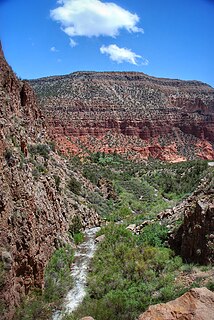
San Felipe Creek is a stream in Imperial and San Diego Counties of California. It arises in the Volcan Mountains of San Diego County 33°11′57″N116°37′35″W, and runs eastward, gathering the waters of most of the eastern slope of the mountains and desert of the county before it empties into the Salton Sea. It is probably the last remaining perennial natural desert stream in the Colorado Desert region. In 1974, the San Felipe Creek Area was designated as a National Natural Landmark by the National Park Service.
San Pasqual, the Kumeyaay pueblo, in San Diego County, California, that was once located in the San Pasqual Valley and for which the valley is named.
References

Coordinates: 33°33′N116°08′W / 33.550°N 116.133°W
| This Riverside County, California-related article is a stub. You can help Wikipedia by expanding it. |