
Caleb, sometimes transliterated as Kaleb, is a figure who appears in the Hebrew Bible as a representative of the Tribe of Judah during the Israelites' journey to the Promised Land. A reference to him is also found in the Quran, although his name is not mentioned.
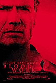
Blood Work is a 2002 American mystery thriller film produced, directed by, and starring Clint Eastwood. The film co-stars Jeff Daniels, Wanda De Jesús, and Anjelica Huston. It is based on the novel of the same name by Michael Connelly.
Elk is an unincorporated community in Mendocino County, California. It is located 22 miles (35 km) south of Fort Bragg, at an elevation of 135 feet.

Caleb Lyon was Governor of Idaho Territory from 1864 to 1865 during the last half of the American Civil War.

Merrimac is an unincorporated community in Butte County, California located along Oroville-Quincy Road about 2.1 miles (3.4 km) south of the Plumas County line. It lies at an elevation of 3999 feet. While the location is shown as official in the National Geographic Names Database, it is not known if locals use this name to describe the place today. Nearby is Rogers Cow Camp, a campground in Lassen National Forest. The USGS feature ID for this populated place is 1659117. The US Postal Service does not show a ZIP Code for this community. The location is within area code 530.

Cromir is an unincorporated community in Fresno County, California. It is located on the Southern Pacific Railroad 4 miles south-southeast of Firebaugh, at an elevation of 164 feet.
Cambio is a former settlement in Kern County, California. It was located on the Southern Pacific Railroad 4 miles (6.4 km) northeast of Mojave, at an elevation of 2835 feet. Cambio still appeared on maps as of 1947.
Desert Lake is an unincorporated community in Kern County, California.
Fig Orchard is an unincorporated community in Kern County, California. It is located on Caliente Creek 3 miles (4.8 km) east-northeast of Caliente, at an elevation of 1,555 feet (474 m).
Levee is a former settlement in Kern County, California. It was located on the Sunset Railroad 1.5 miles (2.4 km) north of Levee Spur, at an elevation of 289 feet. Levee still appeared on maps as of 1933.
Magunden is an unincorporated community in Kern County, California. It is located 4 miles (6.4 km) east of downtown Bakersfield, at an elevation of 440 feet.
Oil Junction is an unincorporated community in Kern County, California. It is located on the Southern Pacific Railroad 4.5 miles (7.2 km) northwest of downtown Bakersfield, at an elevation of 443 feet (135 m).
Pentland is an unincorporated community in Kern County, California. It is located on the Sunset Railroad 2.5 miles (4 km) east of Maricopa, at an elevation of 646 feet (197 m).
Slater is an unincorporated community in Kern County, California. It is located on the Southern Pacific Railroad 3 miles (4.8 km) south of Famoso, at an elevation of 453 feet (138 m).
Sullivan is a former settlement in Kern County, California. It was located on the Southern Pacific Railroad 2.5 miles (4 km) east of Tehachapi, at an elevation of 4029 feet.
Twin Lakes is an unincorporated community in Kern County, California. It is located 4 miles (6.4 km) east-northeast of Liebre Twins, at an elevation of 5,171 feet (1,576 m).
Remington Hill is a historic mining camp in Nevada County, California which prospered in the second half of the 19th century. It was named for Caleb Remington, a prominent local miner who lived mostly in neighboring Little York, where he died in 1865. It lay at an elevation of 4052 feet. It was situated around present Chalk Bluff Road about one mile south of Highway 20 and about 5.5 miles southeast of the town of Washington and 6 miles northeast of Dutch Flat, as the crow flies.

Caleb Fairly is an American former professional road racing cyclist who last rode for Team Giant–Alpecin in the UCI World Tour. Fairly turned professional in 2011.
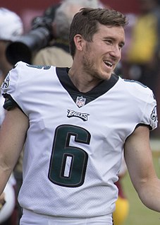
Caleb James Sturgis is an American football placekicker who is currently a free agent. He played college football at Florida, setting team records for field goals completed in a season and a career, and was recognized as an All-American. He was chosen by the Miami Dolphins in the fifth round of the 2013 NFL Draft.


