River Bend Lodge, California

Last updated
River Bend Lodge
USA California location map.svg
Red pog.svg
River Bend Lodge
Location within the state of California
Coordinates: 33°52′10″N114°31′36″W / 33.86944°N 114.52667°W / 33.86944; -114.52667 Coordinates: 33°52′10″N114°31′36″W / 33.86944°N 114.52667°W / 33.86944; -114.52667
Country United States
State California
County Riverside
Time zone UTC-8 (Pacific (PST))
  Summer (DST) UTC-7 (PDT)
ZIP codes
92225
Area code(s) 760

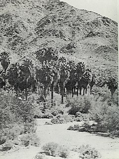
River Bend Lodge is an unincorporated community in Riverside County, California, also known as Aha Quin. The community is near Hall Island along the Colorado River and hosts Riverside County Fire Department, Station 46. [1] River Bend Lodge is also inside the Mojave Desert Air Quality Management District.

Unincorporated area Region of land not governed by own local government

In law, an unincorporated area is a region of land that is not governed by a local municipal corporation; similarly an unincorporated community is a settlement that is not governed by its own local municipal corporation, but rather is administered as part of larger administrative divisions, such as a township, parish, borough, county, city, canton, state, province or country. Occasionally, municipalities dissolve or disincorporate, which may happen if they become fiscally insolvent, and services become the responsibility of a higher administration. Widespread unincorporated communities and areas are a distinguishing feature of the United States and Canada. In most other countries of the world, there are either no unincorporated areas at all, or these are very rare; typically remote, outlying, sparsely populated or uninhabited areas.

Riverside County, California County in California, United States

Riverside County is one of 58 counties in the U.S. state of California. As of the 2010 census, the population was 2,189,641, making it the fourth-most populous county in California and the 11th-most populous in the United States. The name was derived from the city of Riverside, which is the county seat.

Colorado River major river in the western United States and Mexico

The Colorado River is one of the principal rivers in the Southwestern United States and northern Mexico. The 1,450-mile-long (2,330 km) river drains an expansive, arid watershed that encompasses parts of seven U.S. and two Mexican states. Starting in the central Rocky Mountains of Colorado, the river flows generally southwest across the Colorado Plateau and through the Grand Canyon before reaching Lake Mead on the Arizona–Nevada border, where it turns south toward the international border. After entering Mexico, the Colorado approaches the mostly dry Colorado River Delta at the tip of the Gulf of California between Baja California and Sonora.

Contents

This community is part of the Colorado River Indian Reservation. [2] The reservation was established on March 3, 1865. [3] Residents are primarily of Hualapai, Yavapai, Navajo, and Hopi affiliation. [4] In some regulatory filings, tribal government used the name, Colorado River Indian Tribes Utilities Services. [5]

The locale named Haakers Camp [6] is about 0.5 miles, straight-line distance, south. The locale named Thompsons Camp [7] is about 1.1 miles, straight-line distance, south. Both are located on the west shore of the Colorado River. Both are plotted at the edge of the reservation boundary. [8]

The ZIP Code is 92225, and the community is apart inside area code 760.

Geography

At about 300 feet above mean sea level, River Bend Lodge is at latitude/longitude 33°51′43″N114°31′39″W / 33.86194°N 114.52750°W / 33.86194; -114.52750 .

Transportation

U.S. Route 95 runs north-south through the area. [9]

U.S. Route 95 highway in the United States

U.S. Route 95 (US 95) is a north–south U.S. highway in the western United States. Unlike many other US highways, it has not seen deletion or replacement on most of its length by an encroaching Interstate highway corridor, due to its mostly rural course. Because of this, it still travels from border to border and is a primary north–south highway in both Nevada and Idaho. This is one of the only US Routes or Interstate highways to cross from Mexico to Canada.

Aha-Quin airport (FAA identifier: 1CA4) is described as a private airstrip located in the vicinity. [10] [11]

Communications

Area residences have U.S. Postal Service contract route box addresses along Highway Contract Route HC 20 with a city name of Blythe and a ZIP Code of 92225. Wired telephone numbers work out of the Blythe exchange. This area is included inside Area code 760.

Related Research Articles

Parker, Arizona Town in Arizona, United States

Parker is the county seat of La Paz County, Arizona, United States, on the Colorado River in Parker Valley. The population was 3,083 at the 2010 census.

Weitchpec, California Unincorporated community in California, United States

Weitchpec ( WETCH-pek is an unincorporated community within the Yurok reservation in Humboldt County, California, United States. It is located 35 miles northeast of Eureka, at an elevation of 361 feet. The ZIP Code is 95546.

Campo, California census-designated place in California, United States

Campo is a census-designated place (CDP) located in the Mountain Empire area of southeastern San Diego County, California. The population was 2,684 at the 2010 census.

Chiriaco Summit, California Unincorporated community in California, United States

Chiriaco Summit is a small unincorporated community and travel stop located along Interstate 10 in the Colorado Desert of Southern California. It lies 19 miles (31 km) west of Desert Center on the divide between the Chuckwalla Valley and the Salton Sea basin at an elevation of 1,706 feet (520 m).

Corn Springs United States historic place

Corn Springs is a palm oasis situated in the Chuckwalla Mountains of the Colorado Desert in Riverside County, California, United States, seventeen miles southeast of Desert Center. Native Americans relied on the springs, and they engraved many petroglyphs on the rocks in the area. In the late 19th century, miners in the area also relied on the springs, and they established the Corn Springs Mining District in 1897.

Bell Station, California human settlement in California, United States of America

Bell Station is an unincorporated community located along State Route 152 between Casa de Fruta and Pacheco Pass near the southeast extent of Santa Clara County, California.

Ripley, California census-designated place in California, United States

Ripley is a census-designated place community in east Riverside County. It is located along State Route 78 (SR78) between Palo Verde and Blythe. The area is mostly agricultural lands irrigated by Colorado River water. The elevation is 249 feet (76 m). The population was 692 at the 2010 census.

Lost Lake Resort, California Unincorporated community in California, United States

Lost Lake is a desert community located along the west shore of the Colorado River. It also lies along U.S. Route 95 near the northeastern extent of Riverside County. Official U.S. Geological Survey feature ID is 245216 and NAD27 coordinates for the community are 34°00′44″N114°28′27″W. The community lies at the foot of Riverside Mountain, 34°00′49″N114°30′45″W, with a summit measuring 2,127 feet. The community is named for a lake, Lost Lake, located at 34°01′20″N114°28′21″W.

Centerville, Butte County, California Unincorporated community in California, United States

Centerville is an unincorporated community in Butte County, California along Butte Creek. It was midway between Helltown and Diamondville. The area is about one and three quarters miles, straight-line distance, west of Paradise.

Feather Falls, California Unincorporated community in California, United States

Feather Falls is a rural unincorporated community in Butte County, California north and east of Lake Oroville. It lies at an elevation of 2982 feet. It is home to Feather Falls Elementary School, a K-8 facility. It takes its name from nearby Feather Falls, which was recently measured to be 410 feet tall. This concurs with the USGS Brush Creek 7½" quadrangle information.

Pulga, California Unincorporated community in California, United States

Pulga is an unincorporated community in Butte County, California. It is located along the west slope of the Feather River canyon, at an elevation of 1398 feet. A variant name for the community is Big Bar. Other nearby communities include Mayaro, Poe and Parkhill. The town hosts a Caltrans highway maintenance station along State Route 70 (SR70). The place is at the mouth of the Flea Valley Creek, which gives rise to the toponym.

Merrimac, California Unincorporated community in California, United States

Merrimac is an unincorporated community in Butte County, California located along Oroville-Quincy Road about 2.1 miles (3.4 km) south of the Plumas County line. It lies at an elevation of 3999 feet. While the location is shown as official in the National Geographic Names Database, it is not known if locals use this name to describe the place today. Nearby is Rogers Cow Camp, a campground in Lassen National Forest. The USGS feature ID for this populated place is 1659117. The US Postal Service does not show a ZIP Code for this community. The location is within area code 530.

Havilah, California Unincorporated community in California, United States

Havilah is an unincorporated community in Kern County, California. It is located in the mountains between Walker Basin and the Kern River Valley, 5 miles (8.0 km) south-southwest of Bodfish at an elevation of 3,136 feet (956 m).

Andrade, California Locale in California, United States

Andrade is a small locale in the southeasternmost corner of the state of California, in Imperial County. The community is located entirely within the Fort Yuma Indian Reservation. It is directly across the border from Los Algodones, the northernmost town of the municipality of Mexicali, in Baja California, and in all of Mexico. The ZIP Code is 92283. The community is inside area code 760.

South Lake, Kern County, California Unincorporated community in California, United States

South Lake is an unincorporated community in the Kern River Valley, in Kern County, California. It is located 4.5 miles (7.2 km) west-southwest of Weldon, at an elevation of 2,887 feet (880 m).

Rodgers Crossing, California Unincorporated community in California, United States

Rodgers Crossing is an unincorporated community in Fresno County, California. It is located on the Kings River 3 miles (4.8 km) south of Balch Camp, at an elevation of 1020 feet.

Palo Verde Valley valley in California, United States of America

The Palo Verde Valley is located in the Lower Colorado River Valley, next to the eastern border of Southern California with Arizona, United States. It is located on the Colorado Desert within the Sonoran Desert south of the Parker Valley. Most of the valley is in Riverside County, with the southern remainder in Imperial County. La Paz County borders to the east on the Colorado River.

Rifle Creek is a stream in Garfield County in the U.S. state of Colorado. Rifle Creek is a tributary to the Colorado River.

Pine Station, Indiana Unincorporated community in Indiana, United States

Pine Station is an unincorporated community in Union Township, St. Joseph County, in the U.S. state of Indiana.

References

  1. US Geological Survey, Big Maria Mountains SE, California, 7.5 minute quadrangle, 1975. Fire station number is from RCFD web site listed in External links below. The community name is not in the 1995 National Geographic Names Database.
  2. U.S. Geological Survey Geographic Names Information System: Colorado River Indian Reservation
  3. US Geological Survey, National Geographic Names Database, 1995.
  4. Seen on a display at the Heard Museum, 2301 N Central Av., Phoenix, Arizona.
  5. Seen on several regulatory filings submitted to the California Public Utilities Commission.
  6. U.S. Geological Survey Geographic Names Information System: Haakers Camp
  7. U.S. Geological Survey Geographic Names Information System: Thompsons Camp
  8. US Geological Survey, Big Maria Mountains SE, California, 7.5 minute quadrangle, 1975 and US Geological Survey, National Geographic Names Database, 1995. "Locale" means the USGS sees them as unpopulated as of 1995.
  9. US Geological Survey, Big Maria Mountains SE, California, 7.5 minute quadrangle, 1975.
  10. Airport Facility Directory, Southwest, US Department of Transportation, Federal Aviation Administration, unknown year.
  11. U.S. Geological Survey Geographic Names Information System: Aha-quin Airport (historical)