
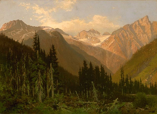
The Beaver Kill, sometimes written as the Beaverkill or Beaverkill River, is a tributary of the East Branch Delaware River, a main tributary of the Delaware River, approximately 44 miles (71 km) long, in the U.S. state of New York. The kill drains a 300-square-mile (780 km2) area of the Catskill Mountains and has long been celebrated as one of the most famous trout streams in the United States. Its preservation helped establish many of the basic conservation principles of rivers in the United States.

The Tualatin Valley is a farming and suburban region southwest of Portland, Oregon. The valley is formed by the meandering Tualatin River, a tributary of the Willamette River at the northwest corner of the Willamette Valley, east of the Northern Oregon Coast Range. Most of the valley is located within Washington County, separated from Portland by the Tualatin Mountains. Communities in the Tualatin Valley include Banks, Forest Grove, Cornelius, Hillsboro, Aloha, Beaverton, Sherwood, Tigard, and Tualatin.
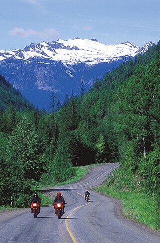
The Selkirk Mountains are a mountain range spanning the northern portion of the Idaho Panhandle, eastern Washington, and southeastern British Columbia which are part of a larger grouping of mountains, the Columbia Mountains. They begin at Mica Peak and Krell Hill near Spokane and extend approximately 320 km north from the border to Kinbasket Lake, at the now-deserted location of the onetime fur company post, Boat Encampment. The range is bounded on its west, northeast and at its northern extremity by the Columbia River, or the reservoir lakes now filling most of that river's course. From the Columbia's confluence with the Beaver River, they are bounded on their east by the Purcell Trench, which contains the Beaver River, Duncan River, Duncan Lake, Kootenay Lake and the Kootenay River. The Selkirks are distinct from, and geologically older than, the Rocky Mountains. The neighboring Monashee and Purcell Mountains, and sometimes including the Cariboo Mountains to the northwest, are also part of the larger grouping of mountains known as the Columbia Mountains. A scenic highway loop, the International Selkirk Loop, encircles the southern portions of the mountain range.

The Bear River Range, is a mountain range located in northeastern Utah and southeastern Idaho in the western United States.
The Colville National Forest is a U.S. National Forest located in northeastern Washington state. It is bordered on the west by the Okanogan–Wenatchee National Forest and the Kaniksu National Forest to the east. The forest also borders Little Pend Oreille National Wildlife Refuge and the Lake Roosevelt National Recreation Area.

The Oregon Coast Range, often called simply the Coast Range and sometimes the Pacific Coast Range, is a mountain range, in the Pacific Coast Ranges physiographic region, in the U.S. state of Oregon along the Pacific Ocean. This north-south running range extends over 200 miles (320 km) from the Columbia River in the north on the border of Oregon and Washington, south to the middle fork of the Coquille River. It is 30 to 60 miles wide and averages around 1,500 feet (460 m) in elevation above sea level. The coast range has three main sections, a Northern, Central, and Southern.

The Tushar Mountains are the third-highest mountain range in Utah after the Uinta Mountains and the La Sal Range. Located in the Fishlake National Forest, Delano Peak, 12,174 ft NAVD 88, is the highest point in both Beaver and Piute counties and has a prominence of 4,689 ft. Delano Peak is named for Columbus Delano (1809–1896), Secretary of the Interior, during the Grant administration. The Tushars receive an ample amount of snow annually even though they are situated within the rainshadow of the Sierra Nevada range in California and the Snake Range located in Nevada.

Sugarloaf Mountain or Mount Sugarloaf, is a butte-like mountain located in South Deerfield, Massachusetts, United States, with two summits, North Sugarloaf Mountain 791 ft (241 m) and its more popular knee, South Sugarloaf Mountain 652 ft (199 m). Its cliffs, made of arkose sandstone, are a very prominent landscape feature visible for miles. Despite low elevations relative to the Berkshire Mountains to the west, dramatic cliff faces and a rise of 500 feet (150 m) to 600 feet (180 m) from the nearby Connecticut River make the mountain a popular tourist and hiking destination. Sugarloaf Mountain is the southern terminus of the Pocumtuck Range.
The Pocumtuck Range, also referred to as the Pocumtuck Ridge, is the northernmost subrange of the Metacomet Ridge mountain range of southern New England, itself a subrange of the Appalachian Mountains. Located in Franklin County, Massachusetts, between the Connecticut River and the Deerfield River valleys, the Pocumtuck Range is a popular hiking destination known for its continuous high cliffs, scenic vistas, and microclimate ecosystems.
West Kill Mountain, or Westkill Mountain, is located in Greene County, New York. The mountain is named after the West Kill stream which flows along its northern side, and is part of the Devil's Path range of the Catskill Mountains. To the east, West Kill Mountain faces Southwest Hunter Mountain across 800-foot-deep (240 m) Diamond Notch; to the west, West Kill faces North Dome across Mink Hollow.

Sugarloaf Mountain is a mountain located in Greene County, New York. The mountain is part of the Devil's Path range of the Catskill Mountains. To the northwest, Sugarloaf is separated from Plateau Mountain by Mink Hollow Notch; to the southeast, Sugarloaf is separated from Twin Mountain by Pecoy Notch.

Plateau Mountain is located in the town of Hunter in Greene County, New York, United States. It is part of the Devil's Path range of the Catskill Mountains. Plateau has a two-mile-long (3.2 km) summit ridge above 3,500 feet (1,100 m). The highest point, at least 3,840 feet (1,170 m), is at the southeast end, facing Sugarloaf Mountain to the east across Mink Hollow Notch. It is the 12th-highest peak in the range Devils Tombstone is located west of Plateau Mountain. The northwest end faces Hunter Mountain to the west across 1,400-foot deep (430 m) Stony Clove Notch.

Balsam Lake Mountain is one of the Catskill Mountains, located in the Town of Hardenburgh, New York, United States. It is the westernmost of the range's 35 High Peaks. Its exact height has not been determined, but the highest contour line on topographic maps, 3,720 feet (1,130 m), is usually given as its elevation.
Doubletop Mountain is a mountain located in Ulster County, New York. The mountain is part of the Catskill Mountains. Doubletop Mountain is flanked to the northwest by Graham Mountain, to the east by Big Indian Mountain, and to the southwest by the Beaver Kill Range.

Graham Mountain is the seventh highest of the Catskill High Peaks and the highest privately owned mountain in the range. It is located in the town of Hardenburgh, New York, United States.
On the continent of Antarctica, the Aramis Range is the third range south in the Prince Charles Mountains, situated 11 miles southeast of the Porthos Range and extending for about 30 miles in a southwest–northeast direction. It was first visited in January 1957 by Australian National Antarctic Research Expeditions (ANARE) southern party led by W.G. Bewsher, who named it for a character in Alexandre Dumas' novel The Three Musketeers, the most popular book read on the southern journey.

The San Francisco Mountains are a 20-mile-long (32 km) mountain range located in north‑central Beaver County, Utah, United States that extend into central-south Millard County.
Beaver Valley is a 16-mile (26 km) long small valley located in eastern Beaver County, Utah, United States. The valley is nestled between three mountain ranges, with the Mineral Mountains at its western border, but also an outlying peak section on the mountain range northeast, forming the northern border of the valley.
Mongaup Mountain is a mountain located in the Catskill Mountains of New York west of Frost Valley. Cradle Rock Ridge is located north, and Beaver Kill Range is located east-northeast of Mongaup Mountain.

