Berajondo, Queensland

Last updated

Berajondo
Queensland
Australia Queensland location map.svg
Red pog.svg
Berajondo
Coordinates 24°37′50″S151°48′55″E / 24.6305°S 151.8152°E / -24.6305; 151.8152 (Berajondo (centre of locality))
Population112 (2021 census) [1]
 • Density0.982/km2 (2.542/sq mi)
Postcode(s) 4674
Area114.1 km2 (44.1 sq mi)
Time zone AEST (UTC+10:00)
Location
LGA(s) Gladstone Region
State electorate(s) Burnett
Federal division(s) Flynn
Suburbs around Berajondo:
Lowmead Lowmead Mount Maria
Lowmead Berajondo Rosedale
Lowmead Rosedale Rosedale

Berajondo is a rural locality in the Gladstone Region, Queensland, Australia. [2] In the 2021 census, Berajondo had a population of 112 people. [1]

Contents

History

Milsted Provisional School opened on 3 June 1895. On 1 January 1909, it became Milstead State School. In 1911, it was renamed Murray's Creek State School and then renamed in 1931 as Berajondo State School. It closed on 31 December 1965. [3] It was at 173 Dawsons Road ( 24°37′39″S151°49′57″E / 24.62758°S 151.83250°E / -24.62758; 151.83250 (Berajondo State School (former)) ). [4] [5]

The Cairns Tilt Train derailment occurred at 11:55 pm on 15 November 2004 when the City of Townsville diesel tilt train derailed north of Berajondo. The prima facie cause of the incident was excessive speed; the train was travelling at 112 km/h (70 mph) when it derailed at the beginning of a curve with a speed limit of 60 km/h (37 mph). Despite the seriousness of the incident, there were no fatalities, but some people were injured. [6] [7]

Demographics

In the 2016 census, Berajondo had a population of 61 people. [8]

In the 2021 census, Berajondo had a population of 112 people. [1]

Education

There are no schools in Berajondo. The nearest government primary schools are Rosedale State School in neighbouring Rosedale to the east and Lowmead State School in neighbouring Lowmead to the north. The nearest government secondary school is Rosedale State School (to Year 12). [9]

Related Research Articles

<span class="mw-page-title-main">Queensland Rail</span> Railway operator in Queensland, Australia

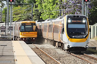
Queensland Rail (QR) is a railway operator in Queensland, Australia. Owned by the Queensland Government, it operates local and long-distance passenger services, as well as owning and maintaining rolling stock and approximately 6,600 kilometres (4,101 mi) of track and related infrastructure.

<span class="mw-page-title-main">Agnes Water, Queensland</span> Town in Queensland, Australia

Agnes Water is a coastal town and a locality in the Gladstone Region, Queensland, Australia. In the 2021 census, Agnes Water had a population of 2,729 people.

<span class="mw-page-title-main">Shire of Miriam Vale</span> Local government area in Queensland, Australia

The Shire of Miriam Vale was a local government area near Gladstone in Queensland, Australia. The administrative centre was the town of Miriam Vale.

<span class="mw-page-title-main">Boyne Valley, Queensland</span> Suburb of Gladstone Region, Queensland, Australia

The Boyne Valley is a rural locality in Gladstone Region, Queensland, Australia. The locality contains four small towns: Nagoorin, Ubobo, Builyan, and Many Peaks. In the 2021 census, Boyne Valley had a population of 301 people.

<span class="mw-page-title-main">Benaraby</span> Town in Queensland, Australia

Benaraby is a rural town and locality in the Gladstone Region, Queensland, Australia. In the 2021 census, the locality of Benaraby had a population of 1,166 people.

<span class="mw-page-title-main">Cairns Tilt Train derailment</span> Train accident that occurred in Queensland Australia in November 2004

The Cairns Tilt Train derailment occurred at 11:55 pm on 15 November 2004 when the City of Townsville diesel tilt train derailed north of Berajondo, approximately 342 km (213 mi) northwest of Brisbane, the state capital of Queensland, Australia.

<span class="mw-page-title-main">Rosedale, Queensland</span> Town in Queensland, Australia

Rosedale is a rural town and locality split between the Gladstone Region and the Bundaberg Region in central Queensland, Australia. In the 2021 census, the locality of Rosedale had a population of 452 people.

Lowmead is a rural town and locality in the Gladstone Region, Queensland, Australia. In the 2021 census, the locality of Lowmead had a population of 179 people.

Baffle Creek is a rural locality in the Gladstone Region, Queensland, Australia. In the 2021 census, Baffle Creek had a population of 155 people.

Boynedale is a rural locality in the Gladstone Region, Queensland, Australia. In the 2021 census, Boynedale had a population of 13 people.

<span class="mw-page-title-main">Wrights Creek, Queensland</span> Suburb of Cairns Region, Queensland, Australia

Wrights Creek is a rural locality in the Cairns Region, Queensland, Australia. In the 2021 census, Wrights Creek had a population of 160 people.

Bukali is a rural locality in the North Burnett Region, Queensland, Australia. In the 2021 census, Bukali had a population of 57 people.

Colosseum is a rural locality in the Gladstone Region, Queensland, Australia. In the 2021 census, Colosseum had a population of 184 people.

Iveragh is a rural locality in the Gladstone Region, Queensland, Australia.

Foreshores is a coastal rural locality in the Gladstone Region, Queensland, Australia. The area is used for farming with some rural residential development.

West Stowe is a rural locality in the Gladstone Region, Queensland, Australia. It is immediately west of the Gladstone urban area and immediately south of the small town of Yarwun. In the 2021 census, West Stowe had a population of 391 people.

Deepwater is a coastal locality in the Gladstone Region, Queensland, Australia. In the 2021 census, Deepwater had a population of 287 people.

Kirkwood is a semi-rural locality in the Gladstone Region, Queensland, Australia. In the 2021 census, Kirkwood had a population of 2,513 people.

<span class="mw-page-title-main">Captain Creek, Queensland</span> Suburb of Gladstone Region, Queensland, Australia

Captain Creek is a rural locality in the Gladstone Region, Queensland, Australia. In the 2021 census, Captain Creek had a population of 452 people.

Taunton is a rural locality in the Gladstone Region, Queensland, Australia. In the 2021 census, Taunton had a population of 57 people.

References

  1. 1 2 3 Australian Bureau of Statistics (28 June 2022). "Berajondo (SAL)". 2021 Census QuickStats. Retrieved 28 February 2023. OOjs UI icon edit-ltr-progressive.svg
  2. "Berajondo – locality in Gladstone Region (entry 46590)". Queensland Place Names. Queensland Government . Retrieved 27 December 2020.
  3. Queensland Family History Society (2010), Queensland schools past and present (Version 1.01 ed.), Queensland Family History Society, ISBN   978-1-921171-26-0
  4. "Queensland Two Mile series sheet 2m159" (Map). Queensland Government. 1963. Retrieved 25 June 2024.
  5. "Rosedale" (Map). Queensland Government. 1943. Archived from the original on 25 June 2024. Retrieved 25 June 2024.
  6. "Rail Safety Investigation QT1472, Derailment of Cairns Tilt Train VCQ5, North of Berajondo, Queensland, 15 November 2004 (part 1)" (PDF). Australian Transport Safety Bureau. 16 October 2005. Archived from the original (PDF) on 30 August 2007. Retrieved 1 April 2008.
  7. Congly, By (15 November 2014). "Tilt Train crash remembered: lessons learned 10 years on". Bundaberg NewsMail . Retrieved 25 June 2024.
  8. Australian Bureau of Statistics (27 June 2017). "Berajondo (SSC)". 2016 Census QuickStats. Retrieved 20 October 2018. OOjs UI icon edit-ltr-progressive.svg
  9. "Layers: Locality; Schools and school catchments". Queensland Globe. Queensland Government. Archived from the original on 19 December 2017. Retrieved 25 June 2024.

Further reading