The Pliocene to Late Neogene Bidahochi Formation lies at an elevation of about 6,300 feet (1,920 m) to 6,600 feet (2,012 m) at the southeast of the Colorado Plateau; the deposits are from Hopi Lake, and the deposits extend southwards to the region at the north perimeter of the White Mountains of central-east Arizona. Bidahochi Lake is thought to have been a single "large lake, or several shallow, and ephemeral ones." Various fossil types are found; also bird trackways.
Aripine is a populated place situated in Navajo County, Arizona, United States.

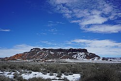
Baby Rocks is a populated place situated in Navajo County, Arizona, United States, and appears on the Baby Rocks U.S. Geological Survey Map.
Burton is a populated place situated in Navajo County, Arizona, United States.
Castle Butte is a populated place situated in Navajo County, Arizona, United States.
Cedar Springs is a populated place situated in Navajo County, Arizona, United States. It has an estimated elevation of 6,279 feet (1,914 m) above sea level.
Chakpahu is a populated place situated in Navajo County, Arizona, United States.
Hano is a populated place situated in the First Mesa CDP in Navajo County, Arizona, United States, on the Hopi Reservation.
Huk Ovi is a populated place situated in Navajo County, Arizona, United States.
Indian Pine is a populated place situated in Navajo County, Arizona, United States.
Kawaika-A is a populated place situated in Navajo County, Arizona, United States.
Manila is a populated place situated in Navajo County, Arizona, United States. Its name was bestowed during the Spanish–American War, being named after the Philippines' capital.
Na Ah Tee, historically also known as Na-Ah-Tee Canyon, Na-a-tih Trading Post, and Na-at-tee Canyon, is a populated place situated in Navajo County, Arizona, United States.
Navajo is a populated place situated in Apache County, Arizona, United States. It has an estimated elevation of 5,676 feet (1,730 m) above sea level.
Pivahn-hon-kya-pi, also known as Pi Va Hon Kia Pi, is a populated place situated in Navajo County, Arizona, United States.

Shumway, also known as Shumay, is a populated place situated in Navajo County, Arizona. It was named after Charles Shumway, a member of the Church of Jesus Christ of Latter-day Saints, who settled the location.
Tsegi is a populated place situated in Navajo County, Arizona, United States.
Twin Buttes is a populated place situated in Navajo County, Arizona, United States. It is one of two populated locations in Arizona with this name, the other being in Pima County.
Wepo Village is a populated place situated in Navajo County, Arizona, United States. Located 5 miles north of Walpi, it is within the boundaries of the Hopi Reservation The name comes from the Hopi word for "onion".
Wheatfields is a populated place situated in Apache County, Arizona, United States, right along the border with New Mexico. It has an estimated elevation of 7,287 feet (2,221 m) above sea level. It is one of two places in Arizona with this name, the other being a CDP in Gila County. In 1909, the US Government set up an irrigation project to assist the Navajo residents. It is a chapter of the Navajo Nation.