C.N. Industrial, Saskatoon

Last updated
C.N. Industrial Area
EarlysSeedandFeed.jpg
Early's Seed and Feed
Coordinates: 52°5′21″N106°39′49″W / 52.08917°N 106.66361°W / 52.08917; -106.66361
CountryFlag of Canada (Pantone).svg  Canada
Province Saskatchewan
CitySaskatoon
Suburban Development Area Nutana
NeighbourhoodC.N. Industrial Area
Annexed1960-1964
CN Industrial 2 Annexed1965-1969
Government
  TypeMunicipal (Ward 7)
  Administrative body Saskatoon City Council
  Councillor Mairin Loewen
Population
 (2006)
   Average Income
$
Time zone UTC-6 (UTC)
List of neighbourhoods in Saskatoon

The CN Industrial Area is the industrial subdivision located in southern Saskatoon. It is also known as South Saskatoon, after the CN rail siding located in the area. It is a part of the Nutana Suburban Development Area. This industrial park was established with the Grand Trunk Pacific Railway crossing the South Saskatchewan River.

Contents

C.N. Industrial is bisected by Circle Drive, which directly links to all major highways entering the city, and is also connected directly to the Idylwyld Freeway, which links to downtown Saskatoon.

This neighbourhood on the east side of Saskatoon is not to be confused with the Canadian National Railway (C.N.) Yards Management Area located on Chappell Drive in the Confederation SDA of Saskatoon's west side. These two sides of Saskatoon are connected with the Grand Trunk Bridge (aka CN railway bridge) and the Gordie Howe Bridge over the South Saskatchewan River.

Geography

CN railway tracks C.N. Industrial, Saskatoon.JPG
CN railway tracks

CN Industrial is bordered to the south by The Willows, Saskatoon, on the north by Idylwyld Drive and Avalon. Stonebridge is to the east, and Sk Hwy 219 to the west. Diefenbaker management area and the South Saskatchewan River are west of the CN Industrial area. The auto mall is a newer part of the CN Industrial area east of Portage Avenue to Clarence Avenue. There is a new interchange at Clarence Avenue and Idylwyld Drive to provide easier access to the area.

The Grand Trunk Bridge (Saskatoon) or CN Bridge crosses the South Saskatchewan River between the Queen Elizabeth Power Station on the upstream (west) side and Diefenbaker Park on the downstream (east) side. The train bridge commenced construction work in 1906 with rail line service beginning on September 21, 1908. [1] A southwest extension of Circle Drive, which opened in July 2013, passes through C.N. Industrial. [2] Access to businesses in C.N. Industrial is facilitated via an interchange at Lorne Avenue, but the area is now split into two sections with Jasper Avenue no longer crossing Circle Drive.

Economy

Auto mall AutomallCNIndustrial.jpg
Auto mall

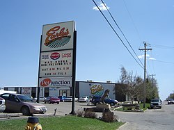
Some of the major employers in this area are Early Seed and Feed, Roadex Services, Ltd., and Speedway Moving & Storage. The Saskatoon Auto Mall, which opened on the east side of C.N. Industrial in the early 2000s, includes Saturn, Mini, Sherwood, Chevrolet, and BMW auto dealers, most of whom relocated to the auto mall from locations along 8th Street. [3]

In addition, retail development has occurred on the west side of Clarence Avenue south of Brand Road in the wake of development of the Stonebridge commercial hub to the east and new residential communities beyond it. The city's detachment of the Royal Canadian Mounted Police relocated to C.N. Industrial from its previous location on 8th Street East in the 2000s. As of early 2019, a hotel is under construction at Lorne Avenue and Jasper Avenue North.

The Saskatchewan Western Development Museum maintains its major storage/refurbishment facility off Lorne Avenue in this area, southeast of the Saskatoon public branch of the museum.

Related Research Articles

Highway 219 is a provincial highway in the Canadian province of Saskatchewan. Saskatchewan's 200-series highways primarily service its recreational areas. The highway runs from Gardiner Dam at the north end of Lake Diefenbaker north to the city Saskatoon. It is about 96 kilometres (60 mi) long.

Nutana Suburban Development Area (SDA) is an area in Saskatoon, Saskatchewan (Canada). It is a part of the east side community of Saskatoon, and should not be confused with Nutana, one of the neighbourhoods within the Core Neighbourhoods SDA. It lies (generally) north of the outskirts of the City and the Rural Municipality of Corman Park No. 344, west of Lakewood SDA, south of the Core Neighbourhoods SDA SDA and University Heights SDA, and east of the South Saskatchewan River and Confederation SDA.

<span class="mw-page-title-main">Central Business District, Saskatoon</span> Neighbourhood in Saskatoon, Saskatchewan, Canada

The Central Business District is one of seven development districts in Saskatoon, Saskatchewan, Canada. The central business district is Ward 6 of a Mayor-Council government represented by councillor Cynthia Block. Formerly called West Saskatoon, this area arose when the steam engines built their pumping stations on the lower west bank of the South Saskatchewan River. Retail enterprises sprang up around the newly created train station and rail yards. The city of Saskatoon's Central Business District has shopping malls and boutiques.

<span class="mw-page-title-main">North Industrial, Saskatoon</span> Neighbourhood in Saskatoon, Saskatchewan, Canada

North Industrial is an established industrial community in the city of Saskatoon, Saskatchewan, which consists primarily of industrial and retail development.

<span class="mw-page-title-main">Kelsey-Woodlawn, Saskatoon</span> Neighbourhood in Saskatoon, Saskatchewan, Canada

Kelsey-Woodlawn is a combination of industrial park nestled between the North West Industrial SDA and the Central Industrial of down town Saskatoon. It is still serviced by the CNR rail lines to both the north and east. There are two older neighbourhoods, one still survives near SIAST - Kelsey institute on Idylwyld Drive North, and the other is the McVicar Addition near the Woodlawn Cemetery.

<span class="mw-page-title-main">Central Industrial, Saskatoon</span> Neighbourhood in Saskatoon, Saskatchewan, Canada

Central Industrial is a light industrial area in Saskatoon, Saskatchewan, Canada, that comprises educational, recreational facilities, hotels and businesses along Idylwyld Drive. The community meets up with the Central Business District CBD to the west and south, and residential areas east and north.

<span class="mw-page-title-main">Exhibition, Saskatoon</span> Neighbourhood in Saskatoon, Saskatchewan, Canada

The Exhibition subdivision of Saskatoon, Saskatchewan, Canada, is located on the banks of the South Saskatchewan River and was developed between the two major World Wars. To the west is the Diefenbaker Management Area which boasts the Diefenbaker park and Pioneer Cemetery. The park includes a medium-sized hill which is used for tobogganing and snowboarding, and the park itself is a frequently-used venue for picnics and public events and performances. The Exhibition community is also known as Thornton, after a (now-demolished) public elementary school that formerly served the area and early in its history also went by the name Bellevue.

<span class="mw-page-title-main">8th Street East (Saskatoon)</span> Road in Saskatoon, Saskatchewan

8th Street East is an arterial road serving the city of Saskatoon, Saskatchewan. It begins as a continuation of a minor residential street at Lorne Avenue in Saskatoon, and runs through the eastern part of city, eventually exiting the city limits as a country road.

<span class="mw-page-title-main">Adelaide/Churchill, Saskatoon</span> Neighbourhood in Saskatoon, Saskatchewan, Canada

Adelaide/Churchill is a mostly residential neighbourhood located in south-central Saskatoon, Saskatchewan, Canada. It is a suburban subdivision, consisting mostly of low-density, single detached dwellings. As of 2009, the area is home to 3,445 residents. The neighbourhood is considered a middle-income area, with an average family income of $78,438, an average dwelling value of $287,976 and a home ownership rate of 90.3%.

<span class="mw-page-title-main">Avalon, Saskatoon</span> Neighbourhood in Saskatoon, Saskatchewan, Canada

Avalon is a mostly residential neighbourhood located in south-central Saskatoon, Saskatchewan, Canada. It is a suburban subdivision, consisting mostly of low-density, single detached dwellings. As of 2007, the area is home to 3,214 residents. The neighbourhood is considered a middle-income area, with an average family income of $65,000, an average dwelling value of $168,444 and a home ownership rate of 77.3%.

<span class="mw-page-title-main">History of Saskatoon</span>

The history of Saskatoon began with the first permanent non-indigenous settlement of Saskatoon, Saskatchewan, Canada, in 1883 when Toronto Methodists, wanting to escape the liquor trade in that city, decided to set up a "dry" community in the rapidly growing prairie region. As of 1882 this area was a part of the provisional district named Saskatchewan, North-West Territories (NWT). Their organization, the Temperance Colonization Society, first examined this area in 1882 and found that it would make an excellent location to found their community based on the ideals of the temperance movement; Saskatoon traditionally considers 1882 its founding year and thus marked its centennial in 1982. The settlers, led by John Neilson Lake, arrived on the site of what is now Saskatoon by traveling by railway from Ontario to Moose Jaw, Assiniboia, NWT, and then completing the final leg via horse-drawn cart. The plan for the Temperance Colony soon failed as the group was unable to obtain a large block of land within the community. Nonetheless, John Lake is commonly identified as the founder of Saskatoon; a public school, a park and two streets are named after him.

<span class="mw-page-title-main">Stonebridge, Saskatoon</span> Neighbourhood in Saskatoon, Saskatchewan, Canada

Stonebridge is a mostly residential neighbourhood located in south-central Saskatoon, Saskatchewan, Canada. It is a suburban subdivision, consisting of low-density, single detached dwellings and a mix of medium-density apartment and semi-detached dwellings. As of 2009, the area is home to 994 residents. The neighbourhood is considered a middle-income area, with an average family income of $67,642, an average dwelling value of $321,004 and a home ownership rate of 72.4%.

<span class="mw-page-title-main">The Willows, Saskatoon</span> City of Saskatoon neighbourhood in Saskatchewan, Canada

The Willows Residential Community and Golf Club, is a residential community in the Nutana Suburban Development Area in the city of Saskatoon, Saskatchewan. The Willows is south of Circle Drive which is concurrent with Saskatchewan Highway 16. Its northern boundary is the CN Rail line and the former Cartwright Street right-of-way ; to the east is Clarence Avenue and to the west is Lorne Avenue. The 36-hole Willows Golf & Country Club winds its way around the subdivision which when construction of homes began in 2004 became the city's first golf course community. Home construction began almost immediately after the land for the subdivision and the golf course was annexed from the rural municipality of Corman Park No. 344, Saskatchewan. The golf course, however, had been in operation for more than a decade before residential development began.

<span class="mw-page-title-main">Circle Drive</span> Road in Saskatoon, Saskatchewan

Circle Drive is a major road constructed as a ring road in Saskatoon, Saskatchewan, Canada. Its route constitutes both part of the Yellowhead Highway and Highway 11, signed as both along the entire length. It was first conceived in 1913 by the city commissioner and completed exactly 100 years later in 2013. Most of the route is a fully-controlled access freeway, however the segment between Airport Drive and Millar Avenue has at-grade intersections.

<span class="mw-page-title-main">Idylwyld Drive</span> Street in Saskatoon, Saskatchewan, Canada

Idylwyld Drive is an arterial road in Saskatoon, Saskatchewan. It is one of the main roads in and out of the downtown area of the city.

Agriplace is an industrial park located in the North Industrial SDA Suburban Development Area of Saskatoon, Saskatchewan. Industrial parks are usually located close to transport facilities, especially where more than one transport modalities coincide. Sk Hwy 16, the Yellowhead, Sk Hwy 11, and Sk Hwy 11 are all accessed directly from Agriplace. The Saskatoon John G. Diefenbaker International Airport is southwest of the Sk Hwy 16, the Yellowhead highway.

Marquis Industrial is an industrial park located in the North Industrial SDA Suburban Development Area of Saskatoon, Saskatchewan. Industrial parks are usually located close to transport facilities, especially where more than one transport modalities coincide. Sk Hwy 11, and Sk Hwy 12 are all accessed directly from Marquis Industrial. The Saskatoon John G. Diefenbaker International Airport is west of the Sk Hwy 11 Sk Hwy 12 concurrency along Idylwyld Drive.

<span class="mw-page-title-main">Airport Business Area, Saskatoon</span> Neighbourhood in Saskatoon, Saskatchewan, Canada

Airport Business Area is an industrial park located in the North Industrial SDA Suburban Development Area of Saskatoon, Saskatchewan. Industrial parks are usually located close to transport facilities, especially where more than one transport modalities coincide. The Idylwyld Drive North, Sk Hwy 11 Louis Riel Trail, and Sk Hwy 12 concurrency are all accessed directly from the Airport Business Area. The Saskatoon John G. Diefenbaker International Airport is north of the Airport Business Area. Circle Drive marks the southern boundary, with access to SK Hwy 14 and Sk Hwy 16, the Yellowhead Trans Canada.

<span class="mw-page-title-main">C.N. Yards Management Area</span> Neighbourhood in Saskatoon, Saskatchewan, Canada

The Canadian National Railway (C.N.) Yards Management Area located on Chappell Drive, Saskatoon, Saskatchewan consists of the VIA Saskatoon railway station and the train switching yards. These yards are a part of the Confederation Suburban Development Area (SDA). It lies (generally) north of the outskirts of the City and the Rural Municipality of Corman Park No. 344, west of Montgomery Place, south of 11th Street and east of Highway 7. Highway 7 has built an overpass over C.N. tracks where they intersect. This neighbourhood is not to be confused with the C.N. Industrial in the Nutana SDA on the east side of Saskatoon. These two sides of Saskatoon are connected with the Grand Trunk Bridge or CN railway bridge over the South Saskatchewan River.

References

  1. "The Wonder City". Archived from the original on 2008-02-24. Retrieved 2008-05-12.
  2. "City of Saskatoon · Departments · Infrastructure Services ..." Archived from the original on August 7, 2007. Retrieved 2008-05-12.
  3. "Saskatoon Auto Mall - Used and New Cars, Trucks and RVs in Saskatoon, SK Canada" . Retrieved 2008-05-12.