
Caswell Hill is a district in the city of Saskatoon, Saskatchewan, Canada. It derives its name from an early homesteader Robert Caswell one of the Temperance Colonists of 1883. It is an area of beautiful character homes first built ca. 1905, tiny war-time houses, and newer houses. Caswell is a thriving and diverse community nestled between two economic areas, the downtown core, and the stores lining 33rd Street West.

Mayfair is a neighbourhood in the city of Saskatoon, Saskatchewan, Canada. Mayfair started out as a community outside of the villages of Riversdale, Nutana and Saskatoon and appears as its own place name on a map of 1907. In 1909 there were 60 residences built in Mayfair, and in 1911, the City of Saskatoon had grown large enough to encompass Mayfair. Homeownership amongst the residents is at 68.2%.
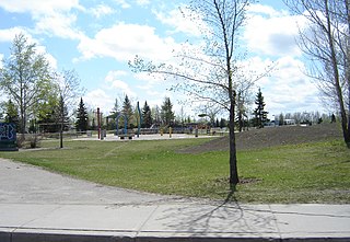
Massey Place, is a geographically localised subdivision of the Confederation Suburban Development Area in the city of Saskatoon, Saskatchewan which is nestled around Archibald McDonald Park. Mcdonald Park is centrally located along the northern perimeter of 33rd Street East. The school yards of both Vincent Massey School and Bishop Klein School have their western boundaries along Archibald McDonald Park which has as its resources ball diamonds, soccer pitches, winter ice rinks, and playground facilities. Massey Place neighbourhood is close to amenities provided by both the commercial district of the Confederation Suburban Centre.

City Park is a mixed-use neighbourhood located near the center of Saskatoon, Saskatchewan, Canada. It comprises a mix of single-family detached homes, apartment buildings and other semi-detached dwellings. It also contains a number of commercial zones with businesses. As of 2009, the area was home to 4,405 residents. The neighbourhood is considered a middle-income area, with an average family income of $42,236, an average dwelling value of $245,254 and a home ownership rate of 28.6%.

Briarwood is a residential neighbourhood located in the southeast part of Saskatoon, Saskatchewan, Canada. The majority of its residents live in low-density, single detached dwellings. As of 2009, the area is home to 4,473 residents. The neighbourhood is considered a very high-income area, with an average family income of $117,619, an average dwelling value of $449,158 and a home ownership rate of 97.0%.

Lakeridge is a residential neighbourhood located in the southeast part of Saskatoon, Saskatchewan, Canada. Almost all of its residents live in low-density, single detached houses. As of 2009, the area is home to 4,051 residents. The neighbourhood is considered an upper-income area, with an average family income of $127,698, an average dwelling value of $357,024 and a home ownership rate of 98.8%.
Fairhaven is a neighbourhood in Saskatoon, Saskatchewan, Canada, located towards the west end of the city, south of 22nd Street and west of Circle Drive.

Kelsey-Woodlawn is a combination of industrial park nestled between the North West Industrial SDA and the Central Industrial of down town Saskatoon. It is still serviced by the CNR rail lines to both the north and east. There are two older neighbourhoods, one still survives near SIAST - Kelsey institute on Idylwyld Drive North, and the other is the McVicar Addition near the Woodlawn Cemetery.

Blairmore Suburban Development Area (SDA) is an area in Saskatoon, Saskatchewan (Canada). It is a part of the west side community of Saskatoon. It lies (generally) north of the outskirts of the City and the Rural Municipality of Corman Park No. 344, west of downtown Saskatoon, and the Core Neighbourhoods SDA, south of the North West Industrial SDA, and west of the Confederation SDA. Most of the Blairmore SDA consists of undeveloped land annexed by the city in the mid-2000s. A total of nine neighbourhoods, primarily residential in nature, are ultimately planned for the SDA. As of late 2019, two are in the process of development: the commercial/residential Blairmore Suburban Centre and the residential community Kensington. A third residential area, Elk Point, is also in its early stages.

Montgomery Place is a post-World War II community erected for veterans outside Saskatoon, Saskatchewan, Canada, that consists primarily of residential homes. It was amalgamated within the city of Saskatoon in 1956, and is now a National Historic Site. Montgomery Place has an average household size of 3.2 persons, and homeownership is at 93.7%. According to MLS data, the average sale price of a home as of 2013 was $403,840. It was named in honour of Field Marshal The 1st Viscount Montgomery of Alamein, the famous Ulster Scots commander in the British Army during the Second World War.

North Park is a community which is just to the north of the Meewasin Riverworks observation area and the CPR Bridge. It has access along its eastern perimeter to the scenic walking trails along the South Saskatchewan River developed by the Meewasin Valley Authority. The average home selling price in 2006 was $101,176- $139,704. Each family was approximately 2.1 residents, and 63.9% of the residents owned their own home.

Richmond Heights, adjacent to the South Saskatchewan River, features walking trails in the Meewasin Valley. G.D. Archibald Park North hosts baseball and soccer games. Luther Heights is a Luther care community for those aged 60 and over. In 2006, 73.5% of the residents owned their own home; the average home size was 2.3 residents.

Dundonald is a neighbourhood located in the northwest corner of Saskatoon, Saskatchewan. The neighbourhood was built in the 1980s, and served as the last development of the northwest corner of the city, prior to the development of Hampton Village. Dundonald is surrounded by a large landscaped park, with a storm pond. In comparison, the neighbourhood of Dundonald with a 2001 census population of 5,285 is larger than the Saskatchewan city of Melville which had a population of 4,149 in 2006, and 4,453 in 2001 and Dundonald is also larger than the provincial city of Humboldt which was 4,998 in 2006, and 5,161 in 2001. In Saskatchewan rural towns must maintain a population above 5,000 to apply for city status.

Hudson Bay Park is geographically located in north west Saskatoon just south of Circle Drive along 33rd Street and Avenue P North. It is mainly characterized by single detached homes along with apartments that are less than five stories in height. Oliver Place and St. Joseph's Home are seniors residences located in this residential neighbourhood. This locale honours the pioneers of Saskatoon, as well as providing two very large park spaces which curve through the neighbourhood. The community was under construction mainly during the post war years between 1940 and 1960 when there was a housing shortage. The land for this neighbourhood was annexed during the City expansion around the time of 1910 to 1915. Following elementary school, students usually attend Mount Royal Collegiate in the neighboring area of Mount Royal or E.D. Feehan Catholic High School on Avenue M North a part of Westmount community. In 2006, the average family size was 2.1 residents. Statistics c2005 -
Pacific Heights is geographically located in north west Saskatoon. The main construction boom for this community was the 1970s, during which the City of Saskatoon annexed the land. Following elementary school, students usually attend Tommy Douglas Collegiate or Bethlehem Catholic High School on Bowlt Crescent a part of Blairmore SDA community. According to MLS data, the average sale price of a home as of 2013 was $279,500.

Parkridge is a residential community in western Saskatoon, Saskatchewan, located on land annexed by the city between 1975 and 1979. Development of the subdivision initially began in the early 1980s. The extreme west end of the neighbourhood remained undeveloped until the subsequent creation of the adjacent Blairmore Suburban Centre led to the final phase of Parkridge being built out in the early 2010s. Whereas the majority of residents are employed in the sales and service sector, the next highest employer is business, finance and administration. The two main age groups are those in their 40s and teenagers as of 2005. Until recently Parkridge was the farthest western neighbourhood of Saskatoon south of 22nd Street. However, new construction will soon see Neighbourhood 2 of the Blairmore SDA bear that claim to fame. In comparison, the neighbourhood of Parkridge with a 2001 census population of 4,505 is larger than the Saskatchewan city of Melville which had a population of 4,149 in 2006, and 4,453 in 2001 and Parkridge is a little smaller than the provincial city of Humboldt which was 4,998 in 2006, and 5,161 in 2001. In Saskatchewan rural towns must maintain a population above 5,000 to apply for city status. According to MLS data, the average sale price of a home as of 2013 was $327,072.
Forest Grove is a primarily residential neighbourhood located in northeast Saskatoon, Saskatchewan, Canada. It is mostly made up of low-density single detached dwellings, with a sizeable minority of multiple-unit apartment dwellings. As of 2011, the area is home to 5,907 residents. The neighbourhood is considered a middle-income area, with an average family income of $70,487, an average dwelling value of $246,680 and a home ownership rate of 62.4%.

Willowgrove is a primarily residential neighbourhood located in the eastside of Saskatoon, Saskatchewan, Canada. It comprises a mix of mainly single-family detached houses and fewer multiple-unit dwellings. As of 2011, the area is home to 3,973 residents. The neighbourhood is considered a middle to high-income area, with an average family income of $96,002, an average dwelling value of $218,357 and a home ownership rate of 84.8%.
Westview is a suburban community in the Confederation Suburban Development Area (SDA) of Saskatoon, Saskatchewan. Originally named "Tuxedo Park" by real estate developers in 1912, the area remained undeveloped until the 1960s. The east half of Westview is located on land annexed by the city in 1911, while the western half did not become part of Saskatoon until 1960.
Kensington is a neighbourhood located in west Saskatoon, Saskatchewan, Canada that began construction in 2013. Around 2028, Kensington will reach completion and have an estimated population of 8,300. Kensington will feature Saskatoon's first application of the fused grid street network.


