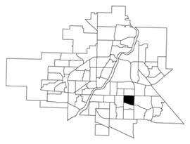
Nutana Suburban Centre is a mixed-development neighbourhood located in south-central Saskatoon, Saskatchewan, Canada. It is a classified as a "suburban centre" subdivision, composed of medium to high-density multiple-unit dwellings, commercial areas and civic facilities. As of 2009, the area is home to 2,962 residents. Housing in the neighbourhood consists of high-density apartment-style dwellings and row houses. The neighbourhood is considered a lower-income area, with an average family income of $34,474, an average dwelling value of $266,311 and a home ownership rate of 29.3%. The low average income but comparatively high dwelling value is due to the number of senior citizens residing in the neighbourhood. The age distribution of Nutana SC's population is skewed very highly toward residents age 65 and older.

Varsity View is a mostly residential neighbourhood located near central Saskatoon, Saskatchewan, Canada. It is immediately south of the University of Saskatchewan campus. It is an older suburban subdivision, comprising a mixture of low-density, single detached dwellings, detached duplexes and apartment-style units. As of 2007, the area is home to 3,611 residents. The neighbourhood is considered a middle-income area, with an average family income of $50,587, an average dwelling value of $284,710 and a home ownership rate of 38.7%. Its proximity to the university gives this area its relatively high student population, almost 25% in 2005.

Silverspring is a residential neighbourhood located in northeast Saskatoon, Saskatchewan, Canada. It is a suburban subdivision, composed mostly of low-density, single detached houses. As of 2007, the area is home to 4,936 residents. The neighbourhood is considered a high income area, with an average family income of $85,084, an average dwelling value of $322,670 and a home ownership rate of 97.8%. According to MLS data, the average sale price of a home as of 2013 was $407,171.

College Park is a primarily residential neighbourhood located in the east-central part of Saskatoon, Saskatchewan, Canada. The majority of its residents live in single-family detached dwellings, with a sizable minority of high-density, multiple-unit dwellings. As of 2011, the area is home to 5,470 residents. The neighbourhood is considered a middle-income area, with an average family income of $65,133, an average dwelling value of $232,228 and a home ownership rate of 58.9%.
College Park East is a primarily residential neighbourhood located in the east-central part of Saskatoon, Saskatchewan, Canada. The majority of its residents live in single-family detached dwellings, with a sizeable minority of high-density, multiple-unit dwellings. As of 2006, the area is home to 4,809 residents. The neighbourhood is considered a middle-income area, with an average family income of $67,946, an average dwelling value of $314,000 and a home ownership rate of 67.2%.

Wildwood is a primarily residential neighbourhood located in the southeast part of Saskatoon, Saskatchewan, Canada. It includes part of the 8th Street business district. The majority of its residents live in a townhouse or apartment-style multiple unit dwellings, with a sizeable minority of low-density, single detached dwellings. As of 2016, the area is home to 7,645 residents. The neighbourhood has an average family income of $37,770, a homeownership rate of 67.0% and an average home sale price of $300,327.

Eastview is a mostly residential neighbourhood located in south-central Saskatoon, Saskatchewan, Canada. It is a suburban subdivision, consisting of low-density, single detached dwellings, low-rise apartment buildings and semi-detached houses. As of 2007, the area is home to 3,566 residents. The neighbourhood is considered a middle-income area, with an average family income of $58,703, an average dwelling value of $260,050 and a home ownership rate of 51.6%.

Westmount is an older inner city neighbourhood located near the centre of Saskatoon, Saskatchewan, Canada. It mostly consists of low-density, single detached dwellings. As of 2009, the area is home to 2,232 residents. The neighbourhood is considered a lower-income area, with an average family income of $44,729, an average dwelling value of $162,491 and a home ownership rate of 68.9%. According to MLS data, the average sale price of a home as of 2013 was $207,347.

Briarwood is a residential neighbourhood located in the southeast part of Saskatoon, Saskatchewan, Canada. The majority of its residents live in low-density, single detached dwellings. As of 2009, the area is home to 4,473 residents. The neighbourhood is considered a very high-income area, with an average family income of $117,619, an average dwelling value of $449,158 and a home ownership rate of 97.0%.

Lakeridge is a residential neighbourhood located in the southeast part of Saskatoon, Saskatchewan, Canada. Almost all of its residents live in low-density, single detached houses. As of 2009, the area is home to 4,051 residents. The neighbourhood is considered an upper-income area, with an average family income of $127,698, an average dwelling value of $357,024 and a home ownership rate of 98.8%.

Erindale is a primarily residential neighbourhood located in northeast Saskatoon, Saskatchewan, Canada. It is mostly made up of low-density single detached dwellings. As of 2011, the area is home to 4,338 residents. The neighbourhood is considered a high-income area, with an average family income of $123,336, an average dwelling value of $340,990 and a home ownership rate of 95.3%.

Lakeview is a primarily residential neighbourhood located in the southeast part of Saskatoon, Saskatchewan, Canada. The majority of its residents live in low-density, single detached dwellings, with a sizeable minority of semi-detached or apartment-style multiple unit dwellings. As of 2011, the area is home to 7,732 residents. The neighbourhood is considered a high income area, with an average family income of $120,042, an average dwelling value of $277,070 and a home ownership rate of 71.0%. It was the first community in Saskatoon to feature a man-made lake amenity.

Greystone Heights is a mostly residential neighbourhood located in east-central Saskatoon, Saskatchewan, Canada. It is a suburban subdivision, consisting mostly of low-density, single detached dwellings and a sizeable minority of apartment-style multiple-unit dwellings. As of 2007, the area is home to 2,525 residents. The neighbourhood is considered a middle-income area, with an average family income of $58,811, an average dwelling value of $241,850 and a home ownership rate of 58.1%.
Holliston is a primarily residential neighbourhood located in the southeast part of Saskatoon, Saskatchewan, Canada. It includes part of the 8th Street business district. Just over half of its dwellings are single detached houses, with a sizeable minority of duplex or apartment-style multiple unit dwellings. As of 2007, the area is home to 3,412 residents. The neighbourhood is considered a middle-income area, with an average family income of $51,674, and a home ownership rate of 62.8%.

Dundonald is a neighbourhood located in the northwest corner of Saskatoon, Saskatchewan. The neighbourhood was built in the 1980s, and served as the last development of the northwest corner of the city, prior to the development of Hampton Village. Dundonald is surrounded by a large landscaped park, with a storm pond. In comparison, the neighbourhood of Dundonald with a 2001 census population of 5,285 is larger than the Saskatchewan city of Melville which had a population of 4,149 in 2006, and 4,453 in 2001 and Dundonald is also larger than the provincial city of Humboldt which was 4,998 in 2006, and 5,161 in 2001. In Saskatchewan rural towns must maintain a population above 5,000 to apply for city status.

Hudson Bay Park is geographically located in north west Saskatoon just south of Circle Drive along 33rd Street and Avenue P North. It is mainly characterized by single detached homes along with apartments that are less than five stories in height. Oliver Place and St. Joseph's Home are seniors residences located in this residential neighbourhood. This locale honours the pioneers of Saskatoon, as well as providing two very large park spaces which curve through the neighbourhood. The community was under construction mainly during the post war years between 1940 and 1960 when there was a housing shortage. The land for this neighbourhood was annexed during the City expansion around the time of 1910 to 1915. Following elementary school, students usually attend Mount Royal Collegiate in the neighboring area of Mount Royal or E.D. Feehan Catholic High School on Avenue M North a part of Westmount community. In 2006, the average family size was 2.1 residents. Statistics c2005 -
Forest Grove is a primarily residential neighbourhood located in northeast Saskatoon, Saskatchewan, Canada. It is mostly made up of low-density single detached dwellings, with a sizeable minority of multiple-unit apartment dwellings. As of 2011, the area is home to 5,907 residents. The neighbourhood is considered a middle-income area, with an average family income of $70,487, an average dwelling value of $246,680 and a home ownership rate of 62.4%.

Nutana Park is a mostly residential neighbourhood located in south-central Saskatoon, Saskatchewan, Canada. It is a suburban subdivision, consisting mostly of low-density, single detached dwellings. As of 2021, the area is home to 2,959 residents. The neighbourhood is considered a middle-income area, with an average personal income of $42,630 and a home ownership rate of 83.3%. According to MLS data, the average sale price of a home as of 2020 was $346,929.

Willowgrove is a primarily residential neighbourhood located in the eastside of Saskatoon, Saskatchewan, Canada. It comprises a mix of mainly single-family detached houses and fewer multiple-unit dwellings. As of 2011, the area is home to 3,973 residents. The neighbourhood is considered a middle to high-income area, with an average family income of $96,002, an average dwelling value of $218,357 and a home ownership rate of 84.8%.

The Confederation Park subdivision of Saskatoon, Saskatchewan, Canada, is located west of the South Saskatchewan River, Saskatoon's west side.