Central Industrial, Saskatoon

Last updated
Central Industrial
Neighbourhood

SIAST.jpg

Kelsey campus of SIAST. Central Industrial, Lawson SDA, Saskatoon
Coordinates: 52°08′31″N106°40′05″W / 52.1419°N 106.6681°W / 52.1419; -106.6681 Coordinates: 52°08′31″N106°40′05″W / 52.1419°N 106.6681°W / 52.1419; -106.6681
Country Canada
Province Saskatchewan
City Saskatoon
Suburban Development Area Lawson Suburban Development Area
Government
  Type Municipal (Ward 1)
  Administrative body Saskatoon City Council
  Councillor Darren Hill
Population (2005) [1]
  Total 75
Time zone CST (UTC-6)
SIAST Saskatoon 034.jpg
SIAST
Hugh Cairns V.C. armoury SaskatoonCannon.jpg
Hugh Cairns V.C. armoury

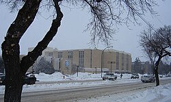
Central Industrial is a light industrial area in Saskatoon, Saskatchewan, Canada, that comprises educational, recreational facilities, hotels and businesses along Idylwyld Drive. The community meets up with the Central Business District CBD to the west and south, and residential areas east and north.

Saskatoon City in Saskatchewan, Canada

Saskatoon is the largest city in the Canadian province of Saskatchewan. It straddles a bend in the South Saskatchewan River in the central region of the province. It is located along the Trans-Canada Yellowhead Highway, and has served as the cultural and economic hub of central Saskatchewan since it was founded in 1882 as a Temperance colony.

Saskatchewan Province of Canada

Saskatchewan is a prairie and boreal province in western Canada, the only province without a natural border. It has an area of 651,900 square kilometres (251,700 sq mi), nearly 10 percent of which is fresh water, composed mostly of rivers, reservoirs, and the province's 100,000 lakes.

Contents

Location

Within the Lawson Suburban Development Area (West Side), the subdivision of the Central Industrial area reaches as far north as 33rd Street East, and is bordered to the west by Idylwyld Drive. The western boundary is just west of the buildings along First Avenue but not inclusive of them, and to the south, just north of the buildings along 24th Street but not inclusive of them. Due to its size the Robin Hood Flour Mill dominates the area.

Idylwyld Drive is an arterial road in Saskatoon, Saskatchewan. It is one of the main roads in and out of the downtown area of the city.

Robin Hood Flour brand of flour

Robin Hood Flour is a brand of flour made by the Horizon Milling division of Cargill. The brand is marketed to the food service and industrial section by Horizon Milling and the consumer retail sector by The J.M. Smucker Company.

History

The industrial area comprising the remnants of the Canadian National Railway train yards and business sector or warehouse district of historical Saskatoon. The Qu'Appelle, Long Lake and Saskatchewan Railway reached Saskatoon in 1890 and crossed the South Saskatchewan River, causing a boom in development on the west side of the river. The CNR Bridge (present day site of the Senator Sid Buckwold Bridge or Freeway/Idywyld Bridge) crosses the South Saskatchewan River through the city connecting Regina, Saskatoon and Prince Albert.

Canadian National Railway railway company

Canadian National is a Canadian Class I freight railway headquartered in Montreal, Quebec that serves Canada and the Midwestern and Southern United States.

The history of Saskatoon began with the first permanent settlement of Saskatoon, Saskatchewan, Canada, in 1883 when Toronto Methodists, wanting to escape the liquor trade in that city, decided to set up a "dry" community in the rapidly growing prairie region. As of 1882 this area was a part of the provisional district named Saskatchewan, North-West Territories. Their organization, the Temperance Colonization Society, first examined this area in 1882 and found that it would make an excellent location to found their community based on the ideals of the temperance movement. The settlers, led by John Neilson Lake, arrived on the site of what is now Saskatoon by traveling by railway from Ontario to Moose Jaw, Saskatchewan, and then completing the final leg via horse-drawn cart. The plan for the Temperance Colony soon failed as the group was unable to obtain a large block of land within the community. Nonetheless, John Lake is commonly identified as the founder of Saskatoon; a public school, a park and two streets are named after him.

Senator Sid Buckwold Bridge bridge in Canada

The Senator Sid Buckwold Bridge is a bridge that spans the South Saskatchewan River between west and east shore in Saskatoon, Saskatchewan, Canada. It was built in 1966, on the same site as the original Qu'Appelle, Long Lake and Saskatchewan bridge. The bridge is part of the Idylwyld Freeway, for which the former CNR Bridge was torn down. The act of dynamiting the original piers of the CNR Bridge became something of a spectacle as demolition experts were unable to completely destroy them. At the time, the new bridge cost $1.5 million to build.

The CNR train yards were moved away from the Central Business District. In 1890 the Qu'Appelle, Long Lake and Saskatchewan Railway Line (QLLR) or The Qu'Appelle, Long Lake and Saskatchewan Steamboat and Railway Line (QLLSR) extended from Regina through to Prince Albert, crossing the South Saskatchewan River where the Senator Sid Buckwold Bridge crosses the river presently. Steam engines could be refilled easier on the west banks of the river which were not so steep. Businesses sprang up around the pumping station forming the beginnings of the Central Business District. [2] The Saskatoon downtown revitalization project began in the 1950s and 1960s when the Canadian National Railway yards were removed and replaced with a shopping mall (which would be renovated several decades later to resemble the original station) called the Midtown Plaza, and its neighbor the TCU Place. [3]

Central Business District, Saskatoon Neighbourhood in Saskatoon, Saskatchewan, Canada

The Central Business District is one of seven development districts in Saskatoon, Saskatchewan, Canada. The central business district is Ward 6 of a Mayor-Council government represented by councillor Cynthia Block. Formerly called West Saskatoon, this area arose when the steam engines built their pumping stations on the lower west bank of the South Saskatchewan River. Retail enterprises sprang up around the newly created train station and rail yards. The city of Saskatoon's Central Business District has shopping malls and boutiques.

Midtown Plaza (Saskatoon) building in Saskatchewan, Canada

Midtown Plaza is a shopping mall in Saskatoon, Saskatchewan, Canada, located in the Central Business District neighbourhood. The main anchor store is Hudson's Bay, with one vacant anchor last occupied by Sears and the shopping centre has a total store count of 154 stores. The mall was built on the former site of the city's main railway station as part of a major inner city redevelopment project in the 1960s that also saw construction of a freeway, the Senator Sid Buckwold Bridge, TCU Place - an arts-convention complex - and a new facility for the city's YMCA.

TCU Place, formerly known as the Saskatoon Centennial Auditorium, is a 104,000-square-foot (9,700 m2) convention and arts centre in Saskatoon, Saskatchewan, Canada. Situated in the Central Business District it is located next to Midtown Plaza.

CPR switching yards

The Canadian Pacific Railway (CPR) downtown switching yards are connected to Saskatoon's east side Sutherland Industrial CPR switching yards via the CPR Bridge across the South Saskatchewan River.

Canadian Pacific Railway railway in Canada

The Canadian Pacific Railway (CPR), also known formerly as CP Rail between 1968 and 1996, and known as simply Canadian Pacific is a historic Canadian Class I railroad incorporated in 1881. The railroad is owned by Canadian Pacific Railway Limited, which began operations as legal owner in a corporate restructuring in 2001.

Sutherland Industrial, Saskatoon Neighbourhood in Saskatoon, Saskatchewan, Canada

Sutherland Industrial is an industrial subdivision located in east-central Saskatoon, Saskatchewan, Canada. It was originally part of Sutherland, a town outside of Saskatoon before being annexed by the city in 1956. The subdivision also contains the first urban reserve in Saskatchewan, the Muskeg Lake Cree Nation.

CPR Bridge (Saskatoon) bridge in Canada

The CPR Bridge is a Canadian railway bridge that spans the South Saskatchewan River in Saskatoon, Saskatchewan.

The City of Saskatoon, Canadian Pacific Railway and the CNR are under negotiations currently to remove these switching yards. This would mean the CPR could use CNR rail lines through the city and be able to use the CN Chappell Yards for switching. Likewise the CNR could run trains along the CPR track through the city and use the Sutherland CPR switching yards. This would involve construction of a connecting switching yard between CP and CN rail lines near 11th Street and Dundonald which could be done as part of the new Circle Drive South Bridge extension project. [4]

In the largest area vacated by the CPR yards would be installed a new larger City Police Station. 25th Street would not be truncated, but rather continue in length connecting Idylwyld Drive and the University Bridge or 25th Street Bridge. There would be provision to make a safe intersection of the main CPR railway track and 25th Street crossing. [4]

Layout

A triangular subdivision without residential homes, and without many inner streets and avenues. [5] [6]

Education

Recreation

Due to the opening of the Blairmore Recreational Civic Centre or Shaw Centre in the fall of 2008, changes are being planned for Harry Bailey Aquatic Centre. [10]

Transportation

Idylwyld Drive has had many titles: Avenue A, (concurrency with Highway 11 and most currently Louis Riel Trail). It is a main thoroughfare through the city connecting Regina, Saskatoon and Prince Albert, Saskatchewan. It also connects west Saskatoon with the bedroom communities of Warman and Martensville

City transit

The Central Industrial is serviced by City Transit Bus Routes Saskatoon Transit.

Related Research Articles

Prince Albert, Saskatchewan City in Saskatchewan, Canada

Prince Albert is the third-largest city in Saskatchewan, Canada, after Saskatoon and Regina. It is situated near the centre of the province on the banks of the North Saskatchewan River. The city is known as the "Gateway to the North" because it is the last major centre along the route to the resources of northern Saskatchewan. Prince Albert National Park is located 51 km (32 mi) north of the city and contains a huge wealth of lakes, forest, and wildlife. The city itself is located in a transition zone between the aspen parkland and boreal forest biomes. Prince Albert is bordered by the Rural Municipality of Prince Albert No. 461 and the Rural Municipality of Buckland No. 491.

Highway 219 is a secondary highway in the Canadian province of Saskatchewan, running from the Gardiner Dam development and the north end of Lake Diefenbaker north to Saskatoon.

Highway 12 is a major highway in the Canadian province of Saskatchewan. It begins in Saskatoon at the intersection of Idylwyld Drive and Highway 11 north, initially running north on Idylwyld Drive concurrently with Highway 11 and Highway 16. Just outside Saskatoon's northern city limits, Highway 11 exits northeast from Idylwyld Drive and Highway 12 begins and travels north, passing through the city of Martensville. Highway 12 cross the North Saskatchewan River over Petrofka Bridge and passes through the town of Blaine Lake and intersects highway Highway 40, finally terminating at Highway 3 near Shell Lake. Highway 12 is about 135 km (84 mi) long.

North Industrial Suburban Development Area (SDA) is located in the province's hub city, Saskatoon, Saskatchewan, Canada. Lower provincial corporate tax rates, no more provincial capital tax, and industrial lease and purchase rates which have stabilized very competitively with neighboring provinces have produced a demand for industrial property which exceeds supply. North Saskatoon Business Association (NSBA) promotes business interests in the Northern Industrial sector of Saskatoon.

Caswell Hill, Saskatoon Saskatoon Neighbourhood in Saskatchewan, Canada

Caswell Hill is a district in the city of Saskatoon, Saskatchewan, Canada. It derives its name from an early homesteader Robert Caswell one of the Temperance Colonists of 1883. It is an area of beautiful character homes first built ca. 1905, tiny war-time houses, and newer houses. Caswell is a thriving and diverse community nestled between two economic areas, the downtown core, and the stores lining 33rd Street West. According to MLS data, the average sale price of a home as of 2013 was $248,594.

Mayfair, Saskatoon Neighbourhood in Saskatoon, Saskatchewan, Canada

Mayfair is a neighbourhood in the city of Saskatoon, Saskatchewan, Canada. Mayfair started out as a community outside of the villages of Riversdale, Nutana and Saskatoon and appears as its own place name on a map of 1907. In 1909 there were 60 residences built in Mayfair, and in 1911, the City of Saskatoon had grown large enough to encompass Mayfair. Homeownership amongst the residents is at 68.2%. According to MLS data, the average sale price of a home as of 2013 was $228,367.

North Industrial, Saskatoon Neighbourhood in Saskatoon, Saskatchewan, Canada

North Industrial is an established industrial community in the city of Saskatoon, Saskatchewan, which consists primarily of industrial and retail development.

Kelsey-Woodlawn, Saskatoon Neighbourhood in Saskatoon, Saskatchewan, Canada

Kelsey-Woodlawn is a combination of industrial park nestled between the North West Industrial SDA and the Central Industrial of down town Saskatoon. It is still serviced by the CNR rail lines to both the north and east. There are two older neighbourhoods, one still survives near SIAST - Kelsey institute on Idylwyld Drive North, and the other is the McVicar Addition near the Woodlawn Cemetery. According to MLS data, the average sale price of a home as of 2013 was $232,279.

North Park, Saskatoon Neighbourhood in Saskatoon, Saskatchewan, Canada

North Park is a community which is just to the north of the Meewasin Riverworks observation area and the CPR Bridge. It has access along its eastern perimeter to the scenic walking trails along the South Saskatchewan River developed by the Meewasin Valley Authority. The average home selling price in 2006 was $101,176- $139,704. Each family was approximately 2.1 residents, and 63.9% of the residents owned their own home.Statistics c2006 - According to MLS data, the average sale price of a home as of 2013 was $290,594.

Hudson Bay Industrial Saskatoon, Saskatchewan, is in the Northwest section of the North West Industrial SDA. Now named Hudson Bay Industrial, in the early days of the Saskatoon's history, the area between 56th Street and 60th Street was originally to have been Swastika Park. Until the late 1990s, the area was part of the North Industrial subdivision until the City of Saskatoon redesignated the lands north of 51st Street and south of 60th Street with this new name. Hudson Bay Industrial subdivision consists primarily of industrial and retail development.

Saskatoon station (Canadian Pacific Railway) railway station in Saskatoon, Canada

Saskatoon station is a historic railway station building in Saskatoon, Saskatchewan, Canada. It was built in 1908. It was designated a National Historic Site of Canada in 1976, and has also been protected as a Heritage Railway Station of Canada since 1990.

Circle Drive

Circle Drive is a major road constructed as a ring road in Saskatoon, Saskatchewan, Canada. The northeastern portion of the road is part of the Yellowhead Highway. It was first conceived in 1913 by the city commissioner and completed exactly 100 years later in 2013.

Transportation in Saskatchewan is the movement of people and goods from one place to another within the province. Transportation in Saskatchewan includes an infrastructure system of roads, highways, freeways, airports, ferries, pipelines, trails, waterways and railway systems serving a population of approximately 1,003,299 inhabitants year-round. It is funded primarily with local, rural municipality and federal government funds.

80% of traffic is carried on our principal system of highways which is 5,031 km in length.

C.N. Industrial, Saskatoon Neighbourhood in Saskatoon, Saskatchewan, Canada

The CN Industrial Area is the industrial subdivision located in southern Saskatoon. It is also known as South Saskatoon, after the CN rail siding located in the area. It is a part of the Nutana Suburban Development Area. This industrial park was established with the Grand Trunk Pacific Railway crossing the South Saskatchewan River.

C.N. Yards Management Area Neighbourhood in Saskatoon, Saskatchewan, Canada

The Canadian National Railway (C.N.) Yards Management Area located on Chappell Drive, Saskatoon, Saskatchewan consists of the VIA Saskatoon railway station and the train switching yards. These yards are a part of the Confederation Suburban Development Area (SDA). It lies (generally) north of the outskirts of the City and the Rural Municipality of Corman Park No. 344, west of Montgomery Place, south of 11th Street and east of Highway 7. Highway 7 has built an overpass over C.N. tracks where they intersect. This neighbourhood is not to be confused with the C.N. Industrial in the Nutana SDA on the east side of Saskatoon. These two sides of Saskatoon are connected with the Grand Trunk Bridge or CN railway bridge over the South Saskatchewan River.

References

  1. SOCIO-DEMOGRAPHIC STUDY OF ABORIGINAL POPULATION IN SASKATOON URL accessed March 4, 2007
  2. A History of Saskatoon To 1914 Archived 2006-10-03 at the Wayback Machine . URL accessed February 1, 2007
  3. Saskatoon and District Chamber of Commerce South Downtown Taskforce Archived 2006-10-23 at the Wayback Machine . URL accessed February 1, 2007]
  4. 1 2 Hutton, Dave (June 23, 2009). "City, CP agree to study move of downtown yard". Saskatoon StarPhoenix . Canwest Publishers. p. A3.
  5. 102 pdf ZAM map Central Industrial Saskatoon URL accessed March 4, 2007
  6. Selling an Idea or a Product Archived September 29, 2007, at the Wayback Machine . URL accessed January 27, 2007
  7. History - Kelsey URL accessed April 1, 2007
  8. City of Saskatoon · Departments · Community Services · Leisure ... URL accessed March 4, 2007
  9. Invitation:Layout 1.qxd URL accessed April 1, 2007
  10. City of Saskatoon · Departments · Community Services · Leisure Services URL accessed March 4, 2007