Rosewood, Saskatoon

Last updated
Rosewood
Rosewood Sign.jpg
Rosewood entrance sign
Rosewood-map.png
Rosewood location map
Coordinates: 52°5′38″N106°32′42″W / 52.09389°N 106.54500°W / 52.09389; -106.54500
CountryFlag of Canada (Pantone).svg  Canada
ProvinceFlag of Saskatchewan.svg  Saskatchewan
CitySaskatoon
Suburban Development Area Lakewood
NeighbourhoodRosewood
Annexed1980-1984
Construction2009-
Government
  TypeMunicipal (Ward 9)
  Administrative body Saskatoon City Council
  Councillor Bev Dubois
Area
  Total2.93 km2 (1.13 sq mi)
Population
 (2022)
  Total6,845
   Average income
$104,964
Time zone UTC-6 (UTC)
Website www.myrosewood.ca

Rosewood is a primarily residential neighbourhood under construction in southeast Saskatoon, Saskatchewan, Canada. The majority of its residents live in single detached dwellings. In 2011, the area was home to 73 residents. In early 2015 there were approximately 900 occupied residences. The neighbourhood is considered a high-income area, with an average family income of $104,964, and a home ownership rate of 93.3%.

Contents

History

The land where Rosewood is planned to exist was annexed between 1980 and 1984. [1] It was considered challenging to develop - the area is dotted with sloughs and has a high water table. The majority of the wetlands were drained and filled with a single large wetland complex modified and used for drainage, eliminating the need for some storm sewer mains. [2] Servicing of the land began in 2008, and home construction in the first phase of the community was underway in the summer of 2009.

The southwest corner of the community will consist of a commercial hub and multi-family dwellings, while a village square with businesses, parks and multi-family dwellings is planned for the centre of the neighbourhood. [3] Housing will consist of 2731 single-unit dwellings and 1760 multi-unit condominium, townhouse and apartment dwellings. [4] Between 2022 and 2025, Rosewood will reach completion and have an estimated population of 10,650. [5] the city of Saskatoon has since updated the master plan eliminating a vital access point to highway 16, adding a large commercial property to the southeast and increasing density on the eastern portion of the subdivision by close to 50%. With a final estimated population exceeding 12,000.

Major access roads carry the Rosewood name, but street names assigned thus far by the city such as Ledingham, Rochelle, and Hastings, show no set pattern, other than to honour notable Saskatonians. One street name that attracted media attention when it was assigned in 2011 was Tweed Lane, named in honor of reality TV star, film actress and onetime Playboy Playmate of the Year Shannon Tweed, at the request of Tourism Saskatoon, which had honored Tweed with a faux street sign bearing the name in 2010. [6] [7]

A proposed amendment to the neighbourhood concept plan would add another 152 acres (62 ha) of land and 1200 people to the area. It incorporates a triangular piece of what was previously dubbed the Southeast Development Area. Originally it had been separated by a future perimeter highway, but in 2014 the alignment of the roadway was being reviewed, making the adjacent land available as an addition to the neighbourhood. [8] The land was ultimately assigned for commercial use, and the city's second Costco outlet opened there in 2016.

Government and politics

Rosewood exists within the federal electoral district of Saskatoon—Grasswood. It is currently represented by Kevin Waugh of the Conservative Party of Canada, first elected in 2015. [9]

Provincially, the area is in the constituency of Saskatoon Southeast. It is currently represented by Don Morgan of the Saskatchewan Party, first elected in 2003 and re-elected in 2007, 2011 and 2016. [10]

In Saskatoon's non-partisan municipal politics, Rosewood lies within ward 9. It is currently represented by Councillor Bev Dubois, first elected in 2016. [11]

Institutions

Education

Colette Bourgonje School
Colette Bourgonje School (Saskatoon).jpg
Location
Rosewood, Saskatoon
169 Olson Lane West

, ,
S7V 0L1

Information
TypeElementary
Opened2017 (2017)
School board Saskatoon Public School Division
PrincipalCurtis Shepherd
GradesKindergarten to Grade 8
Enrollment344 [12]  (2017)
Education systemPublic
LanguageEnglish
Feeder to Walter Murray Collegiate
Website Colette Bourgonje School
St. Thérèse of Lisieux Catholic School
St Therese of Lisieux Catholic School (Saskatoon).jpg
Location
Rosewood, Saskatoon
123 Olson Lane West

, ,
S7V 0L1

Information
TypeElementary
Religious affiliation(s) Catholic
Opened2017 (2017)
School board Greater Saskatoon Catholic Schools
PrincipalTony (Antonio) Bairos
GradesKindergarten to Grade 8
Enrollment165 [12]  (2017)
Education system Separate
LanguageEnglish
Feeder to Holy Cross High School
Website St. Thérèse of Lisieux Catholic School

Land was allocated for two schools at the centre of the neighbourhood as part of the planning phase for Rosewood. [4] On October 22, 2013, the provincial government announced funding for four new P3 facilities in Saskatoon, including a joint-use public/separate school facility in Rosewood. [13] Greater Saskatoon Catholic Schools revealed in June 2015 that the division's new elementary school in Rosewood would be named after Thérèse of Lisieux, [14] while Saskatoon Public Schools announced in October 2016 that its new elementary school would be named after Colette Bourgonje. [15] Both schools were completed ahead of the 2017-2018 school year. [16]

Parks and recreation

The current drawings show a core neighbourhood park at the centre of the neighbourhood adjacent to the school and mixed-use "village square" sites. Linear parks link to two neighbourhood parks closer to the east and west peripheries, and two small "pocket" parks in the northeast part of the neighbourhood. [4]

Commercial

The plans for Rosewood show two dedicated commercial zones: one at the southwest entrance to the neighbourhood, and the other surrounding the village square. Another mixed-use site in the northeast is another possible location for businesses. [4] Rosewood is located adjacent to the Lakewood Suburban Centre which already has established commercial development. Eight home-based businesses exist in the neighbourhood. [17] A revision to the community plan released in 2014 shows a large highway commercial area is now proposed for the southeast corner of the development. The first business constructed in the area, Costco, opened in 2016.

Location

Rosewood is located in the Lakewood Suburban Development Area. It is bounded by the Canadian Pacific Railway tracks and a future highway right-of-way to the east, Highway 16 to the south, Boychuk Drive to the west, and Taylor Street to the north. Inside those boundaries, the roads are a mix of local and collector roads.

The current proposal shows that Rosewood will have access points on all four sides of the community, including an access to Highway 16 to the south and the proposed Perimeter Highway to the east. There will be two access roads off Taylor Street, plus one off Boychuk Drive, Rosewood Boulevard West. [4] Both the south Rosewood access road and Boychuck Drive were indicated to have interchanges with Hwy. 16 in the future. Construction of an interchange at Boychuck is under way as of 2017 with completion expected in 2019. [18]

Related Research Articles

<span class="mw-page-title-main">Meadowgreen, Saskatoon</span> Neighborhood in Saskatoon, Saskatchewan, Canada

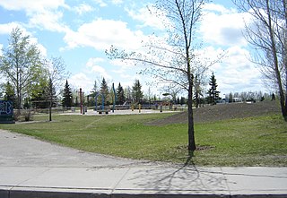
Meadowgreen is a neighbourhood located on the west side of the city in the Confederation Suburban Development Area in the city of Saskatoon, Saskatchewan, Canada. Meadowgreen is surrounded by an abundance of green space and walking trails without being a River side neighbourhood. The buffer zone along Circle Drive has a newly created walking trail. The southern buffer zone along 11th Street connects to the east with Fred Mendel Park of the Pleasant Hill neighbourhood and to the west with the off leash dog run located in the Confederation Suburban Centre neighbourhood. As well the newly re-located Meadowgreen Park and Peter Pond Park provide leisure activities such as basketball courts and playgrounds. Within the Confederation SDA of Saskatoon, the neighborhood of Meadowgreen comprises the area south of 22nd Street, north of the buffer zone between 11th Street and Appleby Drive, east of Circle Drive, and west of Avenue W South. Until the 1990s the portion of the community north of 18th Street was considered part of the Pleasant Hill community until the City of Saskatoon reorganized its community boundaries.

Massey Place, is a geographically localised subdivision of the Confederation Suburban Development Area in the city of Saskatoon, Saskatchewan which is nestled around Archibald McDonald Park. Mcdonald Park is centrally located along the northern perimeter of 33rd Street East. The school yards of both Vincent Massey School and Bishop Klein School have their western boundaries along Archibald McDonald Park which has as its resources ball diamonds, soccer pitches, winter ice rinks, and playground facilities. Massey Place neighbourhood is close to amenities provided by both the commercial district of the Confederation Suburban Centre.

<span class="mw-page-title-main">College Park East, Saskatoon</span> Neighbourhood in Saskatoon, Saskatchewan, Canada

College Park East is a primarily residential neighbourhood located in the east-central part of Saskatoon, Saskatchewan, Canada. The majority of its residents live in single-family detached dwellings, with a sizeable minority of high-density, multiple-unit dwellings. As of 2006, the area is home to 4,809 residents. The neighbourhood is considered a middle-income area, with an average family income of $67,946, an average dwelling value of $314,000 and a home ownership rate of 67.2%.

<span class="mw-page-title-main">Wildwood, Saskatoon</span> City of Saskatoon neighbourhood in Saskatchewan, Canada

Wildwood is a primarily residential neighbourhood located in the southeast part of Saskatoon, Saskatchewan, Canada. It includes part of the 8th Street business district. The majority of its residents live in a townhouse or apartment-style multiple unit dwellings, with a sizeable minority of low-density, single detached dwellings. As of 2016, the area is home to 7,645 residents. The neighbourhood has an average family income of $37,770, a homeownership rate of 67.0% and an average home sale price of $300,327.

<span class="mw-page-title-main">Lakewood Suburban Centre, Saskatoon</span> Neighbourhood in Saskatoon, Saskatchewan, Canada

Lakewood Suburban Centre is a mixed-development neighbourhood located in southeast Saskatoon, Saskatchewan, Canada. It is a classified as a "suburban centre" subdivision, composed of mostly medium to high-density multiple-unit dwellings, commercial areas and civic facilities. As of 2011, the area is home to 1,850 residents. The neighbourhood is considered a middle-income area, with an average family income of $65,927, an average dwelling value of $227,522 and a home ownership rate of 76.8%.

<span class="mw-page-title-main">Briarwood, Saskatoon</span> Neighbourhood in Saskatoon, Saskatchewan, Canada

Briarwood is a residential neighbourhood located in the southeast part of Saskatoon, Saskatchewan, Canada. The majority of its residents live in low-density, single detached dwellings. As of 2009, the area is home to 4,473 residents. The neighbourhood is considered a very high-income area, with an average family income of $117,619, an average dwelling value of $449,158 and a home ownership rate of 97.0%.

<span class="mw-page-title-main">Lakeridge, Saskatoon</span> City of Saskatoon neighbourhood in Saskatchewan, Canada

Lakeridge is a residential neighbourhood located in the southeast part of Saskatoon, Saskatchewan, Canada. Almost all of its residents live in low-density, single detached houses. As of 2009, the area is home to 4,051 residents. The neighbourhood is considered an upper-income area, with an average family income of $127,698, an average dwelling value of $357,024 and a home ownership rate of 98.8%.

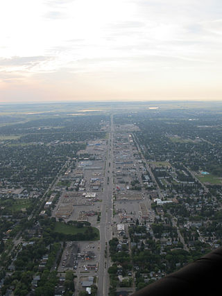
Fairhaven is a neighbourhood in Saskatoon, Saskatchewan, Canada, located towards the west end of the city, south of 22nd Street and west of Circle Drive.

<span class="mw-page-title-main">Blairmore SDA, Saskatoon</span> Place in Saskatchewan, Canada

Blairmore Suburban Development Area (SDA) is an area in Saskatoon, Saskatchewan (Canada). It is a part of the west side community of Saskatoon. It lies (generally) north of the outskirts of the City and the Rural Municipality of Corman Park No. 344, west of downtown Saskatoon, and the Core Neighbourhoods SDA, south of the North West Industrial SDA, and west of the Confederation SDA. Most of the Blairmore SDA consists of undeveloped land annexed by the city in the mid-2000s. A total of nine neighbourhoods, primarily residential in nature, are ultimately planned for the SDA. As of late 2019, two are in the process of development: the commercial/residential Blairmore Suburban Centre and the residential community Kensington. A third residential area, Elk Point, is also in its early stages.

<span class="mw-page-title-main">Blairmore Suburban Centre, Saskatoon</span> City of Saskatoon Neighbourhoods in Saskatchewan, Canada

The Blairmore Suburban Centre is a community service/commercial/residential community currently under development in western Saskatoon, Saskatchewan. It is part of the city's Blairmore Suburban Development Area, a large region annexed from the Rural Municipality of Corman Park No. 344 in 2005. Ultimately, the SDA will consist of seven new neighbourhoods, plus the Blairmore Suburban Centre, which is the first component of the SDA to be developed.

<span class="mw-page-title-main">8th Street East (Saskatoon)</span> Road in Saskatoon, Saskatchewan

8th Street East is an arterial road serving the city of Saskatoon, Saskatchewan. It begins as a continuation of a minor residential street at Lorne Avenue in Saskatoon, and runs through the eastern part of city, eventually exiting the city limits as a country road.

<span class="mw-page-title-main">Lakeview, Saskatoon</span> City of Saskatoon neighbourhood in Saskatchewan, Canada

Lakeview is a primarily residential neighbourhood located in the southeast part of Saskatoon, Saskatchewan, Canada. The majority of its residents live in low-density, single detached dwellings, with a sizeable minority of semi-detached or apartment-style multiple unit dwellings. As of 2011, the area is home to 7,732 residents. The neighbourhood is considered a high income area, with an average family income of $120,042, an average dwelling value of $277,070 and a home ownership rate of 71.0%. It was the first community in Saskatoon to feature a man-made lake amenity.

<span class="mw-page-title-main">Avalon, Saskatoon</span> Neighbourhood in Saskatoon, Saskatchewan, Canada

Avalon is a mostly residential neighbourhood located in south-central Saskatoon, Saskatchewan, Canada. It is a suburban subdivision, consisting mostly of low-density, single detached dwellings. As of 2007, the area is home to 3,214 residents. The neighbourhood is considered a middle-income area, with an average family income of $65,000, an average dwelling value of $168,444 and a home ownership rate of 77.3%.

<span class="mw-page-title-main">Richmond Heights, Saskatoon</span> Neighbourhood in Saskatoon, Saskatchewan, Canada

Richmond Heights, adjacent to the South Saskatchewan River, features walking trails in the Meewasin Valley. G.D. Archibald Park North hosts baseball and soccer games. Luther Heights is a Luther care community for those aged 60 and over. In 2006, 73.5% of the residents owned their own home; the average home size was 2.3 residents.

Pacific Heights is geographically located in north west Saskatoon. The main construction boom for this community was the 1970s, during which the City of Saskatoon annexed the land. Following elementary school, students usually attend Tommy Douglas Collegiate or Bethlehem Catholic High School on Bowlt Crescent a part of Blairmore SDA community. According to MLS data, the average sale price of a home as of 2013 was $279,500.

<span class="mw-page-title-main">Forest Grove, Saskatoon</span> Neighbourhood in Saskatoon, Saskatchewan, Canada

Forest Grove is a primarily residential neighbourhood located in northeast Saskatoon, Saskatchewan, Canada. It is mostly made up of low-density single detached dwellings, with a sizeable minority of multiple-unit apartment dwellings. As of 2011, the area is home to 5,907 residents. The neighbourhood is considered a middle-income area, with an average family income of $70,487, an average dwelling value of $246,680 and a home ownership rate of 62.4%.

<span class="mw-page-title-main">Stonebridge, Saskatoon</span> Neighbourhood in Saskatoon, Saskatchewan, Canada

Stonebridge is a mostly residential neighbourhood located in south-central Saskatoon, Saskatchewan, Canada. It is a suburban subdivision, consisting of low-density, single detached dwellings and a mix of medium-density apartment and semi-detached dwellings. As of 2009, the area is home to 994 residents. The neighbourhood is considered a middle-income area, with an average family income of $67,642, an average dwelling value of $321,004 and a home ownership rate of 72.4%.

Agriplace is an industrial park located in the North Industrial SDA Suburban Development Area of Saskatoon, Saskatchewan. Industrial parks are usually located close to transport facilities, especially where more than one transport modalities coincide. Sk Hwy 16, the Yellowhead, Sk Hwy 11, and Sk Hwy 11 are all accessed directly from Agriplace. The Saskatoon John G. Diefenbaker International Airport is southwest of the Sk Hwy 16, the Yellowhead highway.

Holmwood Suburban Development Area (SDA) is an area in Saskatoon, Saskatchewan (Canada). It is a part of the east side community of Saskatoon. It lies at the far east end of the city boundaries with the Rural Municipality of Corman Park No. 344. The area was annexed by the city on August 1, 2010 and the SDA development plan was approved on April 16, 2012. Land preparation worked started in 2012. Prior to development into a SDA the area was predominantly agricultural land and also housed the Sundown Drive-in that operated off Highway 5 from 1963.

<span class="mw-page-title-main">Aspen Ridge, Saskatoon</span> Neighbourhood in Saskatoon, Saskatchewan, Canada

Aspen Ridge is a neighbourhood located in northeast Saskatoon, Saskatchewan, Canada, construction on which began in 2014. At full build-out, Aspen Ridge will eventually house an estimated 13,000 people. Unlike many of the city's suburban neighbourhoods, it will feature higher density housing on a grid network of roads.

References

  1. Populace Spring 2006, vol. 8, City of Saskatoon - City Planning Branch, Spring 2006, p. 5
  2. Nickel, Rod (May 14, 2008). "New subdivision presents challenges". Archived from the original on November 7, 2012. Retrieved 2009-09-10.
  3. "Rosewood" (PDF). City of Saskatoon. January 2010. Retrieved 2010-09-09.
  4. 1 2 3 4 5 "Rosewood Neighbourhood Concept Plan" (PDF). UMA Engineering Ltd. October 17, 2007. Retrieved 2010-09-09.
  5. Steuart, Tim; Shall Lam; Katherine Whiting (2007-06-17). "Open House Rosewood Neighbourhood Open House". Saskatoon Sun. CanWest. p. 21.
  6. "Saskatoon street could be named after Shannon Tweed". CBC News. June 28, 2011. Retrieved September 7, 2013.
  7. David Hutton (June 29, 2011). "Tweed Lane new jewel on city map". The StarPhoenix. Archived from the original on December 3, 2013. Retrieved September 7, 2013.
  8. Biber, François (2014-03-27). "Saskatoon city planners happy with perimeter highway review". News Talk 650 CKOM. Rawlco Communications . Retrieved 2014-03-27.
  9. Current Members of Parliament , retrieved 2017-04-16
  10. Legislative Assembly of Saskatchewan - Members of the Legislative Assembly , retrieved 2017-04-16
  11. City Councillors - Saskatoon.ca , retrieved 2017-04-16
  12. 1 2 Active List of Saskatchewan Schools/Programs (PDF), retrieved 2018-02-10
  13. "Province announces plan to build 9 new schools using P3". CBC News. 2013-10-22. Retrieved 2013-10-22.
  14. "New Catholic schools get names". StarPhoenix. 2015-06-23. Archived from the original on 2015-07-05. Retrieved 2015-07-01.
  15. Giles, David (2016-10-12). "Saskatoon Board of Education decides on names for new elementary schools - Saskatoon". Global News. Retrieved 2017-07-13.
  16. "Joint-Use Schools Project - PreK-12 Education, Early Learning, and Schools". Government of Saskatchewan. Retrieved 2017-07-13.
  17. "Rosewood" (PDF). 9th Edition Neighbourhood Profiles. City of Saskatoon - City Planning Branch. 2012. Retrieved 2012-08-14.[ permanent dead link ]
  18. City of Saskatoon Boychuck Drive and Highway 16 Interchange Project