
Sutherland is a mostly residential neighbourhood located in east-central Saskatoon, Saskatchewan, Canada. It is an older suburban subdivision, composed of a near-even mix of single-family detached houses and multiple-unit apartment and semi-detached dwellings. As of 2006, the area was home to 5,206 residents. The neighbourhood is a middle-income area, with an average family income of $51,857, an average dwelling value of $204,213 and a home ownership rate of 43.8%. According to MLS data, the average sale price of a home as of 2013 was $288,651. Sutherland was administered as a separate town outside of Saskatoon before being annexed by the city in 1956.

Meadowgreen is a neighbourhood located on the west side of the city in the Confederation Suburban Development Area in the city of Saskatoon, Saskatchewan, Canada. Meadowgreen is surrounded by an abundance of green space and walking trails without being a River side neighbourhood. The buffer zone along Circle Drive has a newly created walking trail. The southern buffer zone along 11th Street connects to the east with Fred Mendel Park of the Pleasant Hill neighbourhood and to the west with the off leash dog run located in the Confederation Suburban Centre neighbourhood. As well the newly re-located Meadowgreen Park and Peter Pond Park provide leisure activities such as basketball courts and playgrounds. Within the Confederation SDA of Saskatoon, the neighborhood of Meadowgreen comprises the area south of 22nd Street, north of the buffer zone between 11th Street and Appleby Drive, east of Circle Drive, and west of Avenue W South. Until the 1990s the portion of the community north of 18th Street was considered part of the Pleasant Hill community until the City of Saskatoon reorganized its community boundaries.
North Industrial Suburban Development Area (SDA) is located in the province's hub city, Saskatoon, Saskatchewan, Canada. Lower provincial corporate tax rates, no more provincial capital tax, and industrial lease and purchase rates which have stabilized very competitively with neighboring provinces have produced a demand for industrial property which exceeds supply. North Saskatoon Business Association (NSBA) promotes business interests in the Northern Industrial sector of Saskatoon.
Lawson Suburban Development Area (SDA) is an area in Saskatoon, Saskatchewan (Canada). It is a part of the west side community of Saskatoon. It lies (generally) south of the outskirts of the North West Industrial SDA, west of the South Saskatchewan River and the University Heights SDA, north of the Core Neighbourhoods SDA, and east of the North West Industrial SDA.

University Heights Suburban Development Area (SDA) is an area in Saskatoon, Saskatchewan (Canada). It is a part of the east side community of Saskatoon. It lies (generally) south of the outskirts of the City and the Rural Municipality of Corman Park No. 344, east of the South Saskatchewan River, and Lawson SDA, north of the Lakewood SDA, and Nutana SDA.

Kelsey-Woodlawn is a combination of industrial park nestled between the North West Industrial SDA and the Central Industrial of down town Saskatoon. It is still serviced by the CNR rail lines to both the north and east. There are two older neighbourhoods, one still survives near SIAST - Kelsey institute on Idylwyld Drive North, and the other is the McVicar Addition near the Woodlawn Cemetery. According to MLS data, the average sale price of a home as of 2013 was $232,279.

Adelaide/Churchill is a mostly residential neighbourhood located in south-central Saskatoon, Saskatchewan, Canada. It is a suburban subdivision, consisting mostly of low-density, single detached dwellings. As of 2009, the area is home to 3,445 residents. The neighbourhood is considered a middle-income area, with an average family income of $78,438, an average dwelling value of $287,976 and a home ownership rate of 90.3%. According to MLS data, the average sale price of a home as of 2013 was $350,096.

Avalon is a mostly residential neighbourhood located in south-central Saskatoon, Saskatchewan, Canada. It is a suburban subdivision, consisting mostly of low-density, single detached dwellings. As of 2007, the area is home to 3,214 residents. The neighbourhood is considered a middle-income area, with an average family income of $65,000, an average dwelling value of $168,444 and a home ownership rate of 77.3%. According to MLS data, the average sale price of a home as of 2013 was $352,359.
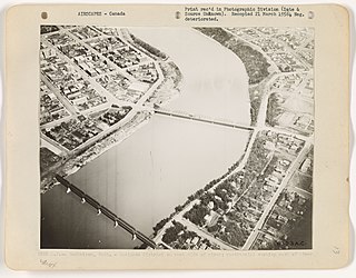
The history of Saskatoon began with the first permanent settlement of Saskatoon, Saskatchewan, Canada, in 1883 when Toronto Methodists, wanting to escape the liquor trade in that city, decided to set up a "dry" community in the rapidly growing prairie region. As of 1882 this area was a part of the provisional district named Saskatchewan, North-West Territories. Their organization, the Temperance Colonization Society, first examined this area in 1882 and found that it would make an excellent location to found their community based on the ideals of the temperance movement. The settlers, led by John Neilson Lake, arrived on the site of what is now Saskatoon by traveling by railway from Ontario to Moose Jaw, Saskatchewan, and then completing the final leg via horse-drawn cart. The plan for the Temperance Colony soon failed as the group was unable to obtain a large block of land within the community. Nonetheless, John Lake is commonly identified as the founder of Saskatoon; a public school, a park and two streets are named after him.

Greystone Heights is a mostly residential neighbourhood located in east-central Saskatoon, Saskatchewan, Canada. It is a suburban subdivision, consisting mostly of low-density, single detached dwellings and a sizeable minority of apartment-style multiple-unit dwellings. As of 2007, the area is home to 2,525 residents. The neighbourhood is considered a middle-income area, with an average family income of $58,811, an average dwelling value of $241,850 and a home ownership rate of 58.1%. According to MLS data, the average sale price of a home as of 2013 was $338,763.

Richmond Heights, adjacent to the South Saskatchewan River, features walking trails in the Meewasin Valley. G.D. Archibald Park North hosts baseball and soccer games. Luther Heights is a Luther care community for those aged 60 and over. In 2006, 73.5% of the residents owned their own home. The average home size was 2.3 residents.Statistics c2006 - According to MLS data, the average sale price of a home as of 2013 was $362,063.

Parkridge is a residential community in western Saskatoon, Saskatchewan, located on land annexed by the city between 1975 and 1979. Development of the subdivision, began in the early 1980s. The extreme west end of the neighbourhood remained undeveloped until the subsequent creation of the adjacent Blairmore Suburban Centre led to the final phase of Parkridge being built out in the early 2010s. Whereas the majority of residents are employed in the sales and service sector, the next highest employer is business, finance and administration. The two main age groups are those in their 40s and teenagers as of 2005. Until recently Parkridge was the farthest western neighbourhood of Saskatoon south of 22nd Street. However, new construction will soon see Neighbourhood 2 of the Blairmore SDA bear that claim to fame. In comparison, the neighbourhood of Parkridge with a 2001 census population of 4,505 is larger than the Saskatchewan city of Melville which had a population of 4,149 in 2006, and 4,453 in 2001 and Parkridge is a little smaller than the provincial city of Humboldt which was 4,998 in 2006, and 5,161 in 2001. In Saskatchewan rural towns must maintain a population above 5,000 to apply for city status. According to MLS data, the average sale price of a home as of 2013 was $327,072.

Rosewood is a primarily residential neighbourhood under construction in southeast Saskatoon, Saskatchewan, Canada. The majority of its residents live in single detached dwellings. In 2011, the area was home to 73 residents. In early 2015 there were approximately 900 occupied residences. The neighbourhood is considered a high-income area, with an average family income of $104,964, and a home ownership rate of 93.3%. According to MLS data, the average sale price of a home as of 2013 was $442,316.

Stonebridge is a mostly residential neighbourhood located in south-central Saskatoon, Saskatchewan, Canada. It is a suburban subdivision, consisting of low-density, single detached dwellings and a mix of medium-density apartment and semi-detached dwellings. As of 2009, the area is home to 994 residents. The neighbourhood is considered a middle-income area, with an average family income of $67,642, an average dwelling value of $321,004 and a home ownership rate of 72.4%. According to MLS data, the average sale price of a home as of 2013 was $380,777.

The Willows Residential Community and Golf Club, is a residential community in the Nutana Suburban Development Area in the city of Saskatoon, Saskatchewan. The Willows is south of Circle Drive which is concurrent with Saskatchewan Highway 16. Its northern boundary is the CN Rail line and the former Cartwright Street right-of-way ; to the east is Clarence Avenue and to the west is Lorne Avenue. The 36-hole Willows Golf & Country Club winds its way around the subdivision which when construction of homes began in 2004 became the city's first golf course community. Home construction began almost immediately after the land for the subdivision and the golf course was annexed from the rural municipality of Corman Park No. 344, Saskatchewan. The golf course, however, had been in operation for more than a decade before residential development began. According to MLS data, the average sale price of a home as of 2013 was $824,493.

Silverwood Heights is a mostly residential neighbourhood located in north-central Saskatoon, Saskatchewan, Canada. It is a suburban subdivision, composed mostly of single detached dwellings and some multiple-unit apartment and semi-detached dwellings. As of 2009, the area is home to 10,786 residents. The neighbourhood is considered a middle to high-income area, with an average family income of $93,772, an average dwelling value of $324,547 and a home ownership rate of 78.8%. According to MLS data, the average sale price of a home as of 2013 was $399,760. By land area and population, Silverwood Heights is the largest subdivision in Saskatoon.

Sutherland Industrial is an industrial subdivision located in east-central Saskatoon, Saskatchewan, Canada. It was originally part of Sutherland, a town outside of Saskatoon before being annexed by the city in 1956. The subdivision also contains the first urban reserve in Saskatchewan, the Muskeg Lake Cree Nation.

The CN Industrial Area is the industrial subdivision located in southern Saskatoon. It is also known as South Saskatoon, after the CN rail siding located in the area. It is a part of the Nutana Suburban Development Area. This industrial park was established with the Grand Trunk Pacific Railway crossing the South Saskatchewan River.
Agriplace is an industrial park located in the North Industrial SDA Suburban Development Area of Saskatoon, Saskatchewan. Industrial parks are usually located close to transport facilities, especially where more than one transport modalities coincide. Sk Hwy 16, the Yellowhead, Sk Hwy 11, and Sk Hwy 11 are all accessed directly from Agriplace. The Saskatoon John G. Diefenbaker International Airport is southwest of the Sk Hwy 16, the Yellowhead highway.

Airport Business Area is an industrial park located in the North Industrial SDA Suburban Development Area of Saskatoon, Saskatchewan. Industrial parks are usually located close to transport facilities, especially where more than one transport modalities coincide. The Idylwyld Drive North, Sk Hwy 11 Louis Riel Trail, and Sk Hwy 12 concurrency are all accessed directly from the Airport Business Area. The Saskatoon John G. Diefenbaker International Airport is north of the Airport Business Area. Circle Drive marks the southern boundary, with access to SK Hwy 14 and Sk Hwy 16, the Yellowhead Trans Canada.