The Blairmore Suburban Centre is a community service/commercial/residential community currently under development in western Saskatoon, Saskatchewan. It is part of the city's Blairmore Suburban Development Area, a large region annexed from the Rural Municipality of Corman Park No. 344 in 2005. Ultimately, the SDA will consist of seven new neighbourhoods, plus the Blairmore Suburban Centre, which is the first component of the SDA to be developed.
The suburban centre lies south of 22nd Street West, which is also Saskatchewan Highway 14. Saskatchewan Highway 7 forms the area's western boundary as it links to the site of a proposed interchange at 22nd Street; prior to 2012, however, the highway was temporarily aligned with Betts Avenue within the suburban centre until a new roadway was later constructed. The community also dovetails with the final phase of construction of the adjacent Parkridge community to the south. At present, the suburban centre consists of two high schools Tommy Douglas Collegiate and Bethlehem High School, plus a recreation/civic centre named Shaw Centre which opened the fall of 2008.; the three facilities are unique in Saskatoon as they are the first to be physically connected as one large building, allowing sharing of recreation amenities.
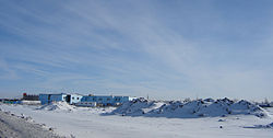
Construction in the Blairmore Suburban Centre, Blairmore SDAConstruction in the Blairmore Suburban Centre, Blairmore SDA
Recreation facilities
Shaw Centre (formerly known as Blairmore Civic Centre) on Bowlt Crescent opened in the fall of 2008 and includes a track and 10, 7.5, 5, & 3 metre platform and springboard diving with 10 lane 50 metre competitive high performance swimming pool and 6 lane warm up pool[3] It is physically connected to the area's two high schools.
Shopping
A major big-box development is located west of Betts Avenue and south of 22nd Street, featuring a Wal-Mart and other retailers including Sally Beauty Supply, Bulk Barn, Jump.ca, Subway, Pennington's, Reitman, Sleep Country, and the Royal Bank.
Additional strip-mall and hotel development exists east of Betts Avenue, as well. The hotels being built includes some of the first new accommodations to be constructed on the west side of the city in decades.
Approximately 315,000 square feet (29,300m2) of retail is expected to be ultimately constructed in Blairmore SDA[4] It is not known how much of this is earmarked for the Suburban Centre itself.
The suburban centre is located a few kilometres west of the main 22nd Street commercial hub at Circle Drive.
Hotels: Best Western Plus
Additional retail is located off 22nd Street in adjacent Kensington.
There is a Boston Pizza, Dollorama, Staples, Montana's, and Wok Box
In Saskatoon's non-partisan municipal politics, Blairmore Suburban Centre lies within ward 3. It is currently represented by Ann Iwanchuk, first elected in 2011.[6]
Education
The area's two high schools are connected together by way of the Shaw Centre recreation complex.[7]
Much of the SC is being constructed on the former alignment of Highway 7; the highway wsd temporarily rerouted along Betts Avenue to Hwy 14/22nd Street. A permanent realignment, farther to the west, was put in place in 2012, with an interchange planned at the junction of Hwys 7 and 14.
Public Transit to the area began on August 31, 2008. Route 23 to Hampton Place runs Monday to Friday at a 30-minute frequency during peak hours, and a 60-minute frequency during midday hours. There is no evening or weekend service.
This page is based on this Wikipedia article Text is available under the CC BY-SA 4.0 license; additional terms may apply. Images, videos and audio are available under their respective licenses.