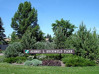
Sidney Labe Buckwold, was a Canadian politician, soldier, and businessman. Buckwold served as a Senator for 20 years and as mayor of Saskatoon, Saskatchewan, for 11 years in two separate tenures.

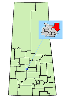
Saskatoon Silver Springs was a provincial electoral district for the Legislative Assembly of Saskatchewan, Canada. The district included the neighbourhoods of Silverspring, Forest Grove, Evergreen, Willowgrove, Erindale and Arbor Creek.
Lawson Suburban Development Area (SDA) is an area in Saskatoon, Saskatchewan (Canada). It is a part of the west side community of Saskatoon. It lies (generally) south of the outskirts of the North West Industrial SDA, west of the South Saskatchewan River and the University Heights SDA, north of the Core Neighbourhoods SDA, and east of the North West Industrial SDA.

University Heights Suburban Development Area (SDA) is an area in Saskatoon, Saskatchewan (Canada). It is a part of the east side community of Saskatoon. It lies (generally) south of the outskirts of the City and the Rural Municipality of Corman Park No. 344, east of the South Saskatchewan River, and Lawson SDA, north of the Lakewood SDA, and Nutana SDA.

The Central Business District is one of seven development districts in Saskatoon, Saskatchewan, Canada. The central business district is Ward 6 of a Mayor-Council government represented by councillor Cynthia Block. Formerly called West Saskatoon, this area arose when the steam engines built their pumping stations on the lower west bank of the South Saskatchewan River. Retail enterprises sprang up around the newly created train station and rail yards. The city of Saskatoon's Central Business District has shopping malls and boutiques.

Grosvenor Park is a mostly residential neighbourhood located in east-central Saskatoon, Saskatchewan, Canada. It is a suburban subdivision, composed of a near-even mix of low-density, single detached dwellings and apartment-style units. As of 2006, the area is home to 1,645 residents. The neighbourhood is considered an upper-income area, with an average family income of $67,544, an average dwelling value of $329,988 and a home ownership rate of 44.8%.

Lawson Heights is a residential neighbourhood located in northern Saskatoon, Saskatchewan, which was developed beginning in the late 1970s.

College Park East is a primarily residential neighbourhood located in the east-central part of Saskatoon, Saskatchewan, Canada. The majority of its residents live in single-family detached dwellings, with a sizeable minority of high-density, multiple-unit dwellings. As of 2006, the area is home to 4,809 residents. The neighbourhood is considered a middle-income area, with an average family income of $67,946, an average dwelling value of $314,000 and a home ownership rate of 67.2%.

Eastview is a mostly residential neighbourhood located in south-central Saskatoon, Saskatchewan, Canada. It is a suburban subdivision, consisting of low-density, single detached dwellings, low-rise apartment buildings and semi-detached houses. As of 2007, the area is home to 3,566 residents. The neighbourhood is considered a middle-income area, with an average family income of $58,703, an average dwelling value of $260,050 and a home ownership rate of 51.6%.

Briarwood is a residential neighbourhood located in the southeast part of Saskatoon, Saskatchewan, Canada. The majority of its residents live in low-density, single detached dwellings. As of 2009, the area is home to 4,473 residents. The neighbourhood is considered a very high-income area, with an average family income of $117,619, an average dwelling value of $449,158 and a home ownership rate of 97.0%.

Erindale is a primarily residential neighbourhood located in northeast Saskatoon, Saskatchewan, Canada. It is mostly made up of low-density single detached dwellings. As of 2011, the area is home to 4,338 residents. The neighbourhood is considered a high-income area, with an average family income of $123,336, an average dwelling value of $340,990 and a home ownership rate of 95.3%.

Holiday Park is a neighbourhood in south-central Saskatoon, Saskatchewan. Located within Saskatoon's Ward 2, Councillor Hilary Gough represents the area's interests at City Hall.
Fairhaven is a neighbourhood in Saskatoon, Saskatchewan, Canada, located towards the west end of the city, south of 22nd Street and west of Circle Drive.

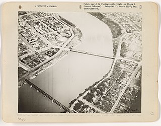
The history of Saskatoon began with the first permanent non-indigenous settlement of Saskatoon, Saskatchewan, Canada, in 1883 when Toronto Methodists, wanting to escape the liquor trade in that city, decided to set up a "dry" community in the rapidly growing prairie region. As of 1882 this area was a part of the provisional district named Saskatchewan, North-West Territories (NWT). Their organization, the Temperance Colonization Society, first examined this area in 1882 and found that it would make an excellent location to found their community based on the ideals of the temperance movement. The settlers, led by John Neilson Lake, arrived on the site of what is now Saskatoon by traveling by railway from Ontario to Moose Jaw, Assiniboia, NWT, and then completing the final leg via horse-drawn cart. The plan for the Temperance Colony soon failed as the group was unable to obtain a large block of land within the community. Nonetheless, John Lake is commonly identified as the founder of Saskatoon; a public school, a park and two streets are named after him.
Pacific Heights is geographically located in north west Saskatoon. The main construction boom for this community was the 1970s, during which the City of Saskatoon annexed the land. Following elementary school, students usually attend Tommy Douglas Collegiate or Bethlehem Catholic High School on Bowlt Crescent a part of Blairmore SDA community. According to MLS data, the average sale price of a home as of 2013 was $279,500.

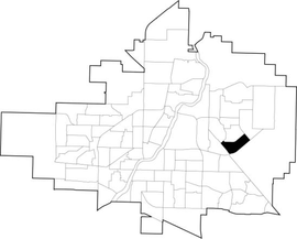
Willowgrove is a primarily residential neighbourhood located in the eastside of Saskatoon, Saskatchewan, Canada. It comprises a mix of mainly single-family detached houses and fewer multiple-unit dwellings. As of 2011, the area is home to 3,973 residents. The neighbourhood is considered a middle to high-income area, with an average family income of $96,002, an average dwelling value of $218,357 and a home ownership rate of 84.8%.

University Heights Suburban Centre is a mixed-development neighbourhood located in northeast Saskatoon, Saskatchewan, Canada. It is a classified as a "suburban centre" subdivision, composed of medium to high-density multiple-unit dwellings, commercial areas and civic facilities. As of 2009, the area is home to 1,479 residents. The neighbourhood is considered a middle-income area, with an average family income of $69,219, an average dwelling value of $237,698 and a home ownership rate of 85.7%.According to MLS data, the average sale price of a home as of 2013 was $304,903.
Westview is a suburban community in the Confederation Suburban Development Area (SDA) of Saskatoon, Saskatchewan. Originally named "Tuxedo Park" by real estate developers in 1912, the area remained undeveloped until the 1960s. The east half of Westview is located on land annexed by the city in 1911, while the western half did not become part of Saskatoon until 1960.

Evergreen is a residential neighbourhood under construction within the University Heights Suburban Development Area of Saskatoon, Saskatchewan. The residential area is constructed around the village centre and a larger district village. The subdivision was created in 2010. Evergreen is projected to have a density of 8.6 units per acre, becoming one of the densest neighbourhoods in Saskatoon when complete.


