
Sutherland is a mostly residential neighbourhood located in east-central Saskatoon, Saskatchewan, Canada. It is an older suburban subdivision, composed of a near-even mix of single-family detached houses and multiple-unit apartment and semi-detached dwellings. As of 2006, the area was home to 5,206 residents. The neighbourhood is a middle-income area, with an average family income of $51,857, an average dwelling value of $204,213 and a home ownership rate of 43.8%. According to MLS data, the average sale price of a home as of 2013 was $288,651. Sutherland was administered as a separate town outside of Saskatoon before being annexed by the city in 1956.
Nutana Suburban Development Area (SDA) is an area in Saskatoon, Saskatchewan (Canada). It is a part of the east side community of Saskatoon, and should not be confused with Nutana, one of the neighbourhoods within the Core Neighbourhoods SDA. It lies (generally) north of the outskirts of the City and the Rural Municipality of Corman Park No. 344, west of Lakewood SDA, south of the Core Neighbourhoods SDA SDA and University Heights SDA, and east of the South Saskatchewan River and Confederation SDA.

Varsity View is a mostly residential neighbourhood located near central Saskatoon, Saskatchewan, Canada. It is immediately south of the University of Saskatchewan campus. It is an older suburban subdivision, comprising a mixture of low-density, single detached dwellings, detached duplexes and apartment-style units. As of 2007, the area is home to 3,611 residents. The neighbourhood is considered a middle-income area, with an average family income of $50,587, an average dwelling value of $284,710 and a home ownership rate of 38.7%. Its proximity to the university gives this area its relatively high student population, almost 25% in 2005.

Buena Vista is a residential neighbourhood located near the centre of Saskatoon, Saskatchewan, Canada. It is an older suburban subdivision, including mostly low-density, single detached dwellings. As of 2011, the area is home to 3,271 residents. The neighbourhood is considered a middle-income area, with an average family income of $67,170, an average dwelling value of $251,560 and a home ownership rate of 77.7%.

Kelsey-Woodlawn is a combination of industrial park nestled between the North West Industrial SDA and the Central Industrial of down town Saskatoon. It is still serviced by the CNR rail lines to both the north and east. There are two older neighbourhoods, one still survives near SIAST - Kelsey institute on Idylwyld Drive North, and the other is the McVicar Addition near the Woodlawn Cemetery.

The Exhibition subdivision of Saskatoon, Saskatchewan, Canada, is located on the banks of the South Saskatchewan River and was developed between the two major World Wars. To the west is the Diefenbaker Management Area which boasts the Diefenbaker park and Pioneer Cemetery. The park includes a medium-sized hill which is used for tobogganing and snowboarding, and the park itself is a frequently-used venue for picnics and public events and performances. The Exhibition community is also known as Thornton, after a (now-demolished) public elementary school that formerly served the area and early in its history also went by the name Bellevue.

Adelaide/Churchill is a mostly residential neighbourhood located in south-central Saskatoon, Saskatchewan, Canada. It is a suburban subdivision, consisting mostly of low-density, single detached dwellings. As of 2009, the area is home to 3,445 residents. The neighbourhood is considered a middle-income area, with an average family income of $78,438, an average dwelling value of $287,976 and a home ownership rate of 90.3%.

Avalon is a mostly residential neighbourhood located in south-central Saskatoon, Saskatchewan, Canada. It is a suburban subdivision, consisting mostly of low-density, single detached dwellings. As of 2007, the area is home to 3,214 residents. The neighbourhood is considered a middle-income area, with an average family income of $65,000, an average dwelling value of $168,444 and a home ownership rate of 77.3%.
Hudson Bay Industrial Saskatoon, Saskatchewan, is in the Northwest section of the North West Industrial SDA. Now named Hudson Bay Industrial, in the early days of the Saskatoon's history, the area between 56th Street and 60th Street was originally to have been Swastika Park. Until the late 1990s, the area was part of the North Industrial subdivision until the City of Saskatoon redesignated the lands north of 51st Street and south of 60th Street with this new name. Hudson Bay Industrial subdivision consists primarily of industrial and retail development.

Dundonald is a neighbourhood located in the northwest corner of Saskatoon, Saskatchewan. The neighbourhood was built in the 1980s, and served as the last development of the northwest corner of the city, prior to the development of Hampton Village. Dundonald is surrounded by a large landscaped park, with a storm pond. In comparison, the neighbourhood of Dundonald with a 2001 census population of 5,285 is larger than the Saskatchewan city of Melville which had a population of 4,149 in 2006, and 4,453 in 2001 and Dundonald is also larger than the provincial city of Humboldt which was 4,998 in 2006, and 5,161 in 2001. In Saskatchewan rural towns must maintain a population above 5,000 to apply for city status.
Pacific Heights is geographically located in north west Saskatoon. The main construction boom for this community was the 1970s, during which the City of Saskatoon annexed the land. Following elementary school, students usually attend Tommy Douglas Collegiate or Bethlehem Catholic High School on Bowlt Crescent a part of Blairmore SDA community. According to MLS data, the average sale price of a home as of 2013 was $279,500.

Nutana Park is a mostly residential neighbourhood located in south-central Saskatoon, Saskatchewan, Canada. It is a suburban subdivision, consisting mostly of low-density, single detached dwellings. As of 2007, the area is home to 2,748 residents. The neighbourhood is considered a middle-income area, with an average family income of $66,555, an average dwelling value of $257,789 and a home ownership rate of 85.1%. According to MLS data, the average sale price of a home as of 2013 was $356,116.

Stonebridge is a mostly residential neighbourhood located in south-central Saskatoon, Saskatchewan, Canada. It is a suburban subdivision, consisting of low-density, single detached dwellings and a mix of medium-density apartment and semi-detached dwellings. As of 2009, the area is home to 994 residents. The neighbourhood is considered a middle-income area, with an average family income of $67,642, an average dwelling value of $321,004 and a home ownership rate of 72.4%.

Circle Drive is a major road constructed as a ring road in Saskatoon, Saskatchewan, Canada. Its route constitutes both part of the Yellowhead Highway and Highway 11, signed as both along the entire length. It was first conceived in 1913 by the city commissioner and completed exactly 100 years later in 2013. Most of the route is a fully-controlled access freeway, however the segment between Airport Drive and Millar Avenue has at-grade intersections.

The CN Industrial Area is the industrial subdivision located in southern Saskatoon. It is also known as South Saskatoon, after the CN rail siding located in the area. It is a part of the Nutana Suburban Development Area. This industrial park was established with the Grand Trunk Pacific Railway crossing the South Saskatchewan River.
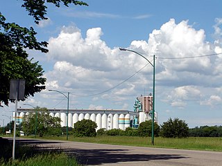
Marquis Industrial is an industrial park located in the North Industrial SDA Suburban Development Area of Saskatoon, Saskatchewan. Industrial parks are usually located close to transport facilities, especially where more than one transport modalities coincide. Sk Hwy 11, and Sk Hwy 12 are all accessed directly from Marquis Industrial. The Saskatoon John G. Diefenbaker International Airport is west of the Sk Hwy 11 Sk Hwy 12 concurrency along Idylwyld Drive.
AgPro Industrial is a small industrial subdivision located in west Saskatoon, Saskatchewan, Canada. Located in the Confederation SDA along 11th Street West and nestled between the residential communities of Fairhaven and Montgomery Place. 11th Street provides direct access to Saskatchewan Highway 7 and the newly completed Circle Drive.

The Confederation Park subdivision of Saskatoon, Saskatchewan, Canada, is located west of the South Saskatchewan River, Saskatoon's west side.

South West Industrial, also known as Holiday Park Industrial and labelled SEDCO Industrial on city maps of the 1980s and 1990s, is an industrial subdivision located in the Confederation SDA in southwest Saskatoon, Saskatchewan, Canada.

Grasswood, also known as Grasswood Park, is an unincorporated hamlet in Saskatchewan. It is part of the Corman Park rural municipality and is located just south of the city limits of Saskatoon. A second unincorporated hamlet, Furdale, is directly to the west.


