Seventeen Seventy, sometimes inaccurately written as 1770 or Town of 1770, is a coastal town and locality in the Gladstone Region, Queensland, Australia. In the 2016 census, the locality of Seventeen Seventy had a population of 69 people.

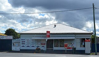
Miriam Vale is a rural town and locality in the Gladstone Region, Queensland, Australia. In the 2016 census, Miriam Vale had a population of 512 people.

Agnes Water is a coastal town and a locality in the Gladstone Region, Queensland, Australia. In the 2021 census, Agnes Water had a population of 2,729 people.

The Shire of Miriam Vale was a local government area near Gladstone in Queensland, Australia. The administrative centre was the town of Miriam Vale.

The Boyne Valley is a rural locality in Gladstone Region, Queensland, Australia. The locality contains four small towns: Nagoorin, Ubobo, Builyan, and Many Peaks. In the 2021 census, Boyne Valley had a population of 301 people.

Coolana is a rural locality in the Somerset Region, Queensland, Australia. In the 2021 census, Coolana had a population of 175 people.
Turkey Beach is a coastal town and locality in the Gladstone Region, Queensland, Australia. In the 2021 census, the locality of Turkey Beach had a population of 148 people.
Hodgson Vale is a rural locality in the Toowoomba Region, Queensland, Australia. In the 2016 census, Hodgson Vale had a population of 1,379 people.

Rosedale is a rural town and locality split between the Gladstone Region and the Bundaberg Region in central Queensland, Australia. In the 2016 census, the locality of Rosedale had a population of 438 people.
Eurimbula is a coastal rural locality in the Gladstone Region, Queensland, Australia. In the 2016 census, Eurimbula had a population of 4 people.

East End is a rural locality in the Gladstone Region, Queensland, Australia. In the 2016 census, East End had a population of 59 people.
Bracewell is a rural locality in the Gladstone Region, Queensland, Australia. In the 2016 census, Bracewell had a population of 196 people.

Bororen is a rural town and locality in the Gladstone Region, Queensland, Australia. In the 2016 census, Bororen had a population of 398 people.
Lowmead is a rural town and locality in the Gladstone Region, Queensland, Australia. In the 2021 census, the locality of Lowmead had a population of 179 people.
Baffle Creek is a rural locality in the Gladstone Region, Queensland, Australia. In the 2016 census Baffle Creek had a population of 156 people.
New Auckland is an urban locality in Gladstone in the Gladstone Region, Queensland, Australia. In the 2016 census, New Auckland had a population of 5,085 people. It is on the outskirts of the Gladstone urban area, but, as at December 2020, is experiencing high levels of suburban development.
Coal Creek is a rural locality in the Somerset Region, Queensland, Australia. In the 2021 census, Coal Creek had a population of 50 people.
Colosseum is a rural locality in the Gladstone Region, Queensland, Australia. In the 2016 census, Colosseum had a population of 218 people.
Westvale is a locality in the Somerset Region, Queensland, Australia. In the 2021 census, Westvale had a population of 0 people.
Kirkwood is a semi-rural locality in the Gladstone Region, Queensland, Australia. In the 2021 census Kirkwood had a population of 2,513 people.


