Chase County is a county in the U.S. state of Nebraska. As of the 2010 United States Census, the population was 3,966. Its county seat is Imperial.

The Pillsbury A-Mill is a former flour mill located on the east bank of the Mississippi River in Minneapolis, Minnesota. It was the world's largest flour mill for 40 years. Completed in 1881, it was owned by the Pillsbury Company and operated two of the most powerful direct-drive waterwheels ever built, each capable of generating 1,200 horsepower . In 1901 one of the turbines was replaced with a 2,500 horsepower one. Both the mill and its headrace tunnel are contributing resources to the St. Anthony Falls Historic District, which is on the National Register of Historic Places. The mill is also independently on the NRHP. The mill was named a National Historic Landmark in 1966 and has since been converted into resident artist lofts.

The National Register of Historic Places in the United States is a register including buildings, sites, structures, districts, and objects. The Register automatically includes all National Historic Landmarks as well as all historic areas administered by the U.S. National Park Service. Since its introduction in 1966, more than 90,000 separate listings have been added to the register.

Breakheart Reservation is a public recreation area covering 652 acres (264 ha) in the towns of Saugus and Wakefield, Massachusetts. The reservation features a hardwood forest, two freshwater lakes, a winding stretch of the Saugus River, and scenic views of Boston and rural New England from rocky hilltops. The park is managed by the Massachusetts Department of Conservation and Recreation.

The Tuthilltown Gristmill is located off Albany Post Road in Gardiner, New York, United States. It was built in 1788, as the National Register reports, and has been expanded several times since.

Enders is an unincorporated community and census-designated place in Chase County, Nebraska, United States. As of the 2010 census it had a population of 42. Although Enders is unincorporated, it has a post office, with the ZIP code of 69027.

Frenchman Creek is a spring-fed waterway that begins in Phillips County, Colorado, crosses Chase and Hayes counties in Nebraska and ends at its juncture with the Republican River in Hitchcock County, Nebraska. The length of the waterway is approximately 166 miles (267 km).

The Albers Brothers Milling Company building is a historic mill and contemporary office building located on the banks of the Willamette River in Portland, Oregon, United States. In the early decades of the 20th century, the German-immigrant Albers brothers built the largest flour and feed milling enterprise on the West Coast, headquartered in Portland and comprising operations in four states. This combined milling, warehousing, shipping, and office facility, built in 1909–1911, is the oldest remaining flour or feed mill in the city. The silos built into the south elevation of the building are painted with representations some of the mill's products as advertisements.

The Hadley Flour and Feed Mill is located at 3633 Hadley Road in rural Hadley Township in southwestern Lapeer County, Michigan. It was designated as a Michigan State Historic Site and also added to the National Register of Historic Places on September 25, 1986.

The Wolcott Mill is a grist and feed mill located at 63841 Wolcott Road in Ray Township, Michigan. It was listed on the National Register of Historic Places in 2009.

Enders Dam is a dam in Chase County, Nebraska, near the southwestern corner of the state.

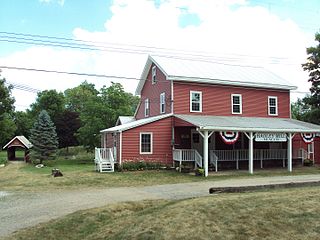
Hagood Mill is an operational water-powered gristmill built in 1845 by James Hagood near Pickens, South Carolina. It was listed in the National Register of Historic Places in 1972.

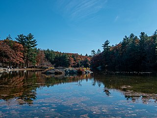
Hopeville Pond State Park is a public recreation area located on Hopeville Pond, an impoundment of the Pachaug River, in the town of Griswold, Connecticut. A portion of the 554-acre (224 ha) state park occupies the site of the lost village of Hopeville. The park manager's house occupies Avery House, which is listed on the National Register of Historic Places. The park offers fishing, swimming, camping, and trails for hiking and biking. It is managed by the Connecticut Department of Energy and Environmental Protection.

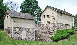
The Parker Mill, also known as Parker Mill Park or Parker Mill Complex, is a mill located at 4650 Geddes Road, east of Ann Arbor, Michigan. The mill is a well-preserved example of a small-scale grist mill operation that was once common in Michigan. The mill and nearby Parker House were listed on the National Register of Historic Places in 1982.

The Neligh Mill is a water-powered flour mill in the city of Neligh in the northeastern part of the state of Nebraska in the Midwestern United States. The mill was built in 1873 by John Neligh, the city's founder, to make use of water power from the Elkhorn River. It operated for nearly one hundred years until it closed in 1969.

The Grist Mill Bridge, Dam and Mill Site consists of three structures located along Upton Road between Island Road and the Maple River, one-half mile west of Elsie, Michigan in Duplain Township. The three structures are:

Lewis and Clark State Recreation Area (SRA) is an 864-acre State Recreation Area located on the southern shore of Lewis and Clark Lake, in northeastern Nebraska. The recreation area is located in Knox County, approximately 12 miles (19 km) northwest of Crofton. The recreation area is managed by the Nebraska Game and Parks Commission.

Enders Reservoir State Recreation Area (SRA) is a state recreation area in southwestern Nebraska, United States. The recreation area surrounds the Enders Reservoir, a reservoir on Frenchman's Creek, approximately 1 mile (1.6 km) south of Enders, or about 7.5 miles (12.1 km) southeast of Imperial. The recreation area is managed by the Nebraska Game and Parks Commission. There are camping, fishing, swimming, and other recreational opportunities available.
St. Anthony Falls in Minneapolis, Minnesota, is the only natural falls on the Mississippi River. Since almost the beginning of settlement in the area by European descendants, the St. Anthony Falls have been used for waterpower. The first allowed settlers were at Ft. Snelling, where construction began in 1820. A sawmill was operating 1821 and a flour mill in 1823. As soon as the land at the sides of the falls became available it was purchased with the intent of using the waterpower of the falls. First lumber mills covered the falls, cutting lumber floated down the Mississippi. After 1870 flour mills started to dominate the area. From 1880 to 1930 the area was the number one flour producer in the US. In later years, some of the power came from steam, but in 1923 half of the waterpower used was for flour milling. Other industries have also used the waterpower.


