
County Durham, officially simply Durham (/ˈdʌrəm/), is a ceremonial county in North East England. The county borders Northumberland and Tyne and Wear to the north, the North Sea to the east, North Yorkshire to the south, and Cumbria to the west. The largest settlement is Darlington.

West Hartlepool was a predecessor of Hartlepool, County Durham, England. It developed in the Victorian era and took the name from its western position in the parish of what is now known as the Headland.
Blackwell is a suburb in the borough of Darlington and the ceremonial county of Durham, England. It is situated towards the edge of the West End of Darlington, beside the River Tees. Blackwell consists of large 1930s style semi-detached and detached houses, and private, newly built homes. Blackwell Grange is an 18th-century country house converted into a hotel.

Throston is an area of north Hartlepool within the borough of Hartlepool in County Durham, England. The area name is from the Anglo Saxon thosson meaning hill.

Mainsforth is a small village and former civil parish, now in the parish of Bishop Middleham, in the County Durham district, in the ceremonial county of Durham, England. It is to the east of Ferryhill. The earliest settlement in Mainsforth may have been on Marble. It has been suggested, without great historical foundation, that this was a Danish settlement. In 1961 the parish had a population of 229. From medieval times through to the early twentieth century the village was in effect a small collection of farms and farm workers' cottages.

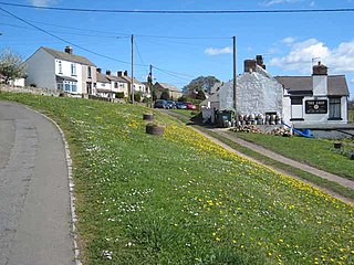
Seaton Carew is a seaside resort in the Borough of Hartlepool in County Durham, England. It gives its name to the Seaton ward, which had an estimated population of 7,194 in 2021. It is deemed part of the Hartlepool built-up area by the Office for National Statistics, but is separated from the main part of the urban area by the Durham Coast Line. The resort is on the North Sea coast and north of the River Tees estuary.
Mordon is a village and civil parish in County Durham, England. It is situated a few miles to the north-east of Newton Aycliffe. The population recorded by the 2011 census for the parish was 260.

Cowpen Bewley is a village and former civil parish, now in the parish of Billingham, in the Stockton-on-Tees district, in the ceremonial county of Durham, England. In 1931 the parish had a population of 706.

Middleton is an area of Hartlepool, in the Borough of Hartlepool, County Durham, England. It is on the North Sea coast between the centre of Hartlepool and The Headland.

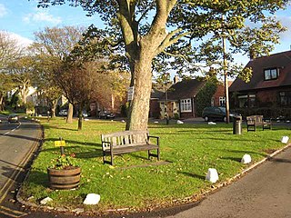
Hart is a village and civil parish in County Durham, England, northwest of Hartlepool.
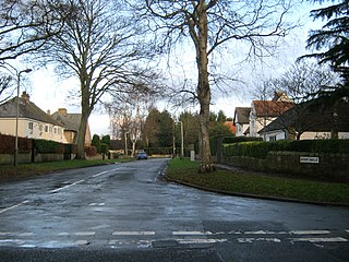
Elwick is a village and civil parish in the borough of Hartlepool in County Durham, England. It is situated near the A19 road to the west of Hartlepool. Historically, Elwick was a township until 1866 when it became a civil parish.

Embleton is a hamlet and former civil parish, now in the parish of Sedgefield, in the County Durham district, in the ceremonial county of Durham, in England, as well as the site of a medieval village and manor. It is situated 3 miles (5 km) east of Sedgefield and 4 miles (6 km) west of Hartlepool. In 1961 the parish had a population of 80. The township was historically named "Elmdene", supposedly derived from the site's proximity to a woodland of elm trees which, at an earlier time, flourished in the bordering dene. A single farmstead now occupies the site which lies adjacent to the ruins of a small church dedicated to the Virgin Mary.
Middlestone is a village and former civil parish in the County Durham district, in the ceremonial county of Durham, England. It is situated to the south of Spennymoor, near Kirk Merrington. In the 2001 census Middlestone had a population of 67.

The Borough of Hartlepool is a unitary authority area with borough status in County Durham, England. Hartlepool Borough Council became a unitary authority in 1996; it is independent from Durham County Council. It is named after its largest settlement, Hartlepool, where the council is based. The borough also includes a rural area to the west of the town. The population of the borough at the 2021 census was 92,571, of which over 95% (87,995) lived in the built-up area of Hartlepool itself.

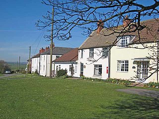
Greatham is a village and civil parish in the borough of Hartlepool, County Durham, England. The population of the civil parish was taken in the 2011 census was 2,132. Greatham village is located approximately three miles south of Hartlepool town centre.
Westerton is a village and former civil parish in the County Durham district, in the ceremonial county of Durham, England. In the 2001 census Westerton had a population of 44. It is situated between Bishop Auckland and Spennymoor. It sits on top of a hill which is one of the highest points in County Durham, and is the location of an observatory built for Thomas Wright, who was the first person to suggest that the Milky Way consisted of a flattened disk of stars. The observatory is known today as "Wright's Folly".
Sadberge was a wapentake in northern England until the 16th century. Named after the village of Sadberge, the wapentake covered land now in County Durham, north of the River Tees as far west as Barnard Castle and as far east as Hartlepool.

Marwood is a civil parish in County Durham, England. It had a population of 529 at the 2011 Census.

Stranton is an area of south Hartlepool in the borough of Hartlepool, County Durham, England. It is a former village and parish.
