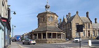
Barnard Castle is a market town on the north bank of the River Tees, in County Durham, England. The town is named after and built around a medieval castle ruin. The town's Bowes Museum has an 18th-century Silver Swan automaton exhibit and paintings by Goya and El Greco.

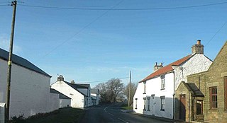
Killerby is a hamlet in the borough of Darlington and the ceremonial county of County Durham, England. It is situated a few miles to the west of Darlington. In 2021 the parish had a population of 62.

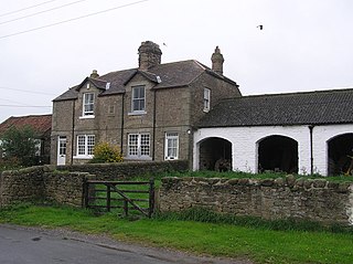
Butterknowle is a village in Teesdale, County Durham, England. Butterknowle is situated between the market towns of Bishop Auckland and Barnard Castle. It has an attractive rural setting within the Gaunless Valley, overlooked by the gorse-covered Cockfield Fell. The fell itself is a scheduled ancient monument, containing evidence of Roman settlements and a medieval coal mine (Vavasours), thought to be the earliest inland colliery recorded.
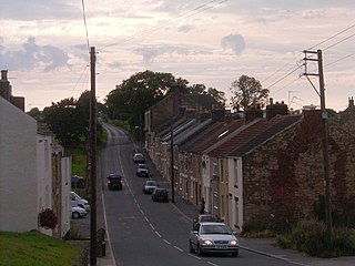
Woodland is a rural village in County Durham, England. It is situated 1100 feet above sea level, a few miles to the north of Barnard Castle, and west of Bishop Auckland. Woodland is a typical small rural community with most villagers finding employment in local towns and cities. Agriculture provides a living for a number of villagers, livestock rearing being the most suitable practice for such an upland area. The population of the village was 234 at the 2011 Census. They are served by a primary school, St. Mary's Church, a village hall, a single shop/post office and ‘The Edge’ public house.

Lartington is a village and civil parish about 2 miles (3 km) west of the town of Barnard Castle, in Teesdale, in the Pennines of England. The 2011 Census recorded the parish's population as 135.

Wycliffe is a village on the south bank of the River Tees in the North East of England, situated a short distance to the east of Barnard Castle. Wycliffe is in the civil parish of Wycliffe with Thorpe.

Bedburn is a village in County Durham, in England. It is in the civil parish of South Bedburn, near Hamsterley, and Hamsterley Forest. The Bedburn Beck a tributary of the River Wear, flows past the village. The population of this civil parish at the 2011 census was 171.

Bowlees is a small village in County Durham, England. It is situated near Newbiggin, on the other side of Teesdale from Holwick.
Kinninvie is a hamlet in the civil parish of Marwood, in County Durham, England. It is situated to the north of Barnard Castle.

Ingleton is a village and civil parish in County Durham, England. The population of the parish as taken at the 2011 census was 420. It is situated about eight miles to the west of Darlington, and a short distance from the villages of Langton, Hilton and Killerby. The Church of St John the Evangelist in Ingleton was built in 1843 by Ignatius Bonomi and J.A. Cory., and is a Grade II listed building.

Hill End is a village in the civil parish of Stanhope, in County Durham, England. It is situated on the south side of Weardale, near Frosterley.
East Briscoe is a village in Baldersdale, in the Pennines district of County Durham, England. It is traditionally located in the North Riding of Yorkshire but along with the rest of the former Startforth Rural District it was transferred to County Durham for administrative and ceremonial purposes on 1 April 1974, under the provisions of the Local Government Act 1972.
Morton Tinmouth is a hamlet of a few farms in County Durham, England. It is situated a few miles to the north-west of Darlington close to the village of Bolam. In 2021 the parish had a population of 14.
Woodside is a village in County Durham, England. It is situated 2 miles (3 km) to the west of Bishop Auckland. In the 2001 census Woodside had a population of 153.

Headlam is a hamlet and civil parish in County Durham, England. It lies to the west of Darlington. In 2021 the parish had a population of 41. The hamlet has 14 stone houses plus 17th-century Headlam Hall, now a country house hotel. The village is set around a village green with a medieval cattle-pound and an old stone packhorse bridge across the beck. Headlam is classed as Lower Teesdale and has views to the south as far as Richmond and to the Cleveland Hills in the east.

Evenwood Gate is a small village in County Durham, England. It is situated to the south west of Bishop Auckland, close to Evenwood.

Bishop Auckland is a constituency in County Durham that is represented in the House of Commons since 2024 by Sam Rushworth of the Labour Party.
The A67 is a road in England that links Bowes in County Durham with Crathorne in North Yorkshire. The road from Middlesbrough to Darlington was previously the A66 road, the road also starts and ends on the A66.

Forcett is a village in the former Richmondshire district of North Yorkshire, England. It lies near the border with County Durham, on the B6274 road about 8 miles south of Staindrop. Nearby villages include Eppleby, Caldwell and Aldbrough.

Baldersdale is a dale, or valley, on the east side of the Pennines in England, northwest of Barnard Castle. Its principal settlements are Hury and Briscoe. Baldersdale lies within the traditional boundaries of the North Riding of Yorkshire. Under provisions of the Local Government Act 1972, it was incorporated into County Durham for administrative purposes on 1 April 1974, along with the rest of the former Startforth Rural District.
