Cleveland (village), Wisconsin

Last updated

Cleveland
Village
Cleveland WI Sign.jpg
Manitowoc County Wisconsin Incorporated and Unincorporated areas Cleveland Highlighted.svg
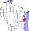
Location of Cleveland in Manitowoc County, Wisconsin.
USA Wisconsin location map.svg
Red pog.svg
Cleveland
Location within the state of Wisconsin
Coordinates: 43°55′4″N87°44′47″W / 43.91778°N 87.74639°W / 43.91778; -87.74639
Country Flag of the United States.svg  United States
State Flag of Wisconsin.svg  Wisconsin
County Manitowoc
Area
[1]
  Total1.98 sq mi (5.13 km2)
  Land1.98 sq mi (5.12 km2)
  Water0.01 sq mi (0.01 km2)
Population
 (2020) [2]
  Total1,579
  Density736.20/sq mi (284.22/km2)
Time zone UTC-6 (Central (CST))
  Summer (DST) UTC-5 (CDT)
ZIP code
53015
Area code 920
FIPS code 55-15400
GNIS feature ID1582976
Website www.clevelandwi.gov

Cleveland is a village in Manitowoc County, Wisconsin, United States. The population was 1,579 at the 2020 census.

Contents

History

The village was named after President Grover Cleveland. [3] [4] The village was formed in 1958 out of the unincorporated communities of Centerville, Hika, and St. Wendel. [5]

Education

The main campus for Lakeshore Technical College is located in the village, while public school students are a part of the Sheboygan Area School District; the district maintains Cleveland Elementary School in the village, and those students usually attend Horace Mann Middle School and Sheboygan North High School in the city of Sheboygan later on if they have no school choice preference.

Geography

Cleveland is located at 43°55′4″N87°44′47″W / 43.91778°N 87.74639°W / 43.91778; -87.74639 (43.917829, -87.746250). [6]

According to the United States Census Bureau, the village has a total area of 2.09 square miles (5.41 km2), of which, 2.08 square miles (5.39 km2) of it is land and 0.01 square miles (0.03 km2) is water. [7]

Demographics

Historical population
CensusPop.Note
1960 687
1970 76110.8%
1980 1,27066.9%
1990 1,39810.1%
2000 1,361−2.6%
2010 1,4859.1%
2020 1,5796.3%
U.S. Decennial Census [8]

2010 census

As of the census [2] of 2010, there were 1,485 people, 587 households, and 428 families living in the village. The population density was 713.9 inhabitants per square mile (275.6/km2). There were 643 housing units at an average density of 309.1 per square mile (119.3/km2). The racial makeup of the village was 94.4% White, 0.3% African American, 0.5% Native American, 0.7% Asian, 3.2% from other races, and 0.8% from two or more races. Hispanic or Latino of any race were 8.7% of the population.

There were 587 households, of which 31.5% had children under the age of 18 living with them, 62.5% were married couples living together, 6.1% had a female householder with no husband present, 4.3% had a male householder with no wife present, and 27.1% were non-families. 23.0% of all households were made up of individuals, and 10.4% had someone living alone who was 65 years of age or older. The average household size was 2.53 and the average family size was 2.97.

The median age in the village was 39.1 years. 25.9% of residents were under the age of 18; 5.7% were between the ages of 18 and 24; 25.8% were from 25 to 44; 29.7% were from 45 to 64; and 12.9% were 65 years of age or older. The gender makeup of the village was 51.3% male and 48.7% female.

2000 census

As of the census [9] of 2000, there were 1,361 people, 536 households, and 384 families living in the village. The population density was 669.2 people per square mile (258.9/km2). There were 578 housing units at an average density of 284.2/sq mi (109.9/km2). The racial makeup of the village was 98.02% White, 0.29% African American, 0.15% Native American, 0.15% Asian, 0.66% from other races, and 0.73% from two or more races. Hispanic or Latino of any race were 1.47% of the population.

There were 536 households, out of which 32.1% had children under the age of 18 living with them, 65.1% were married couples living together, 4.1% had a female householder with no husband present, and 28.2% were non-families. 23.3% of all households were made up of individuals, and 9.5% had someone living alone who was 65 years of age or older. The average household size was 2.54 and the average family size was 3.02.

In the village, the population was spread out, with 25.3% under the age of 18, 7.1% from 18 to 24, 31.8% from 25 to 44, 24.5% from 45 to 64, and 11.3% who were 65 years of age or older. The median age was 37 years. For every 100 females, there were 107.5 males. For every 100 females age 18 and over, there were 105.9 males.

The median income for a household in the village was $50,739, and the median income for a family was $56,607. Males had a median income of $37,917 versus $25,556 for females. The per capita income for the village was $21,761. About 1.8% of families and 1.6% of the population were below the poverty line, including 0.6% of those under age 18 and 1.4% of those age 65 or over.

Media

Cleveland is part of the Green Bay television market, although some residents even outside of Cleveland receive stations over-the-air from Milwaukee, most notably WITI due to the TV's station location. The village is also part of the Sheboygan/Manitowoc Radio Market.

Notable people

Images

Related Research Articles

<span class="mw-page-title-main">Brice, Ohio</span> Village in Ohio, United States

Brice is a village in Franklin County, Ohio, United States, on the southeast side of the Columbus metropolitan area. The population was 93 at the 2020 census.

<span class="mw-page-title-main">Newport, Wisconsin</span> Town in Wisconsin, United States

The Town of Newport is located in Columbia County, Wisconsin, United States. The population was 681 at the 2000 census. The ghost town of Moe Settlement was located in the town.

<span class="mw-page-title-main">Centerville, Manitowoc County, Wisconsin</span> Town in Wisconsin, United States

Centerville is a town in Manitowoc County, Wisconsin, United States. The population was 713 at the 2000 census. The town is divided by I-43 and surrounds the Village of Cleveland.

<span class="mw-page-title-main">Maribel, Wisconsin</span> Village in Wisconsin, United States

Maribel is a village in Manitowoc County, Wisconsin, United States. The population was 336 at the 2020 census.

<span class="mw-page-title-main">Meeme, Wisconsin</span> Town in Wisconsin, United States

Meeme is a town in Manitowoc County, Wisconsin, United States. The population was 1,538 at the 2000 census. Its Menominee name is Omīnīw which means "pigeon". The Menominee sold this land to the United States in the 1831 Treaty of Washington.

<span class="mw-page-title-main">Newton, Manitowoc County, Wisconsin</span> Town in Wisconsin, United States

Newton is a town in Manitowoc County, Wisconsin, United States. The population was 2,241 at the 2000 census.

<span class="mw-page-title-main">Schleswig, Wisconsin</span> Town in Wisconsin, United States

Schleswig is a town in Manitowoc County, Wisconsin, United States. The population was 1,900 at the 2000 census.

<span class="mw-page-title-main">Valders, Wisconsin</span> Village in Wisconsin, United States

Valders is a village in Manitowoc County, Wisconsin, United States. The population was 962 at the 2010 census.

<span class="mw-page-title-main">Adell, Wisconsin</span> Village in Wisconsin, United States

Adell is a village in Sheboygan County, Wisconsin, United States. The population was 516 at the 2010 census. It is included in the Sheboygan, Wisconsin Metropolitan Statistical Area.

<span class="mw-page-title-main">Cascade, Wisconsin</span> Village in Wisconsin, United States

Cascade is a village in Sheboygan County, Wisconsin, United States. The population was 709 at the 2010 census. It is included in the Sheboygan, Wisconsin Metropolitan Statistical Area. Wisconsin Highway 28 passes through Cascade.

<span class="mw-page-title-main">Cedar Grove, Wisconsin</span> Village in Wisconsin, United States

Cedar Grove is a village in Sheboygan County, Wisconsin, United States, within the Town of Holland. The population was 2,101 at the 2020 census. It is included in the Sheboygan, Wisconsin Metropolitan Statistical Area.

<span class="mw-page-title-main">Glenbeulah, Wisconsin</span> Village in Wisconsin, United States

Glenbeulah is a village in Sheboygan County, Wisconsin, United States. The population was 463 at the 2010 census. It is included in the Sheboygan, Wisconsin Metropolitan Statistical Area. Glenbeulah is situated on the Mullet River.

<span class="mw-page-title-main">Herman, Sheboygan County, Wisconsin</span> Town in Wisconsin, United States

Herman is a town in Sheboygan County, Wisconsin, United States. The population was 2,044 at the 2000 census. It is included in the Sheboygan, Wisconsin Metropolitan Statistical Area. The town is home to Lakeland University.

<span class="mw-page-title-main">Howards Grove, Wisconsin</span> Village in Wisconsin, United States

Howards Grove is a village in Sheboygan County, Wisconsin, United States. The population was 3,237 at the 2020 census. It is part of the Sheboygan, Wisconsin Metropolitan Statistical Area.

<span class="mw-page-title-main">Kohler, Wisconsin</span> Village in Wisconsin, United States

Kohler is a village in Sheboygan County, Wisconsin, United States, along the Sheboygan River. The population was 2,120 at the 2010 census. It is included in the Sheboygan, Wisconsin Metropolitan Statistical Area.

<span class="mw-page-title-main">Random Lake, Wisconsin</span> Village in Wisconsin, United States

Random Lake is a village in Sheboygan County, Wisconsin, United States. The population was 1,594 at the 2010 census. It is part of the Sheboygan, Wisconsin Metropolitan Statistical Area.

<span class="mw-page-title-main">Waldo, Wisconsin</span> Village in Wisconsin, United States

Waldo is a village along the Onion River in Sheboygan County, Wisconsin, United States. The population was 503 at the 2010 census. It has a post office with ZIP code 53093. It is included in the Sheboygan, Wisconsin Metropolitan Statistical Area.

<span class="mw-page-title-main">Kiel, Wisconsin</span> City in Wisconsin, United States

Kiel is a city in Calumet and Manitowoc counties in the U.S. state of Wisconsin. The population was 3,738 at the 2010 census. Of this, 3,429 residents lived in Manitowoc County, and 309 residents lived in Calumet County. The city is located primarily within Manitowoc County, though a portion extends west into adjacent Calumet County and is known as "Hinzeville".

Manitowoc is a town in Manitowoc County, Wisconsin, United States. The population was 1,073 at the 2000 census. The city of Manitowoc divides the town into two noncontiguous sections, one north of the city and one south.

<span class="mw-page-title-main">Sheboygan Falls (town), Wisconsin</span> Town in Wisconsin, United States

Sheboygan Falls is a town located in Sheboygan County, Wisconsin, United States. As of the 2000 census, the town had a total population of 1,706. It is included in the Sheboygan, Wisconsin Metropolitan Statistical Area. The unincorporated community of Johnsonville is located in the town.

References

  1. "2019 U.S. Gazetteer Files". United States Census Bureau. Retrieved August 7, 2020.
  2. 1 2 "U.S. Census website". United States Census Bureau . Retrieved November 18, 2012.
  3. Chicago and North Western Railway Company (1908). A History of the Origin of the Place Names Connected with the Chicago & North Western and Chicago, St. Paul, Minneapolis & Omaha Railways. p. 57.
  4. "Profile for Cleveland, Wisconsin". ePodunk . Retrieved June 20, 2010.
  5. "History | Village of Cleveland" . Retrieved July 23, 2021.
  6. "US Gazetteer files: 2010, 2000, and 1990". United States Census Bureau. February 12, 2011. Retrieved April 23, 2011.
  7. "US Gazetteer files 2010". United States Census Bureau. Archived from the original on July 2, 2012. Retrieved November 18, 2012.
  8. "Census of Population and Housing". Census.gov. Retrieved June 4, 2015.
  9. "U.S. Census website". United States Census Bureau . Retrieved January 31, 2008.
  10. THE BLUE BOOK OF THE STATE OF WISCONSIN. 1883. pp. 495–496.
  11. 'Wisconsin Blue Book 1931,' Biographical Sketch of John Lorfeld, pg. 221
  12. THE BLUE BOOK OF THE STATE OF WISCONSIN. 1891. p. 602.