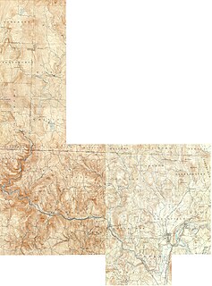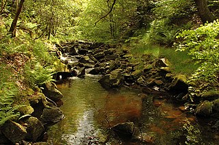
The Chenango River is a 90-mile-long (140 km) tributary of the Susquehanna River in central New York in the United States. It drains a dissected plateau area in upstate New York at the northern end of the Susquehanna watershed.

The Beaver Kill, sometimes written as the Beaverkill or Beaverkill River, is a tributary of the East Branch Delaware River, a main tributary of the Delaware River, approximately 44 miles (71 km) long, in the U.S. State of New York. The kill drains a 300-square-mile (780 km2) area of the Catskill Mountains and has long been celebrated as one of the most famous trout streams in the United States. Its preservation helped establish many of the basic conservation principles of rivers in the United States.

The West Branch Delaware River is one of two branches that form the Delaware River. It is approximately 90 mi (144 km) long, and flows through the U.S. states of New York and Pennsylvania. It winds through a mountainous area of New York in the western Catskill Mountains for most of its course, before joining the East Branch along the northeast border of Pennsylvania with New York. Midway or so it is empounded by the Cannonsville Dam to form the Cannonsville Reservoir, both part of the New York City water supply system for delivering drinking water to the City.

Deerfield River is a river that runs for 76 miles (122 km) from southern Vermont through northwestern Massachusetts to the Connecticut River. The Deerfield was historically influential in the settlement of western Franklin County, Massachusetts, and its namesake town. The Deerfield River is the Connecticut River's second longest tributary in Massachusetts, 2.1 miles (3.4 km) shorter than the Metropolitan Springfield's Westfield River.

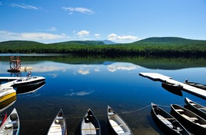
Lake Tarleton is a 334-acre (1.35 km2) water body located in Grafton County on the western edge of the White Mountains in New Hampshire, United States. The lake is located in the towns of Piermont and Warren. Water from Lake Tarleton flows via Eastman Brook west to the Connecticut River.
The Cold River is a 22.6-mile-long (36.5 km) river located in western New Hampshire in the United States. It is a tributary of the Connecticut River, which flows to Long Island Sound.
Great Brook is a 10.0-mile-long (16.1 km) tributary of the Cold River in western New Hampshire in the United States.

The Cold River is a 16.7-mile-long (26.9 km) river in western Maine in the United States. It very briefly enters New Hampshire as well. It is part of the Saco River drainage basin.

The Wild River is a 17.2-mile-long (27.7 km) river in the White Mountains of New Hampshire and Maine in the United States. It is a tributary of the Androscoggin River, which flows east and south to the Kennebec River near the Atlantic Ocean.

The River Roddlesworth is a river in Lancashire, England, a tributary of the River Darwen.
The Middle Branch of the Mad River is a 0.8-mile (1.3 km) long mountain brook on the Maine-New Hampshire border in the United States, within the eastern White Mountains. It is a tributary of the Mad River, a short feeder of the Cold River, part of the Saco River watershed.
The South Branch of the Mad River is a 1.1-mile (1.8 km) long mountain brook on the Maine-New Hampshire border in the United States, within the eastern White Mountains. It is a tributary of the Mad River, a short feeder of the Cold River, part of the Saco River watershed.

Browning Pond is located in Oakham and Spencer, Massachusetts. This 89-acre (360,000 m2) great pond forms the headwaters of the Seven Mile River. It is part of the Chicopee River Watershed.
Mount Marshall is a mountain located in Essex County, New York. Originally named for Governor DeWitt Clinton, and then for Herbert Clark, it was renamed for wilderness activist Bob Marshall (1901–1939) after his death. Marshall is part of the MacIntyre Mountains. Mount Marshall is flanked to the northeast by Iroquois Peak, and faces Wallface Mountain to the northwest across Indian Pass.

Piethorne Brook is a watercourse in Greater Manchester. It is a tributary of the River Beal.
The Turner Brook Reserve is a nature preserve located in Forestburgh, New York, United States. Its western boundary runs along the Cold Spring Road in Forestburgh and its easternmost point is High Falls in The Neversink Gorge. The reserve is named after Turner Brook, a stream that runs along the westernmost part of the reserve and flows into Gillman Pond.

South Baldface is a 3,547-foot (1,081 m) mountain in the town of Chatham, New Hampshire in the eastern White Mountains. It gets its name from its steep barren eastern face. Along with the neighboring summit North Baldface, it is a popular hiking destination, especially in the summer. The two mountains are ascended by the Slippery Brook, Baldface Knob, Baldface Circle, Meader Ridge, and Bicknell Ridge trails.

West Branch Sacandaga River converges with the Sacandaga River in Blackbridge, New York.


