Concordia, Portland, Oregon

Last updated
Concordia
Neighborhood
Kennedy School - Portland Oregon.jpg
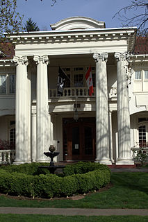
The Kennedy School restaurant and hotel in the Concordia neighborhood
Portland map.png
Red pog.svg
Concordia
Coordinates: 45°33′59″N122°37′50″W / 45.56629°N 122.63065°W / 45.56629; -122.63065 Coordinates: 45°33′59″N122°37′50″W / 45.56629°N 122.63065°W / 45.56629; -122.63065 PDF map
Country United States
State Oregon
City Portland
Government
  Association Concordia Neighborhood Association
  Coalition Northeast Coalition of Neighborhoods
Area
  Total1.33 sq mi (3.44 km2)
Population
(2000) [1]
  Total9,564
  Density7,200/sq mi (2,800/km2)
Housing
[1]
  No. of households3,769
  Occupancy rate96% occupied
  Owner-occupied2,676 households (71%)
  Renting1,093 households (29%)
  Avg. household size2.54 persons

Concordia is a neighborhood in the Northeast section of Portland, Oregon, United States, named after Concordia University, which is located within it. The neighborhood borders are NE 22nd Ave. on the west, NE Columbia Blvd. on the north, and NE 42nd Ave. on the east. On the south, the border is NE Prescott St. and NE Alberta Ct., to the west and east of NE 33rd Ave., respectively. Neighborhoods bordering Concordia are Woodlawn, Vernon, and Sabin on the west, Sunderland on the north, Cully on the east, and Alameda and Beaumont-Wilshire on the south.

Neighborhoods of Portland, Oregon

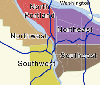
There are five sections of Portland, Oregon, though a sixth is planned, and 95 officially recognized neighborhoods, each of which is represented by a volunteer-based neighborhood association. These associations serve as the liaison between residents and the city government, as coordinated by the city's Office of Community & Civic Life, which was created in 1974 and known as the Office of Neighborhood Involvement until July 2018. The city subsequently provides funding to this "network of neighborhoods" through district coalitions, which are groupings of neighborhood associations. On June 6, 2018, Portland City Council voted to add a sixth section to Portland; it will be called South Portland and the transition to the new system is expected to start in May 2020.

Portland, Oregon City in Oregon, United States

Portland is the largest and most populous city in the U.S. state of Oregon and the seat of Multnomah County. It is a major port in the Willamette Valley region of the Pacific Northwest, at the confluence of the Willamette and Columbia rivers. As of 2017, Portland had an estimated population of 647,805, making it the 26th most populated city in the United States, and the second-most populous in the Pacific Northwest. Approximately 2.4 million people live in the Portland metropolitan statistical area (MSA), making it the 25th most populous MSA in the United States. Its Combined Statistical Area (CSA) ranks 18th-largest with a population of around 3.2 million. Approximately 60% of Oregon's population resides within the Portland metropolitan area.

Woodlawn, Portland, Oregon Neighborhood in Portland, Oregon, United States

Woodlawn is a neighborhood in the Northeast section of Portland, Oregon. It borders Sunderland on the north, Concordia on the east, King and Vernon on the south, and Piedmont on the west.

Most of the Alberta Street Arts District is in Concordia.

Concordia University, a private liberal arts institution associated with the Lutheran Concordia University System, has been located in the central portion of the neighborhood since 1905.

The Concordia University System (CUS) is an organization of eight colleges and universities in the United States that are operated by the Lutheran Church–Missouri Synod (LCMS). All of the institutions are named "Concordia"--a reference to the Latin title of The Book of Concord, the collection of Lutheran confessions--and all include professional church work programs as part of their curricula. The CUS was formed in 1992. As of 2011, 28,421 students attend Concordia University System institutions.

Neighborhood parks include Kennedy Community Garden and Fernhill Park. Notable landmarks include the Kennedy School, a former elementary school converted into a dining and hotel facility, and the Concordia University & Community Athletic Complex which opened in 2011.

Kennedy School former school, now hotel and movie theater, in Portland, Oregon

The Kennedy School, originally the John D. Kennedy Elementary School, is a former elementary school that has been converted to a hotel, movie theater and dining establishment in northeast Portland, Oregon. The facility is operated by the McMenamins chain. The hotel has 35 guestrooms, a brewery, four bars, and a restaurant.

Related Research Articles

Multnomah, Portland, Oregon Neighborhood in Portland, Oregon, United States

Multnomah is a neighborhood in the southwest section of Portland, Oregon, centered on the Multnomah Village business district. The community developed in the 1910s around a depot of the Oregon Electric Railway of the same name. It was annexed by the city of Portland on November 7, 1950.

Maplewood, Portland, Oregon Neighborhood in Portland, Oregon, United States

Maplewood is a suburban neighborhood in Southwest Portland, Oregon, United States.

Alberta Arts District is a neighborhood in Portland, Oregon, United States. The neighborhood centers on Alberta Street, and stretches from approximately Williams Ave to 33rd Ave in the Northeast section of the city.

Northwest District, Portland, Oregon Neighborhood in Portland, Oregon, United States

The Northwest District is a densely populated retail and residential neighborhood in the northwest section of Portland, Oregon. Craftsman-style and Old Portland-style houses are packed tightly together with grand old apartment buildings and sleek new condominiums, within walking distance of restaurants, bars, and shops. The Portland Streetcar's first line terminates there, connecting the district to the Pearl District, Downtown Portland and points south to the South Waterfront.

South Portland, Portland, Oregon Neighborhood in Portland, Oregon, United States

South Portland is a long, narrow neighborhood just south of Downtown Portland, Oregon, hemmed in between the Willamette River and the West Hills. It stretches from I-405 and the Marquam Bridge on the north, to SW Canby St. and the Sellwood Bridge in the south. The Willamette forms the eastern boundary, and SW Barbur Blvd. most of the western boundary. In addition to Downtown to the north, other bordering neighborhoods are Southwest Hills, Homestead, Hillsdale, and South Burlingame to the west, and Hosford-Abernethy, Brooklyn, and Sellwood-Moreland across the river on the east.

Beaumont-Wilshire, Portland, Oregon Neighborhood in Portland, Oregon, United States

The Beaumont-Wilshire neighborhood of Portland, Oregon is located in the city's northeast section, on Alameda Ridge with views of Downtown, the Willamette River, and the Cascades. It is bordered by the Alameda, Concordia, Cully, Rose City Park, and Grant Park neighborhoods. "Beaumont Village", located on NE Fremont Street, from NE 33rd Ave. to NE 50th Ave., is the main commercial district in the neighborhood, but the neighborhood also lies within walking distance of the Hollywood District, a major commercial and shopping area to the south.

Irvington, Portland, Oregon Neighborhood in Portland, Oregon, United States

Irvington is a neighborhood in the Northeast section of Portland, Oregon. According to the city's Office of Community and Civic Life, it consists of a rectangular area extending east to west from NE 7th Ave. to NE 26th Ave., and north to south from NE Fremont St. to NE Broadway. It borders the King, Sabin, and Alameda neighborhoods to the north; Alameda and Grant Park to the east; Sullivan's Gulch and the Lloyd District to the south; and Eliot to the west.

Buckman, Portland, Oregon Neighborhood in Portland, Oregon, United States

Buckman is a neighborhood in the Southeast section of Portland, Oregon. The neighborhood is bounded by the Willamette River on the west, E Burnside St. on the north, SE 28th Ave. on the east, and SE Hawthorne Blvd. on the south.

North Tabor, Portland, Oregon Neighborhood in Portland, Oregon, United States

North Tabor Neighborhood in Portland, Oregon, United States, is on the east side of the Willamette River on the northern slope of Mount Tabor. The Banfield Expressway forms its northern boundary, separating it from the Hollywood District, Rose City Park, and Madison South neighborhoods to the north. NE/SE 44th Ave. separates it from Laurelhurst to the west and NE 68th Ave. from Montavilla to the east. East Burnside Street forms most of the southern boundary, except for a section west of SE 49th Ave. for which SE Stark Street forms the boundary with the Sunnyside neighborhood.

Lents, Portland, Oregon Neighborhood in Portland, Oregon, United States

The Lents neighborhood in the Southeast section of Portland, Oregon is bordered by SE Powell Blvd. on the north, the Clackamas County line or City of Portland line on the south, SE 82nd Ave. to the west, and roughly SE 112th on the east. The NE corner overlaps with the Powellhurst-Gilbert neighborhood. In addition to Powellhurst-Gilbert on the north and east, Lents also borders Foster-Powell, Mt. Scott-Arleta, and Brentwood-Darlington on the west and Pleasant Valley on the east.

West Portland Park, Portland, Oregon Neighborhood in Portland, Oregon, United States

West Portland Park is a neighborhood in the Southwest section of Portland, Oregon. It lies between SW 53rd Ave. in the west and SW 35th Ave. in the east, and I-5 in the north and SW Stephenson St. in the south. South of SW Pomona St., the western border is SW 49th Ave. The neighborhood borders Crestwood and Far Southwest to the west, Multnomah to the north, Markham and Arnold Creek to the east, and the city of Lake Oswego to the south.

Cully, Portland, Oregon Neighborhood in Portland, Oregon, United States

Cully is a neighborhood in the Northeast section of Portland, Oregon. The neighborhood, as well as NE Cully Blvd. that runs diagonally through it, is named after English stonemason Thomas Cully (1810–1891), an early settler. Cully borders Sunderland, Concordia, and Beaumont-Wilshire on the west, Portland International Airport on the north, Sumner on the east, and Rose City Park and Roseway on the south.

Madison South, Portland, Oregon Neighborhood in Portland, Oregon, United States

Madison South is a neighborhood in the Northeast section of Portland, Oregon. It is bordered by the Roseway, Sumner, Cully, Parkrose, Montavilla, and Rose City Park neighborhoods, and by the enclave city of Maywood Park. The neighborhood roughly conforms to the boundaries of Interstate 84 to the south, Interstate 205 to the east, NE Sandy Boulevard to the north, and NE 65th Avenue to the west.

Roseway, Portland, Oregon Neighborhood in Portland, Oregon, United States

Roseway is a neighborhood in the Northeast section of Portland, Oregon. It is bordered by the neighborhoods Cully to the north and west, Sumner to the northeast, Madison South to the east and south, and Rose City Park to the west

Mt. Scott-Arleta, Portland, Oregon Neighborhood in Portland, Oregon, United States

The Mt. Scott-Arleta neighborhood of Portland, Oregon is located in the city's southeast quadrant. It is bounded on the north by SE Foster Road, west by SE 60th Avenue, east by SE 82nd Avenue, and south by SE Duke. Mt. Scott-Arleta borders the neighborhoods of Woodstock on the west, Foster-Powell on the north, Lents on the east, and Brentwood-Darlington on the south.

Kerns, Portland, Oregon Neighborhood in Portland, Oregon, United States

Kerns is a neighborhood in the inner Northeast and Southeast sections of Portland, Oregon. It borders the Lloyd District and Sullivan's Gulch on the north, Laurelhurst on the east, Buckman and Sunnyside on the south, and Old Town Chinatown on the west.

Montavilla, Portland, Oregon Neighborhood in Portland, Oregon, United States

Montavilla is a neighborhood in the Northeast and Southeast sections of Portland, Oregon, United States, and contains an area east of Mount Tabor and west of Interstate 205, from the Banfield to SE Division. It is bordered by North Tabor, Mount Tabor, Madison South, Hazelwood, and Powellhurst-Gilbert.

Russell, Portland, Oregon Neighborhood in Portland, Oregon, United States

Russell is a neighborhood in the Northeast section of Portland, Oregon, United States. Russell lies between Interstate 84 on the north and NE Halsey St. on the south, and between NE 122nd Ave on the west and NE 142nd Ave. on the east. It borders Argay on the north, Wilkes on the east, Hazelwood on the south, and Parkrose Heights on the west.

Portland, Maine is home to many neighborhoods.

References

  1. 1 2 Demographics (2000)