
The Ross Island Bridge is a cantilever truss bridge that spans the Willamette River in Portland, Oregon. It carries U.S. Route 26 across the river between southwest and southeast Portland. The bridge opened in 1926 and was designed by Gustav Lindenthal and honors Oregon pioneer Sherry Ross. It is named for its proximity to Ross Island. Although it looks like a deck arch bridge, it is a cantilever deck truss bridge, a rare type in Oregon.

Downtown Portland is the central business district of Portland, Oregon, United States. It is on the west bank of the Willamette River in the northeastern corner of the southwest section of the city and where most of the city's high-rise buildings are found.

Oregon Route 43 is an Oregon state highway that runs between the cities of Oregon City and Portland, mostly along the western flank of the Willamette River. While it is technically known by the Oregon Department of Transportation as the Oswego Highway No. 3, on maps it is referred to by its route number or by the various street names it has been given.

Harbor Drive is a short roadway in Portland, Oregon, spanning a total length of 0.7 miles (1.1 km), which primarily functions as a ramp to and from Interstate 5. It was once much longer, running along the western edge of the Willamette River in the downtown area. Originally constructed from 1942–43, the vast majority of the road was replaced with Tom McCall Waterfront Park in the 1970s. Signed as U.S. Route 99W, it had been the major route through the city and its removal is often cited as the first instance of freeway removal in the U.S. and as a milestone in urban planning; the original road is remembered as the first limited-access highway built in the city.

Oregon Route 99W is a state-numbered route in Oregon, United States, that runs from OR 99 and OR 99E in Junction City north to I-5 in southwestern Portland. Some signage continues it north to US 26 near downtown, but most signage agrees with the Oregon Department of Transportation's (ODOT) description, ending it at I-5. OR 99W is known by ODOT as the Pacific Highway West No. 1W ; that highway continues north through downtown to the Pacific Highway No. 1 (I-5) in northern Portland, as well as south on OR 99 to the Pacific Highway (I-5) in Eugene.

The South Waterfront is a high-rise district under construction on former brownfield industrial land in the South Portland neighborhood south of downtown Portland, Oregon, U.S. It is one of the largest urban redevelopment projects in the United States. It is connected to downtown Portland by the Portland Streetcar and MAX Orange Line, and to the Oregon Health & Science University (OHSU) main campus atop Marquam Hill by the Portland Aerial Tram, as well as roads to Interstate 5 and Oregon Route 43.

Old Town Chinatown is the official Chinatown of the northwest section of Portland, Oregon. The Willamette River forms its eastern boundary, separating it from the Lloyd District and the Kerns and Buckman neighborhoods. It includes the Portland Skidmore/Old Town Historic District and the Portland New Chinatown/Japantown Historic District, which are listed on the National Register of Historic Places. It has been referred to as the "skid row" of Portland.
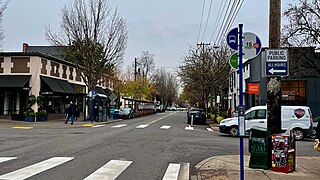
The Northwest District is a densely populated retail and residential neighborhood in the northwest section of Portland, Oregon, United States. Craftsman-style and Old Portland-style houses are packed tightly together with old apartment buildings and new condominiums, within walking distance of restaurants, bars, and shops. The Portland Streetcar's first line terminates there, connecting the district to the Pearl District, Downtown Portland and points south to the South Waterfront, and several TriMet bus lines also serve the district.
Homestead is a Southwest Portland, Oregon, United States, neighborhood in the city's West Hills. The neighborhood is home to Marquam Nature Park, which offers urban hiking in the form of the Marquam Trail, which one can follow to Downtown. Scenic Terwilliger Boulevard also passes through the neighborhood.
Bridlemile is a Southwest Portland, Oregon neighborhood in the West Hills. The Portland city boundary runs through the neighborhood such that the southern part of the neighborhood is within Portland proper, but the northern portion is unincorporated Multnomah County. The portion within Portland city limits extends into Washington County in two places.
Southwest Hills is a neighborhood in the West Hills in the southwest section of Portland, Oregon, United States. The northeastern part of the neighborhood, above Goose Hollow and Downtown Portland, is known as Portland Heights. Much of the western portion of the neighborhood lies outside the Portland city limits, in unincorporated Multnomah County.

Buckman is a neighborhood in the Southeast section of Portland, Oregon. The neighborhood is bounded by the Willamette River on the west, E Burnside St. on the north, SE 28th Ave. on the east, and SE Hawthorne Blvd. on the south.

Terwilliger Boulevard is a street in Portland, Oregon, U.S. It begins at SW 6th Avenue and SW Sheridan Street south of Portland State University. It passes through the neighborhoods of Marquam Hill, Southwest Hills, and Burlingame and by Lewis and Clark College before ending at Oregon Route 43 in Lake Oswego. For portions of its route, it is a traditional parkway through Duniway and Marquam Parks. The land surrounding Terwilliger Boulevard is heavily wooded in nature.

Butterfly Park is a city park of about 1 acre (0.4 ha) in Portland, in the U.S. state of Oregon. Located at 7720 South Macadam Avenue, the park includes a natural area and walking paths near the Willamette River. The natural area provides important habitat for butterflies, including mourning cloaks and orange sulphurs.
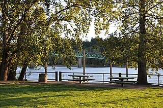
Sellwood Riverfront Park is a city park of about 7.6 acres (3.1 ha) in southeast Portland, in the U.S. state of Oregon. Located at Southeast Spokane Street and Oaks Parkway, the park has paths, picnic tables, a stage, a boat dock on the Willamette River, restrooms, and a dog off-leash area.
South Portland is a sextant of Portland, Oregon and the complement to North Portland, a group of contiguous neighborhoods delimited by geographical boundaries.

James Terwilliger was an Oregon pioneer and one of the first English-speaking settlers of Portland, Oregon. He is the namesake of Portland's Terwilliger Boulevard and Terwilliger School.

Naito Parkway is a major thoroughfare of Portland in the U.S. state of Oregon. It was formerly known as Front Avenue and Front Street and was renamed in 1996 to honor Bill Naito. It runs between SW Barbur Boulevard and NW Front Avenue, and adjacent to Tom McCall Waterfront Park through Downtown Portland.

Southwest Portland is one of the sextants of Portland, Oregon.
